Ancient Aboriginal trade routes of Australia
Ancient Aboriginal trade routes of Australia Trade was a central part of life for Aboriginal people prior to the British settlement of Australia. Trading routes criss-crossed the nation, dispersing goods, information, technologies and culture thousands…
14 Feb 21 · 16 mins read

Ancient Aboriginal trade routes of Australia
Trade was a central part of life for Aboriginal people prior to the British settlement of Australia. Trading routes criss-crossed the nation, dispersing goods, information, technologies and culture thousands of kilometres away from their origins.
The extent of trade was vast. The historian Geoffrey Blainey has written that ‘it is probable that nearly every tribe in Australia traded something with others.’ Thanks to this exchange, Nic Peterson has written, ‘one can speak of a common indigenous way of life’ (Gammage, 150), linking Aboriginal peoples around mainland Australia and Tasmania.
In our international tours, Odyssey Traveller has drawn upon ancient trading, exploration, and pilgrimage routes as a point of entry to understand our location, whether that’s tracing medieval European pilgrimage routes such as the Camino and the Via de la Plata in Spain; or following the ancient Silk Road through China and Uzbekistan. Now, we have drawn from ancient Aboriginal trading routes to build our Australia tours, enabling us to understand the history and significance of the landscape that surrounds us.
This article will discuss the history and archaeology of Aboriginal trade, before showing how this has determined many of the routes we use today. For more information, readers are urged to take a look at Bill Gammage’s The Biggest Estate on Earth; Geoffrey Blainey’s The Story of Australia’s People; and Billy Griffiths’ Deep Time Dreaming, each of which was used in the writing of this article.
The importance of trade:
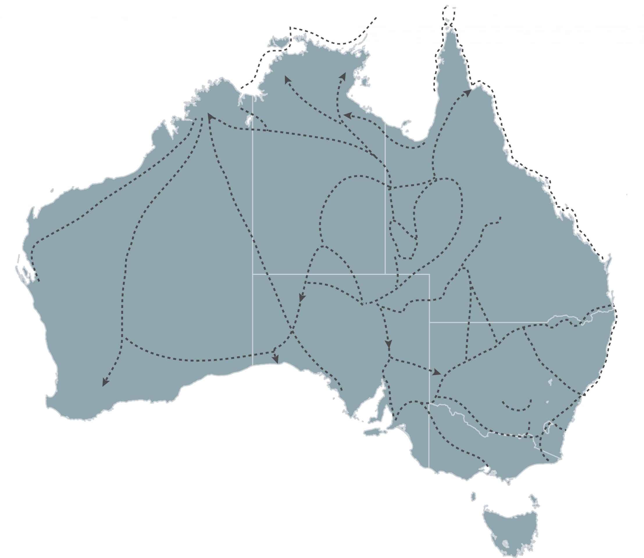
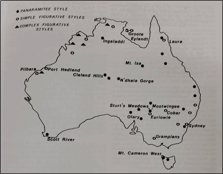
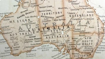
As far back as 1939, archaeologists could show that Australia was criss-crossed by Aboriginal trade routes (see map, above, for more detail on these routes). For Isabel McBryde – ‘the mother of Australian archaeology’ – these Aboriginal trade networks were ‘among the world’s most extensive systems of human communication recorded in hunter-gatherer societies’.
Goods and people travelled vast distances: the Dieri people, east of Lake Eyre, South Australia, visited places at least 800 kilometres apart; while shell from Papua New Guinea reached western New South Wales (Gammage, 149).
Every individual was touched by trade: as archaeologist John Mulvaney has written
‘it was possible for a man who had bought pituri from the Mulligan River and ochre from Parachilna to own a Cloncurry axe, a Boulia boomerang and wear shell pendants from Carpentaria and Kimberley‘ (quote Griffiths, 47-48).
Trade had a cultural and social importance, as Mowaljarlai and Malnic (1993) write:
‘The lines are the way the history stories travelled along the trade routes. They are all interconnected. It’s the pattern of the sharing system.’
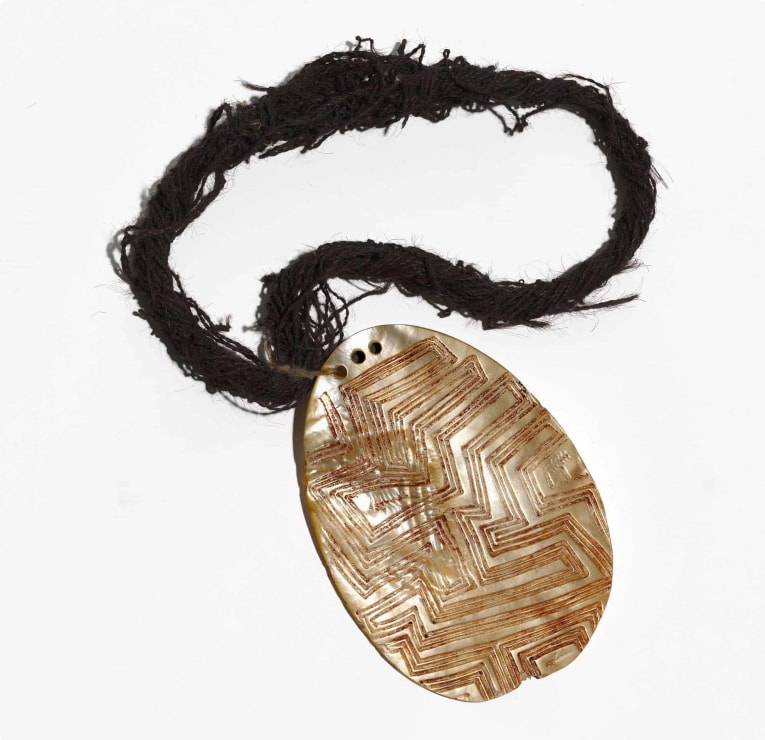
Some goods had a social value that meant they were traded particularly widely. Pearl shells from the Kimberley coast (where Broome is still the centre of Australia’s pearl industry) have been believed to have travelled at least 800 kilometres away from their point of origin; with some claiming that they reached as far as the mallee, in western Victoria and eastern South Australia. Some pearl shells were as wide as a small plate, engraved with patterns and worn as a pendant by powerful men.
Stone axes also spread over vast distances. At Moore Creek, near Tamworth, New South Wales, an outcrop of greywacke running along the crest of a saddleback ridge was mined prolifically for over 100 metres. In the 1960s, McBryde used petrological analysis – which had previously been used to show that the bluestone used in building England’s Stonehenge had come from Pembrokeshire, Wales – to examine 517 stone axes that had been scattered across New South Wales. They found that rock from the quarry near Tamworth had been carried as far as Cobar, Bourke, Wilcannia and other parts of western New South Wales – a journey equal to that between Belgium and the south of Spain (Blainey, 191-192).
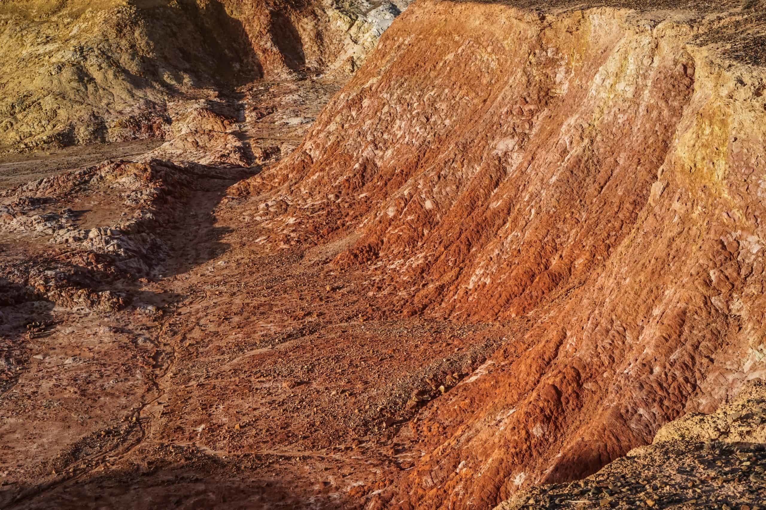
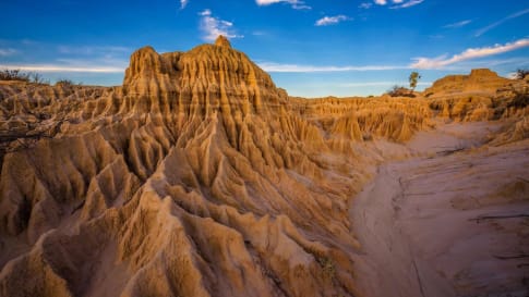
Ochre was another commodity which was traded widely. Red ochre was particularly important to First Nations peoples across Australia: it was used to adorn the body during ceremonies, decorate wooden implements, and in rock art. The ochre trade is particularly ancient: Mungo Man, the 40, 000 year old ritual burial found in the Willandra Lakes area of Western New South Wales, was covered in over two kilograms of red ochre. The ochre had been brought over 200 kilometres to the burial site (Griffiths, 131).
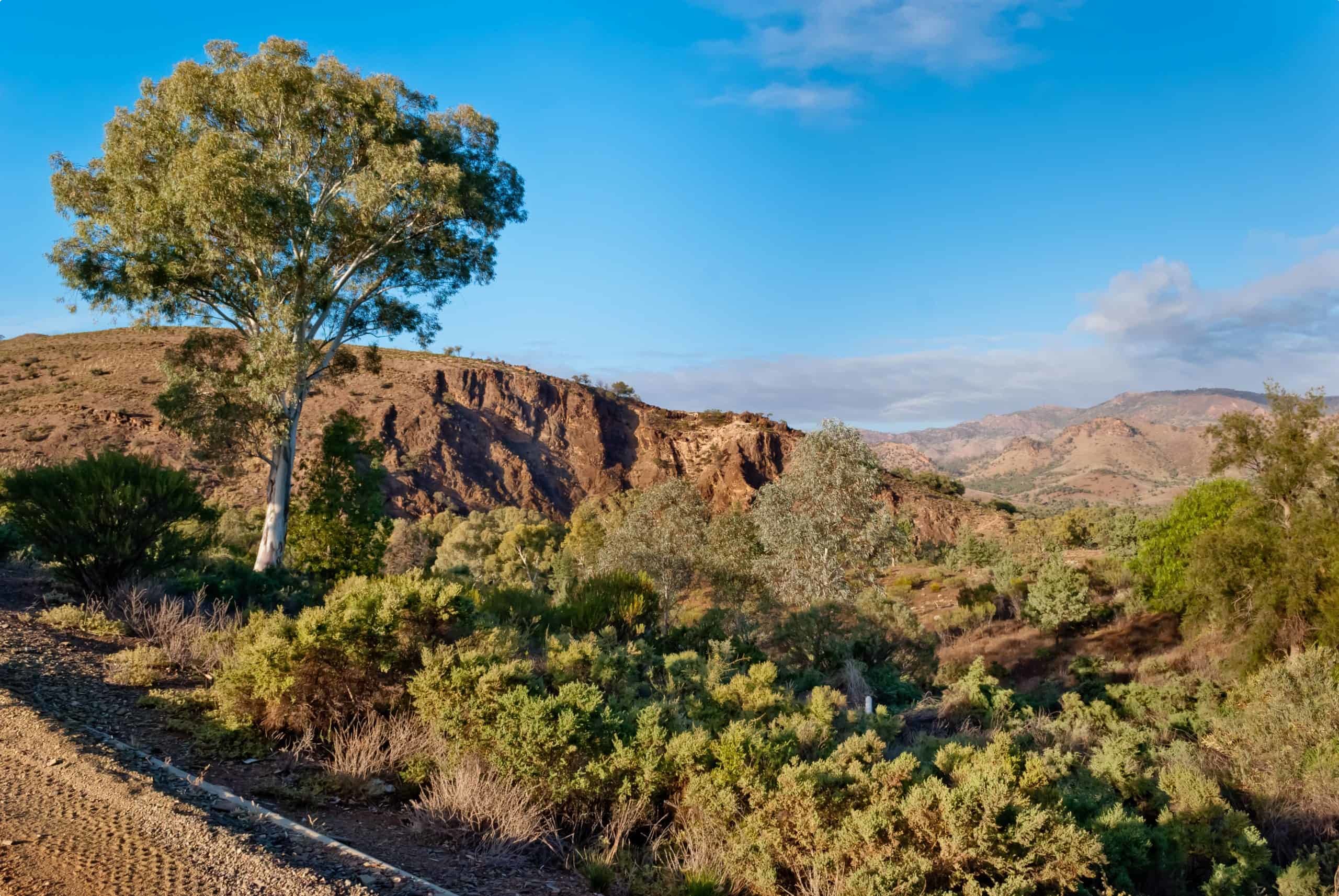
The first material to be mined in the Flinders Ranges, South Australia, was not copper or gold but red ochre. Ochre from a quarry east of Parachilna township, known as Bookatoo, was celebrated among the Dieri people of central Australia. It was regarded as being of an exceptionally high quality, and held a spiritual importance, believed to be the blood of a sacred emu. The Dieri would send armed bands of 70-80 men 500 kilometres to the south to barter with the traditional owners of the mine, the Adnyamathanha people – even though there were plenty of more accessible ochre mines, such as the Ochre Cliffs near Lyndhurst on the Strzelecki Track.
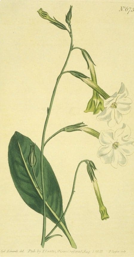
It is also likely that the Dieri people used their access to the prized ochre to trade for pituri, a psychoactive drug made from the leaves of duboisia hopwoodii, used as both a painkiller and stimulant. The most prized variety of pituri comes from near Bedourie in western Queensland, which was traded north to the Gulf of Carpentaria and south as far as Port Augusta, South Australia. It is said that pituri provided the one solace for Burke and Wills, slowly dying in remote Central Australia in 1861 (Flood, 202).
The act of trade had a cultural importance; taking on ritual and ceremonial aspects. It shaped the way that landscapes were understood. Particular localities became associated with particular manufactured goods, as different groups made objects with skill that was admired elsewhere. This specialisation was the basis of trade. So, for instance, groups living near Alice Springs were particularly admired for skill in making wooden bowls used for liquids. Specialisation was a source of identity, often expressed through local mythologies (Blainey, 194).
The extensive travel that trade required meant that Aboriginal people had a vast knowledge of the world in which they lived, far beyond their direct locality. They used knowledge of the stars to guide them on long journeys; and had understandings of places that they did not have direct experience of. Early West Australian settler George Moore observed that ‘the natives are all aware that [Australia] is an island’. In 1840, men near Fowler’s Bay, South Australia, correctly assured Edward John Eyre that there was no inland sea; while Sturt recalled that Toonda, his guide in 1844, was able to accurately draw a plan of the Murray-Darling river system.
People were curious about the world that surrounded them, exchanging long-distance visits to learn of far-away lands and skills. Songs and ceremonies, holding practical knowledge needed for survival and navigation of the land, travelled thousands of kilometres in a short period along what is known as Songlines.
Anthropologists were astounded, for example, when Aboriginal women in Port Augusta, South Australia, accurately provided details of places in a song series describing Alice Springs, 1200km away. They were able to trace the trading of the ceremony, songs, stories, dances and art back to Alice Springs via the outback South Australian town of Oodnadatta.
This trading of songs can be thought of as a trading of intellectual property to assist travelling. Aboriginal people travelled a lot. They renewed and created relationships and socialised at small ceremonies and huge gatherings. They travelled for seasonal harvests on land, in rivers or at sea, either seeking or avoiding dominant weather events. If you knew the songs, you held knowledge of the land to aid navigation as well as find water and food resources.
Trade also necessitated linguistic dexterity, as Walter Roth, the ‘Aboriginal protector’ of Northern Queensland, recalls:
Picked men may be sent to a distant tribe just for the sake of learning [a dance] … It may thus come to pass, and almost invariably does, that a tribe will learn and sing by rote whole corrobborees [sic] in a language absolutely remote from its own.
Though there was no common language across the continent, there was extensive contact between different language groups. Children frequently had parents who spoke different languages. People spoke up to three or four languages, and some could understand several more; making Aboriginal Australians among the world’s most multilingual people. Such multilingualism is still common today, with people in Arnhem Land frequently speaking English as a third (or thirteenth!) language.
Dialect chains enabled long-distance communication. For example, Group A was able to understand Group B, who understood Group C, but Group A might not have been able to understand Group C (Flood, 173). In Central Queensland and the Western Desert, these chains extended over 3000 kilometres.
The Panaramitee Rock Art Tradition: Markings in the land
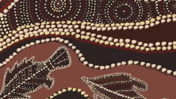
The extent of cultural exchange between Aboriginal groups is indicated by the widespread Panaramitee rock art style – also known as ‘track and circle’ – which is found across mainland Australia and Tasmania.
The style was discovered by Bob Edwards, an amateur field photographer on a survey of north-east South Australia with his mentor, Charles Mountford. One of their starting points was the series of engravings found at Panaramitee Station.
Moving from station to station, they found over a thousand similar pieces of art, depicting animal tracks and circles, and less frequently crescents, human footprints, radiating lines, and other nonfigurative designs. These same motifs appeared in a number of sites.
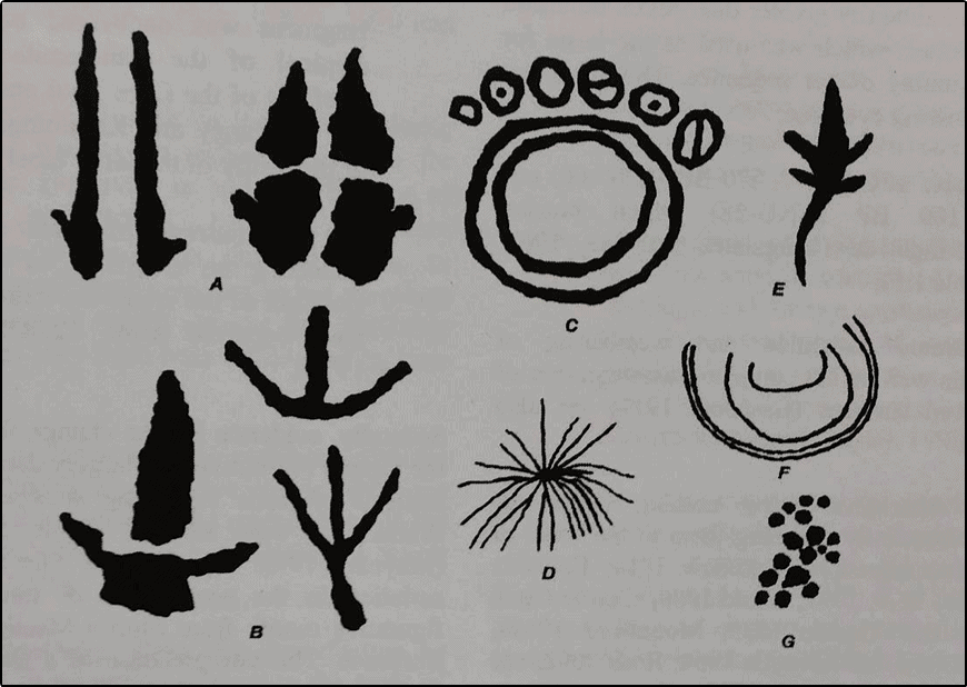
Early European explorers had believed the engravings to be fossil footprints, or the result of algae and lichens eating into rock. But it was clear that they were human markings, formed by pecking with a stone hammer into the rock, which were then covered by ‘desert varnish’, a shiny, rust-coloured accretion that builds up over a long period of time. Mountford believed that the varnish was evidence that the carvings were extremely old, confirmed by his interviews with Aboriginal elders, who claimed that the engravings ‘had always been there.’
As Edwards and Mountford ended their survey, the rains hit, filling rockholes and causing creeks to flow. This stroke of good luck revealed to them another continuity of the engravings: each was next to a waterhole, or other form of supply.
Over the following three years, Edwards collected instances of this style across South Australia and the arid centre of Australia, virtually all associated with water sources and arid camp sites. He had uncovered what archaeologists call a ‘stylistic unit’, the artistic signature of an ancient, widespread cultural tradition. The consistency of the drawings led him to believe that these motifs predated ‘the time when tribal boundaries became rigid and separate cultural entities developed.’
In 1966, as part of a team of researchers led by John Mulvaney, Edwards uncovered tracks and grooves resembling the Panaramitee engravings, at a site west of Katherine, in the Northern Territory. They were able to date the engravings at 5000-7000 years old, the first such dating of rock art in Australian history, proving Edwards’ argument that the style was ancient.
In 1974, the archaeologist Lesley Maynard studied engravings in Laura in Queensland, Mount Cameron West in Tasmania, and Ingaladdi in the Northern Territory, each of which she believed to be part of the Panaramitee style. The Tasmanian find was particularly important, indicating that the style developed before the creation of the Bass Strait by rising seas at the end of the Ice Age.
This led her to develop a chronology of Australian rock art. The first was ancient ‘deep cave art’, produced in the last Ice Age; then the homogenous and widely distributed forms of the Panaramitee, also dating to the Pleistocene (Ice Age); and finally the regionally diverse styles of the Holocene (post-Ice Age), both ‘simple figurative styles’, and ‘complex figurative styles’, including the striking Wandjina of the Kimberley, and the intricate X-ray art found in Arnhem Land and Kakadu.
Maynard’s chronology has since been challenged by other archaeologists, including Andrée Rosenfeld, who has argued for greater cultural difference between North Queensland styles and those found in the ‘red centre’. Others have challenged the antiquity of Panaramitee style, suggesting that many of the tracks do not actually date back to the Pleistocene. Many of the artworks found in the central deserts of Australia are of much more recent origin, indicating a continuation of the style into recent years across a large part of Australia (Griffiths, 174-199).
Trade in south-east Australia:
The trade of Aboriginal peoples in south-east Australia (southern New South Wales and Victoria) has been extensively studied by Isabel McBryde.
In particular, greenstone axes produced at the Mount William Stone Hatchet Quarry (known as Wil-im-ee Moor-ring), on the outskirts of Melbourne, were revealed by McBryde to have travelled over 1000 kilometres across southern Australia. The quarry today, listed as a National Heritage Place, bears the scars of thousands of years of mining by the traditional owners, the Wurundjeri. Deep pits were dug to reach unweathered stone; and the surface of boulders were heated to break away pieces of rock. The heads were then shaped using a large boulder as an anvil, which were then shaped further by their new owners.
Though the whole tribe had an interest in the place, it was under the special custodianship of one man (in the 19th century, a man named Billibellary), who had inherited this from his father, and traded stone for weapons, rugs and ornaments. In one instance, a visitor exchanged a possum-skin rug for three pieces of the stone (McBryde, 148). It seems to have supported a sedentary population: one settler described thirteen ‘warm and well constructed huts’ near Mount William (Gammage, 300).
Stone from the quarry reached the numerous groups of the Murray River, as far away as Yelta (near Mildura). Early settler Isaac Batey was told in 1862 by an Aboriginal stockman from the Lachlan River, New South Wales, that stone for hatchet heads came ‘from a hill down in the Melbourne country’ (McBryde, 133), while the stone also reached Guichen Bay, near Mount Gambier, South Australia.
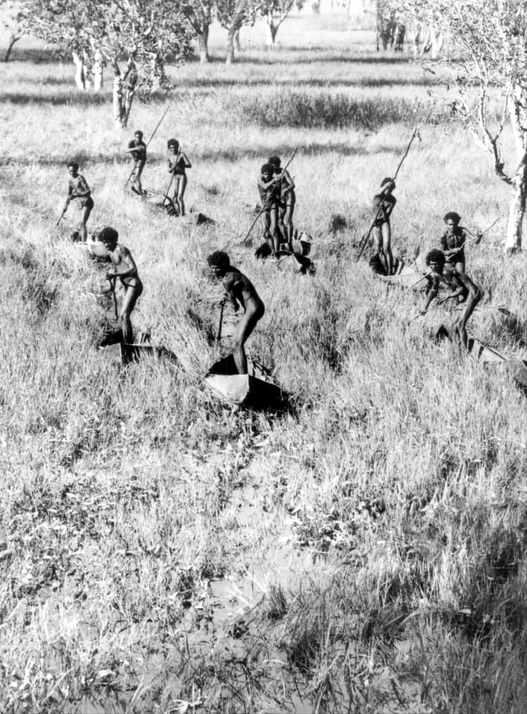
In turn, the people of the Murray produced goods from the roots of kumpung river grass. Twine was made by twisting fibre, which was used for fishing line; bags, belts and headbands; for binding axe heads; and for ritual purposes. It was also knotted into nets, used to fish and catch emu, ducks, and small animals. Each group needed around thirty-five kilometres of raw twine to have a set of nets, which meant that twelve kilometres of twine had to be manufactured each year. In total, the process of creating a net took around a year of 35-hour weeks. The work of preparing twine and smaller nets was done primarily by women, while men worked on the larger nets. Much like in pre-industrial England, work was cooperative and social, as people sat around, gossiped, and told stories while producing objects.
Great trading meetings were held on the Murray River. These festivities were often tied to particular food harvests, such as the collection of taarp (lerp), a carbohydrate secreted on eucalypt leaves by plant-eating insects, prized for its sugary taste.
The eel harvest of the Budj Bim Cultural Landscape – a sophisticated aquaculture system that is believed to have supported a sedentary population – was another major festivity, which attracted people from as far away as New South Wales and South Australia to feast on smoked eels caught in the traps. The Brewarrina Fish Traps of northern New South Wales were also host to one of Eastern Australia’s great festivities, with huge numbers of people coming to partake of the harvest, with fish complimented by flour-based breads.
Patterns of exchange in Arnhem Land:
At the other end of Australia, the trading and exchange patterns of the people of Arnhem Land have also been extensively studied. Thanks to challenging tropical conditions and the fierce resistance of the local Yolngu people, Arnhem Land was never conquered or systematically settled by British colonisation. For the British, its history is a series of failed military, pastoral and mining settlements. As a result, traditional Yolngu life patterns have remained strong to this day.
In the 1930s, the anthropologist Donald Thompson studied the trading patterns of the Yolngu people extensively. Thompson found that every individual in Arnhem Land was a part of a ‘great ceremonial exchange cycle’. A man on the Lower Glyde River, for example, would have received black pounding stones from the east; possum fur, dillybags and spearheads from the south-east; boomerangs, hooked spears and ceremonial belts from the southwest; heavy fighting-clubs from the north-west; and foreign goods (traded by Macassan sailors) from the coastal north-east, calico, blankets, tobacco, knives and glass, much of which he traded away in further exchanges.
This exchange cycle was at the heart of Arnhem Land culture: each individual was under a social obligation to send gifts to partners in remote areas. The act of giving gave esteem, while slowness and a lack of generosity in giving earned disapproval, even social ostracism.
Unlike trade elsewhere in pre-settlement Australia (with the exception of the trade between Cape York, the Torres Strait Islands, and Papua New Guinea), Arnhem Land formed part of a truly international network of exchange. For centuries fishermen and voyagers from Makassar, a city on Indonesia’s Sulawesi island, searched the shores of Arnhem Land in search of trepang, a sea cucumber prized as a delicacy in China.
Anthropologist Campbell Macknight suggested that the trade began between 1650 and 1750, while later scholars such as Darrell Lewis and Anne Clarke have argued that the Macassans started visiting much earlier, around 1000 years ago. The trade only came to an end in 1907, outlawed by the brand-new Australian government.
While on the shores of Arnhem Land, the Macassans grew rice, built stone hearths, and traded with the local Yolngu community, exchanging tobacco, pipes, beads, belts, cloth, iron knives and axeheads and strong dugout canoes, known as lippa-lippa, for the right to fish on Australian waters and employ local labour. They introduced new technologies, such as the dug-out canoe, and inspired a shift in diet to one including more seafood. Macassan words entered the local languages, and some Yolngu people even spent time in the city of Makassar.
The Makassars were integrated into the global trade network, passing goods on to China and using Dutch coins (thanks to Dutch colonisation in Indonesia). The extent of global connection to Arnhem Land is displayed by the mystery of a 12th century African coin found by a serviceman during World War Two.
Macassan goods travelled widely in Australia, even down to the ‘red centre’: botanist Christopher Giles found in a rainmaker’s bag by the Finke River, in central Australia, ‘a curious examples of extremes meeting’, pearl shells obtained from ‘the Malays’ and a boy’s marble from Adelaide.
The Body of Australia: A Connected Continent:
Evidence of the trade routes in Aboriginal Australia indicates that Australia was a network of peoples ‘economically integrated’ by the Dreaming. David Mowaljarlai, the late elder of the Kimberley District of Western Australia, detailed the interconnectedness of Aboriginal people in his map Bandaiyan, Corpus Australis (The Body of Australia).
On his map the whole continent and its islands are joined in a single grid system of social and spiritual connections. The diamonds within the pattern are communities of Aboriginals and the lines connecting them the ancient trade routes and Dreaming pathways that Mowaljarlai calls ‘landstories’. At the nodes connecting the lines is concentrated knowledge – sites of significance or ‘story places’ in which knowledge is embedded. Corpus Australis represents the country as connected through these nodes in the sharing of resources and technology over millennia.
The map of Australia is remapped by Mowaljarlai as a map of the human body, with the line from the Gulf of Caprentariria to the Great Australian Bight the spinal column on which the body is constructed. Cape York and Anhrem Lands constitutes the lungs, Uluru the bellybutton, the Great Australian Bight the public sections, and the southern offshore islands the feet.
For Aboriginal people, society, the environment, and the individual person are not separate from each other. Rather they are united in what the author Mudrooroo describes as “the unity of the people with natural and all living creatures and life forms”. Life and land are intimately connected in a vast network interwoven across vast landscapes.
Aboriginal trading routes today:
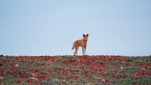
These Aboriginal trading routes shape the way that we navigate the Australian landmass today. Thanks to their intricate knowledge of Country, Aboriginal navigators were able to cross the vast arid distances that would later defeat European explorers such as Charles Sturt, Ludwig Leichhardt, and Burke and Wills.
Many of the most successful exploits of settlers and explorers was thanks to their making use of older Aboriginal trade routes. John McDouall Stuart, the first European to cross the Australian continent, followed an Aboriginal route that led traders from spring to spring in the harsh South Australian outback, linking Cape York and the Kimberley to the southern coast. This route was used in the 1870s to establish the Australian Overland Telegraph Line, connecting Port Augusta to Darwin, with the help of camels and camelmen from the Middle East and Asia.
The route was later used by camel trains led by ‘Afghan’ camelleers to haul goods into central Australia and formed the base of the Great Northern Railway, known as the Ghan, which closed in 1980. Today, the Oodnadatta Track, linking Oodnadatta to Marree, is one of Australia’s great outback adventures, explored by Odyssey Traveller on our Tour of the Flinders Ranges.
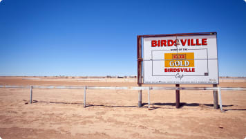
Similarly, the cattle thief and bushman, Harry Reardon, was able to successfully transport 1200 head of stolen cattle from Bowen Downs Station, 130 kilometres north of Longreach, 1000 kilometres south to Hill Hill Station, South Australia, thanks to his communication with Aboriginal people, which allowed him to navigate the desert successfully. The route he established from Lyndhurst to Innamincka was one long traversed by Aboriginal traders, who transported red ochre from the Ochre Cliffs near Lyndhurst north to the Gulf of Carpentaria and south to the Southern Ocean. Today known as the Strzelecki Track, it is another of Australia’s great remote journeys. We take on parts of this trail on our Broken Hill and ‘Back Tour.
The town of Halls Creek, Western Australia, was an important place of exchange for the traditional owners, the Jaru and Kija people, thanks to its location on the trading routes stretching from the centre of Australia to the Kimberley coast. Even in the cities, many of today’s major landmark have long been ceremonial gathering places for Aboriginal people, including the Melbourne Cricket Ground and King’s Park, Perth.
Odyssey Traveller has drawn on these ancient Aboriginal trading paths in designing our tours of Australia. From our escorted tour of Aboriginal World Heritage Sites in Victoria, New South Wales and South Australia, to our tour of the spectacular scenery of Kakadu National Park, and even our Marvellous Melbourne tour, we take the time to learn about the ancient history of our destination, showing how the places we encounter were at the heart of pre-settlement Aboriginal lifeways.
Odyssey Traveller has been designing international tours for mature and senior travellers since 1983, with an emphasis on educational tours, designed to give you an in-depth experience of your travel destination. We are now pleased to announce that we are running fifteen new tours of Australia. An Odyssey guided tour is not your typical Australia vacation – Great Barrier Reef, Sydney Harbour and iconic Uluru (Ayers Rock) – but a chance to get off the beaten path. On one Australia tour we explore stunning coastline on a trip around the Eyre Peninsula – better than Bondi Beach, Byron Bay or the Gold Coast, and without any of the crowds of the East Coast! Another small group tour sees us explore Adelaide and surrounds, making a day tour to beautiful Kangaroo Island. Or why not choose our tour of the Kimberley, on the remote north west coast, for your next Australia trip?
Our tours are really small group tours, generally including 6-12 travellers accompanied by an expert tour operator/tour guide. The tour package price generally includes accommodation, transport in a comfortable vehicle, access to attractions, and several meals, to give you the opportunity to get to know the rest of your small group tour passengers.
Articles about Australia published by Odyssey Traveller:
- The Kimberley: A Definitive Guide
- Uncovering the Ancient History of Aboriginal Australia
- Aboriginal Land Use in the Mallee
- Understanding Aboriginal Aquaculture
- Mallee and Mulga: Two Iconic and Typically Inland Australian Plant Communities (By Dr. Sandy Scott).
- The Australian Outback: A Definitive Guide
- The Eyre Peninsula: Australia’s Ocean Frontier
- Archaeological mysteries of Australia: How did a 12th century African coin reach Arnhem Land?
For all the articles Odyssey Traveller has published for mature aged and senior travellers, click through on this link.
External articles to assist you on your visit to Australia:
- John Mulvaney: ‘… these Aboriginal lines of travel‘
- Queensland Historical Atlas: Aboriginal dreaming paths and trading ways
- National Museum Australia: Trade with the Makasar
- Fish traps and stone houses: New archaeological insights into Gunditjmara use of the Budj Bim lava flow of southwest Victoria over the past 7000 years
- Isabel McBryde: Exchange in south eastern Australia
- Shells, not pearls, were the real prize in traditional Aboriginal culture
We acknowledge Aboriginal and Torres Strait Islander peoples as the First Australians and Traditional Custodians of the lands where we live, learn and work. We pay our respects to Elders past, present and emerging.
Article Updated February, 2021
Related Tours
days
Mar, May, Aug, Sep, Oct +2Small group tour of World Heritage sites and more in the Southern States of Australia
Visiting New South Wales, South Australia
Discover the World Heritage Sites of the southern states of Australia travelling in a small group tour. A journey of learning around the southern edges of the Murray Darling basin and up to the upper southern part of this complex river basin north of Mildura. We start and end in Adelaide, stopping in Broken Hill, Mungo National Park and other significant locations.

days
Jun, Jul, Sep, Feb, Mar +1Darwin and Kakadu small group tour
Visiting Northern Territory
Explore and learn as part of a small group tour for seniors on this package tour to Darwin and Kakadu National park, a UNESCO world heritage site. This program also visits Arnhem land. Our focus is on ecology, landscapes and history on this 14 day program in the far north of the Northern Territory.
days
Apr, May, Jul, Aug, Oct +2Small group tour of Australia's Flinders ranges
Visiting South Australia
Escorted small group tour of the Flinders range in South Australia from Adelaide. Learn about Coober Pedy, Wilpena pound and water system of Lake Eyre as we explore and learn also about the history of the people who explored the Flinders.
