Aboriginal land use in the Mallee
Learning about the Mallee for a escorted small group tour of South Australia and Western Australia for mature and senior travellers. Understand the Mallee & Wildflowers relationship and the indigenous community land use.
9 Jun 20 · 17 mins read

Aboriginal land use in the Mallee
When European settlers first reached the vast, semi-arid lands of the Mallee, they thought they had come upon a desolate wilderness, unfit for human habitation. It was ‘a disgusting country’, in the memorable phrase of pastoralist John Beilby, ‘bleak, barren, desolate’ and ‘dreary’.
Viewing the landscape through the lens of European forms of agriculture, they were unable to appreciate how this ‘dreary’, semi-arid landscape had supported Aboriginal peoples for thousands of years: and how, in turn, Aboriginal people had skilfully shaped the landscape in which they lived to effectively meet their needs.
This article tells that story, exploring how pre-settlement Aboriginal groups made the ‘desolate’ Mallee into a home. We have drawn from Richard Broome, Charles Fahey, Andrea Gaynor and Katie Holmes’s fascinating Mallee Country: Land, People, History, published just this year by Monash University Press. Readers with an interest in exploring Aboriginal land management practices may also be interested in Bruce Pascoe’s best-selling Dark Emu, and Bill Gammage’s The Biggest Estate on Earth: How Aborigines Made Australia, both of which were used in the writing of this article.
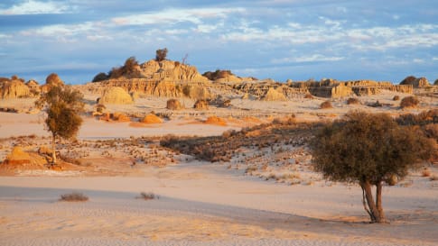
What is the Mallee?
The term ‘Mallee’ is one of ambiguity and contention. It was named by settlers after a Wemba Wemba word (a group from the north-west of Victoria), mali, for a type of eucalyptus.
Geologically, the ‘mallee’ regions cluster in three areas across the southern part of Australia:
- North-western Victoria around the Murray-Darling Basin, beginning just east of Swan Hill and spreading north into the far south-west of New South Wales and the eastern part of South Australia
- The Eyre Peninsula of South Australia, spreading west of Ceduna, before meeting the Nullarbor Plain.
- In southern Western Australia, a band of land beginning spanning from the longitude of Albany past that of Esperance, but not touching the coast until the Great Australian Bite begins.
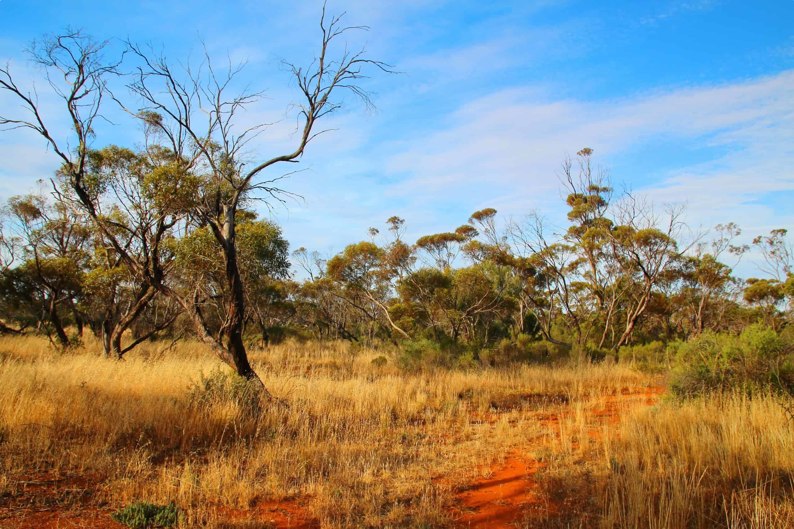
All three areas share common ecological features. Each is part of a semi-arid zone, where mallee eucalypts predominate – or once predominated, before their habitat was transformed into wheat farms. ‘Mallee woodlands’ have been defined by the Australian Department of Environment and Energy as one of the 32 ‘Major Vegetation Groups’ of Australia.
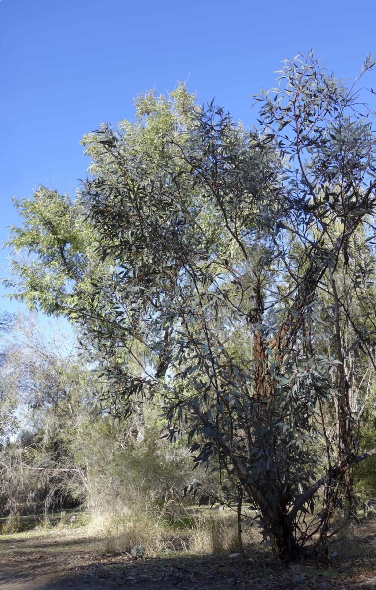
The areas share a Mediterranean climate of hot, hot summers (with temperatures frequently reaching around 40 degrees Celsius for days on end) and mild winters. The mallee is a hardy eucalypt, which can grow in most soils (except heavy clays and deep siliceous sands with few nutrients).
Described by one European observer as having a shape like a ‘skeleton umbrella reversed’, the trees are usually less than ten metres in height, with several stems growing from the one ‘mallee root’ (or lignotuber). The lignotuber allows mallees to grow close to one another, and gives them a strong resilience – if a mallee is cut down, new shoots simply burst out of the lignotuber.
Despite these similarities, the term ‘mallee’ is not universally used in all three areas. In Western Australia the term ‘mallee’ is not used, with ‘Wheatbelt’ preferred (though strictly speaking, the mallee regions are part of and extend beyond the Wheatbelt). In New South Wales, the term ‘mallee’ is used to refer to certain country, but the term does not designate a particular region. In South Australia the area between the Murray River is referred to as ‘Murray Mallee’, but only in Victoria is there a region referred to as ‘The Mallee’.
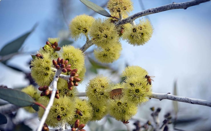
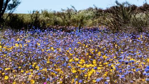
The mallee country of Australia is diverse. The engineer and historian Alfred Kenyon divided Victorian mallee into four regions: scrub country, broken country with mixed mallee vegetation, heath country (infertile sands and stunted mallee trees), and Murray River frontage country, with grass, red gums, and box forests. The South Australian areas adjoining the Murray are similar. In Western Australia, salmon gums are replaced by different kinds of mallee woodland. The western Australian mallee areas are noted for their incredible biodiversity, hosting an incredible 3, 559 kinds of endemic plants, including 192 mallee eucalypts, and over 12, 000 wildflowers, 60% of which are found only in the area. [For more information, take a look at our wildflower tour of Western Australia].
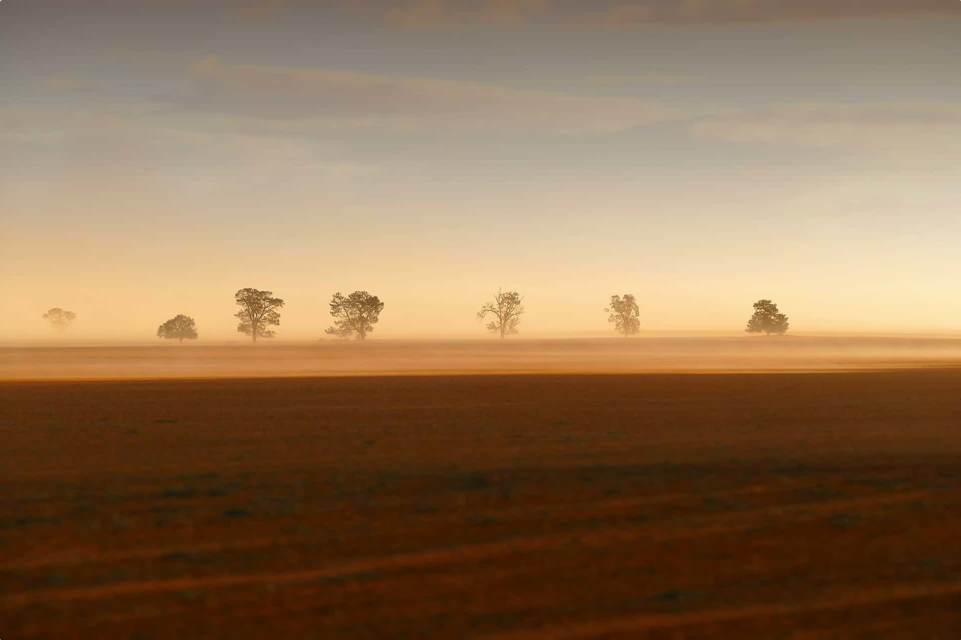
Mallee country as a whole is semi-arid, marked by drought years and sudden heavy rains, which can cause flooding. Yet, some areas are drier than others. The Victorian and South Australian mallees are defined by the permanent presence of the Murray, the intermittently flowing Wimmera River, and occasional salt lakes. The Eyre Peninsula is broken up by salt lakes, including Hamilton, Greenly and Malata, and Lake Gillies west of Whyalla. Lake Grace in Western Australia is one of the state’s biggest salt lakes, part of a hundred-kilometre chain of salt lakes stretching from Pingrup to Kondinin.

The Mallee in Deep Time:
The landscapes of the Mallee we encounter today are the result of geological processes spanning over millions of years. A hundred million years ago, Australia – along with Africa, South America, India, Arabia, and Antarctica – was part of the southern supercontinent Gondwana. Fifty million years ago, the continent started to break up, with Australia and Antarctica the last to separate. Over millions of years, Australia drifted north (as it still does today).
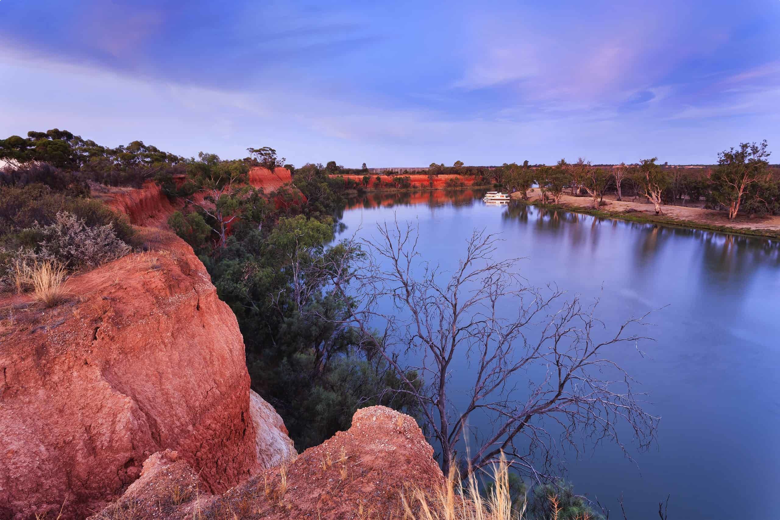
Five million years ago, the mallee country of Victoria, South Australia and New South Wales would have been part of a vast inland sea, stretching five hundred kilometres inland to Menindee, near Broken Hill. The seas contracted, and the areas became lakes, while a much faster-flowing Murray River emerged around 500, 000 years ago. The modern Murray Mallee landscape emerged around half a million years ago as the lakes dried, and dunes and dust defined the landscape.
The Western Australian mallee has a different geology, characterised by a long period of stability and weathering. The mallee there is part of one of the oldest exposed landscapes on earth: a 600-million-year old plateau, which had been part of the supercontinent Gondwana. While minor uplifts caused the Stirling and Ravensthorpe Ranges, the landscape has remained remarkably flat. This long time without inundation or glaciation gave Western Australian flora long time to evolve in diverse ways to deal with the nutrient-poor soils, leading to the incredible biodiversity we see today.
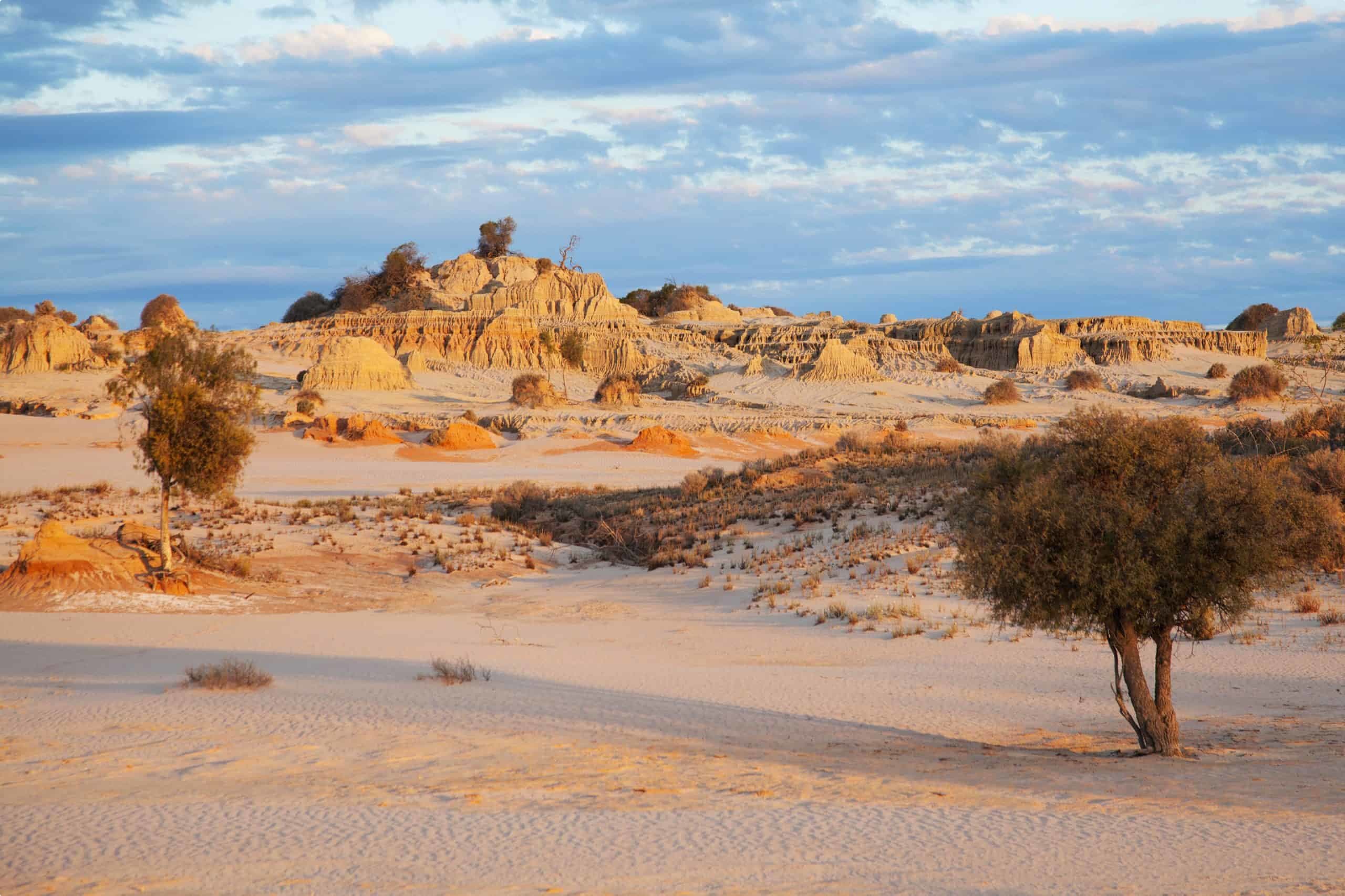
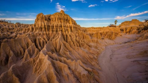
While the precise point at which the first people reached Australia is a matter of debate (with estimates ranging from 50,000 to 120, 000 years ago), the point at which they reached the Mallee is less so. In Western Australia, there is evidence of human occupation at least 48, 000 years ago. The changing climate makes it hard to trace presence in the south-east, but we know that Lake Mungo – where the remains of Mungo Man and Mungo Lady were found – was inhabited from 60, 000 to 50, 000 to 15, 000 years ago.
The first people to reach the Mallee encountered a very different environment than today. Conditions would have been cooler, with plentiful food from wetlands and rivers. Later, they would have cooled further (dropping average temperatures to around 6 degrees cooler than today), increasing aridity. Yet, with the end of the Ice Age around 11,700 years ago, the ice retreated, and conditions became warmer and wetter, creating lakes and making the mallee more habitable. Around 4,000 years ago the landscape became the dry one we see today. People shifted around during these climatic shifts, with human remains along the Murray becoming more prominent from 10,000 years ago, indicating a growth in population.
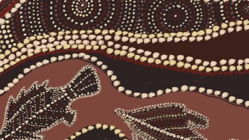
Over the generations, local groups living in the Mallee formed their own distinctive languages and cultures. There are currently twenty-five different Aboriginal groupings in mallee country: six in Western Australia; nine in South Australia; and ten in Victoria, several of which straddle the border of New South Wales. Each group held custodianship over specific lands, mutually agreed upon with their neighbours and justified by creation stories. Neighbouring groups shared cultural features – over-arching Great Ancestors and overlapping languages. People in south-east Australia believed in an all-Father who was the creator of all things, though he bore different names to different peoples – Bunjil the eaglehawk to the Wotjobaluk and Kulin people, Tha-tha-pulli to the Wadi Wadi, and Tulong to the Dadi Dadi. Attachment to country was crystallised through individual relationships with natural species. Ethel Hassell, a pastoralist in the 1870s, found that every person in Aboriginal society had their own birth totem, which provided a source of individual identity, and carried responsibilities to replenish these species through ritual acts of land management. Rituals of song and dance were part of caring for country, while each landform had a name and a story, revealing the lack of divide between humans and nature in Aboriginal society.

The use of fire:
As soon as Aboriginal people arrived in the Mallee, they reshaped it to their own needs, most prominently through the use of fire. Bill Gammage has written extensively about Aboriginal uses of fire in his The Biggest Estate on Earth, claiming that fire allowed Indigenous Australians to manage Australia collectively, as an ‘estate they thought of as single and universal’. Aboriginal people burnt vegetation in patterns that Gammage terms ‘mosaics’, in order to encourage the growth of certain plants, and to attract grazing animals by selectively locating their feed and shelter. Combining intimate local management of plants and animals – a deep understanding of the behaviour of both flora and fauna – with alliances with adjoining groups, clans worked together to manage Australia on a large-scale. Such management made ‘resources as predictable as farming’, and more so in times of natural disaster, allowing people to live in abundance.
Though there is less evidence of extensive burning in the mallee than in other regions of Australia, it is clear that fire was effectively used in the region. In the South Australian mallee, explorer Edward John Eyre encountered grassy openings and plains, in the midst of the deepest eucalyptus scrub, while Charles Sturt, floating down the Murray, noticed ‘narrow lanes, or openings which the Natives had burnt’, in order to create roads (Gammage, 10, 180). Similarly, John Septimus Roe noted on his explorations of southern Western Australia that several stretches of land had been ‘extensively burnt by the natives’. (Broome etc. 21)
Burning in the mallee was set by understanding of the seasons. In Victoria, land was burnt in the late summer on a regular and controlled basis, often every few years – creating controlled, cool burns, and avoiding the huge ones stemming from lightning strikes in long unburnt areas.
Burning was integrated with ritual. Ethel Hassell recalled that two girls in her employ told her that their people were going to start man carls (bush fires), with a corroboree to be held that night. Hassell wrote that they told her that burning was done annually ‘to ensure that the grass and herbage [came] up green and sweet at the first rains’, but that this could only be done after ground birds had hatched and ‘the young ground rats were running about.’ (Broome etc. 20).
Aboriginal peoples of the Murray-Darling Basin:
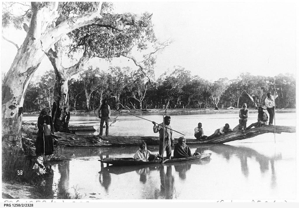
The Murray-Darling was home to a number of Aboriginal groups, including the Jari Jari, Keramin, Ladjiladji, Dadidadi, Madimadi, Wekiweki, Wadi Wadi, and Wemba Wemba. These peoples were fortunate to live close to the most reliable source of water and life in the Mallee region, with the river’s zig zag path across flat plains, creating a more extensive river frontage than the direct distance would allow. This allowed for a significant population: Charles Sturt recalls that, floating down the Murray, he ‘seldom communicated with fewer than 200 daily’, an impression confirmed by the surveyor Thomas Mitchell.
The Murray provided abundant resources for much of the year. Fishing was the easiest source of food, trapped behind lattice weirs and smoked, along with mussels and foods found along the river’s edge – duck and other eggs, emu, kangaroo, along with plant foods and compung (the root of the bulrush). The Wadi Wadi, wrote pastoralists James Kirby and Peter Beveridge, built weirs in the river system to dam the stream, allowing them to direct fish as required. These foods sustained semi-sedentary populations. Times were harder during myangie (winter), and the people, observed Beveridge, were in a ‘state of semi-starvation’.
Also central to the lives of the Murray peoples were fibrous water plants, including kumpung, fibre rush, and giant mallow. These provided food – with new shoots of kumpung eaten as part of a salad, and its roots providing a carbohydrate starch, steamed in a giant earth oven. James Kirby, an explorer who ate kumpung starch prepared by the Wadi Wadi described the meal as similar to flour, or potato meal. For the Surveyor General of New South Wales, Major Thomas Mitchell, cakes made from kumpung ‘were lighter and sweeter than those made from common flour’. Twine was made out of the fibre, used for fishing line and nets, for weaving of bags, belts, headbands, binding axe heads, and ritual purposes.
The work of making twine objects is estimated to have taken about two thousand hours, or a year of 35-hour weeks. Work was divided along gender lines (though both men and women fished) with men hunting larger meat sources and made large nets, while women foraged for plant foods, hunted small game, and made flax into cord, weaving the smaller, more delicate nets. People worked cooperatively both at hunting and weaving. Much like in the pre-industrial cottage industries of Europe, workers shared stories and gossiped with other members of camp as they worked.
Fish and woven products were then traded at great meetings, held on the Murray or by lakes in Victoria, given in exchange for stone axeheads and myall spears. Jade tomahawks used by people of the Murray came from Mount Macedon near Melbourne, indicating the spread of trade.
The scrub or ‘waterless’ backcountry near the Murray was not permanently occupied, but the river peoples used it on a seasonal basis and for specific purposes – tough wood for clubs and axes, ochres for ceremonies, and foods such as kangaroo, emu, and lowan eggs. They also sought taarp (or lerp), a sugary carbohydrate extruded by coccids, psyllids, and aphids. A stockman, Robert Cay, described it as tasting like ‘the ice on a wedding cake’, while the Wadi Wadi on the Murray mixed it with water to create a sweet beverage.
In his later life, pastoralist Peter Beveridge recorded the traditional lore of the Wadi Wadi. Indicating a settled existence, many of the stories include extensive advice: on how to plant and care for particular plants, how to store produce, and even detailed recipes for food preparation.
The lives of Murray River Aboriginal groups can be traced in the exploration accounts of Charles Sturt and Thomas Mitchell. Sturt, with a party of seven explorers, headed down the Murrumbidgee River in 1830, in order to solve the enigma of the west-ward flowing rivers, encountering a ‘broad and noble river’ which he named the Murray. For much of the journey, Sturt was accompanied by people from local Aboriginal groups, who he termed ‘ambassadors’, who slept in his camp, and exchanged food, goods and experiences as best they could across the cultural divide. As Sturt moved out of each clan’s territory, they passed him on to the next tribe. Relations at first appear to have been good, with gift exchanges, singing, while in one instance, Sturt’s group shaved a man, to his apparent delight.
How Aboriginal people found these encounters is less known. It is likely that the ‘ambassadors’ were on a reconnaissance mission, trying to work out why the party were passing through their country – and to get rid of them as soon as possible by passing them down river. Though there had been no direct contact between the Murray groups and white settlers before, the Murray groups had trading relationships with groups to the north (such as the Wiradjuri of the Bathurst Plains), and would have been well aware of the threat they posed.

Relationships increasingly became sour. At the junction of the Murray-Darling River, six hundred armed warriors stood on a long spit on the north-east, threatening Sturt’s progress. Sturt issued guns to his men. However, before fighting broke out, one of the ‘ambassadors’ – (whom Sturt referred to in his diary as ‘the remarkable savage’) dived into the water and convinced the warriors not to attack. What Sturt deemed an act of ‘Providence and courage’ was likely an issue of local politics.
In 1836, Thomas Mitchell encountered the man who had saved Sturt and his party. Mitchell found that the armed men ‘did not belong to that part of the country’. Sturt’s ‘remarkable savage’ was maintaining the rights of his group, asserting ‘the rights of local land owners to determine policy on country’. The incident reveals the complex ways in which Aboriginal peoples responded to colonisation, with some preferring negotiation and others warfare.
South Australia:
Several Aboriginal language groups also lived in the drier regions of the South Australian mallee, far from the water source of the Murray. The Naou people, living on the Eyre Peninsula, South Australia, lacked obvious sources of fresh water, and instead exploited soaks, wells, and rock waterholes. When struggling to find water, they were able to alleviate dehydration by covering themselves in damp mud.
Food was certainly less abundant than on the Murray, but the Naou seemed to have been able to meet their needs. Reverend C.W. Schürmann, a Lutheran missionary, listed an abundance of game, smaller animals, birds and reptiles and root vegetables, gathered by the Naou. Their lives supported a leisurely pace: ‘They seem never in a hurry to start in the morning’, and arrived in camp well before sunset. Root vegetables were roasted, but the roots of the grass tree were eaten raw, as was pigface, abundant during the summer. The explorer Edward Eyre recorded that local people had used fires to create plains of silky grass, and lived in huts around Mount Hall.
The Ngargad lived in arid regions in the south-east of South Australia, between the Southern Ocean, the Victorian border, and the Murray to the far north-west. They, too, had to contend with a lack of surface water, which they responded to by digging soaks into impervious clays that collected underground water. They also had several permanent wells, which gave access to deeper waters. When soaks dried out in severe drought, the Ngargad moved to the Murray River, where they were hosted by a neighbouring people.
Little can be known about the Ngargad people, thanks to the lack of European exploration in this region. In the 1970s, the anthropologist Dick Kimber suggested that they probably lived in small groups, and numbered only around 100 people, by far the smallest of the mallee groups. Tragically, the Ngargad people did not survive invasion and settlement. Their population was already in decline, thanks to a smallpox epidemic spread by Indonesian fishermen on the north coast of Australia in the 1790s. They had prevailed in the most difficult landscapes, but could not survive the changes wrought by colonisation.
Western Australia:
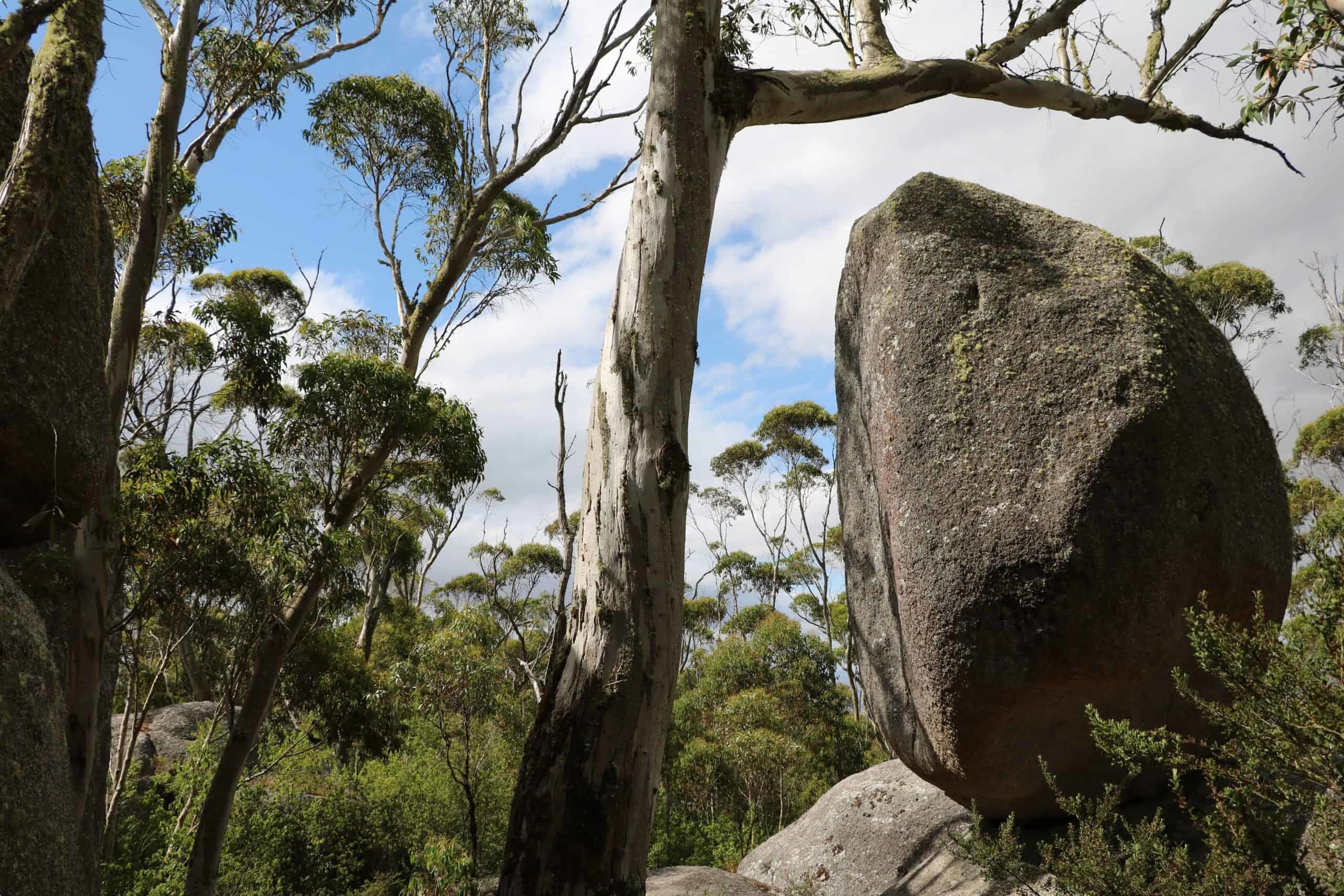
The Western Australian mallee groups – the Nyungar, Ngadju, and Mirning – also lived in mallee country without permanent water. The lake systems extending from Lake Grace to Lake Dundas were salty, though they were a helpful source of bird, animal and reptiles for food. Aboriginal peoples instead lived in adjoining country containing granite outcrops. Rain falling on granite collected in holes, providing water, which Aboriginal people then covered in order to extend their usefulness.
This water run-off created an ecosystem that sustained the Nyungar people. Their calendar contained six seasons, indicating a sophisticated understanding of their landscape and climate. Giant ceremonial and trading meets were a common feature of life. An important place of gathering was Jerramungup, to which people came from as far as Balladonia, over five hundred kilometres to the east. Local people traded stone flakes, spear sticks, throwing sticks and local foods in exchange for red and yellow ochres from inland tribes, and pods of honey from coastal people.
Information about the peoples of the Western Australian mallee can be found in the reports of John Septimus Roe, Surveyor-General of Western Australia, who passed through in 1848. Roe encountered mosaic burns in the area, suggesting that Aboriginal people used fire to encourage new grass, while leaving shelter for game. Unlike the explorers in the east, Roe failed to make contact with Aboriginal people.
The journey also uncovered extensive amounts of a Western Australian variety of sandalwood, Santalum spicatum, which had been discovered in 1844. Widely used in Asia to create incense sticks and perfumed carvings, sandalwood became a major export of the new colony, bringing high prices when the new colony was in recession. By the early 1850s, global oversupply of sandalwood led to a crash in the industry, while the majority of wood near Perth had been logged out.
The Mallee today:
In recent years, we have seen a re-emergence of Aboriginal land use in the Mallee. Post Mabo and the Native Title Act 1993, Aboriginal people have attempted to regain land in the mallee, though this has been limited, as much of this is held in freehold farms. Non-freehold land is claimable, but applicants must pass strict tests of traditional connection. In 2003, the Wotjobaluk of the Victorian mallee became the first acknowledge native title holders in Victoria. The Ebenezer Mission is now in Wotjobaluk hands, though the site still needs a plan for reuse and preservation of the historic buildings. As of 2018, a number of mallee groups have native title claims in process with the Native Title Tribunal.
The past decade has seen a revival of Aboriginal cultures across the Mallee. In 2015, Mutti Mutti, Latji Latji, and Barkinji women – from Lake Mungo, north of the Murray River – collaborated with the Japanese artist Yutaka Kobayshi to harvest and extract grain from native millet. They successfully baked bread in ovens on the sands of Lake Mungo.
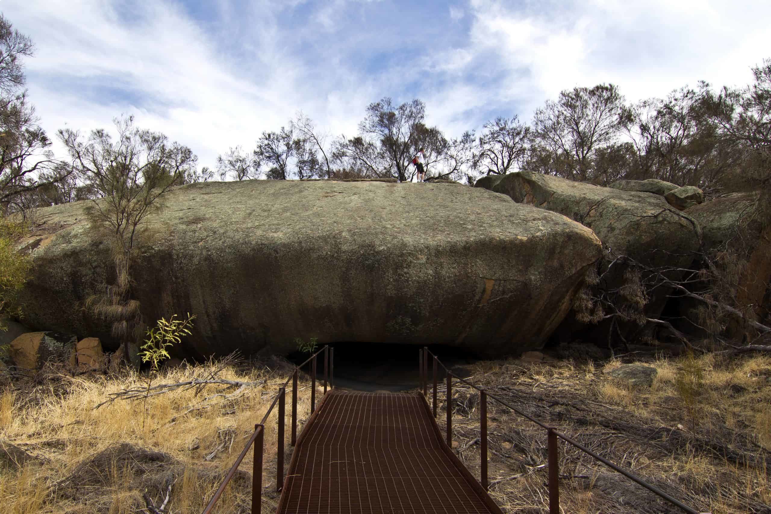
Mulka’s Cave, a natural cavern near Wave Rock in Western Australia is part of a massive granite outcrop of particular spiritual significance. For the Nyungar, the cave was the home of Mulka, the son of a tribally ‘wrong’ marriage, who was left cross-eyed by the cultural transgression. A poor hunter, he instead lived in the cave and ate children who strayed from their camp. Today, visitors have to adjust to the low light, but are rewarded with 450 hand stencils and motifs, the largest rock art site in the south-west of Western Australia (visited as part of our wildflowers tour of Western Australia). The site is now managed through a collaborative approach with the Nyungar, which includes a heritage trail introducing visitors to the plants, animals and gnamma (water holes) used by the Nyungar people to survive.
Many regions of the mallee have also been converted to silo art trails. In the Victorian mallee, Brisbane street artist Guido van Helten painted silos in January 2016, attracting visitors and becoming a social media sensation. The project inspired a 200-kilometre ‘silo art trail’ in the Wimmera region. Paintings expressed the pride of the rural culture of the mallee. Street artist Adnate collaborated with the Wotjobaluk, working with Aboriginal elders and children to create art celebrating the first peoples of the mallee.
Odyssey Traveller visits the Mallee regions of Victoria, New South Wales, and South Australia as part of our new tour of the Southern States of Australia. Designed to make you re-think the way you understand Australia, our tour finds cultural and geographical continuities across state lines, epitomised by the idea of a ‘mallee country’ found across Australia. Our tour through Southern Australia gets away from the major centres – Melbourne, Sydney, and Adelaide – and discovers some of the remote corners of this fascinating country. We hope after reading this article, you will be able to see the semi-arid mallee country through new eyes, imagining how Aboriginal Australians lived and built community in these not-so-desolate lands.
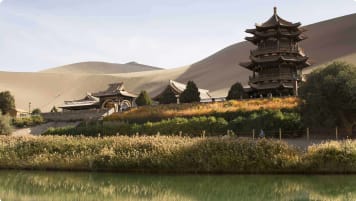
Our tour begins in Adelaide, from which we head to the historic shipping town of Port Fairy, Victoria. We then head to the Budj Bim Cultural Landscape, a fascinating example of indigenous aquaculture and a UNESCO World Heritage Site, and to the Naracoorte Caves Park, another UNESCO site, which is home to fossils of ancient megafauna – Australian wildlife on a giant scale. At yet another UNESCO World Heritage Site, we visit the Willandra Lakes, where geologist Jim Bowler found the ancient remains of Mungo Man and Mungo Lady, 42,000 years after their burials.
From here, our tour heads to the Murray River town of Mildura, where we enjoy a river cruise, before heading to the outback capital of Broken Hill. From Broken Hill, we then head back into South Australia, visiting the railway town of Peterborough and the mining town of Burra.
Travellers with an interest in learning more about the Aboriginal heritage of Australia may want to check out our other outback Australia tours, which include visits to the important cultural site of Wilpena Pound on our tour of the Flinders Ranges; to ancient rock art in the Kimberley, Western Australia, and to the Brewarrina Fish Traps, on our tour of outback Queensland.
The Mallee region is also visited on our tour of Western Australian wildflowers, where we see the endemic flora of Western Australia on a tour that takes us from Perth to Esperance, passing through the Stirling Ranges National Park and the Margaret River wine country.
Every Odyssey guided tour is designed especially for mature and senior travellers, who want an authentic and informed experience of their destinations. Our tours aren’t the typical tourism Australia holiday – Blue Mountains, the Great Barrier Reef, and the penguin parade on Port Phillip Island. Instead, we pride ourselves on getting of the beaten path and making you think about Australia and New Zealand in new ways on every New Zealand and Australia tour.
On our trip to Adelaide, we enjoy wine tasting on a day tour through the Barossa Valley, uncover the Arts and Crafts heritage of the Adelaide Hills, and visit the spectacular scenery of Kangaroo Island. Our Australian outback tour, Broken Hill to Broken Hill, takes you through some of the most remote areas of Central Australia, where Queensland, South Australia, and the Northern Territory meet.
We hope that – with the current easing of coronavirus restrictions by both the federal government and Australian state and territory governments – interstate travel within mainland Australia and Tasmania will resume soon, allowing for our tour of Australia‘s southern states to commence in the second half of 2020.
Articles about Australia published by Odyssey Traveller:
- The Kimberley: A Definitive Guide
- Uncovering the Ancient History of Aboriginal Australia
- Understanding Aboriginal Aquaculture
- Mallee and Mulga: Two Iconic and Typically Inland Australian Plant Communities (By Dr. Sandy Scott).
- The Australian Outback: A Definitive Guide
For all the articles Odyssey Traveller has published for mature aged and senior travellers, click through on this link.
External articles to assist you on your visit to Australia:
- UNESCO: Budj Bim Cultural Landscape and Willandra Lakes Region
- Finding Mungo Man: the moment Australia’s story suddenly changed
- A 42,000-Year-Old Man Finally Goes Home
- Fish traps and stone houses: New archaeological insights into Gunditjmara use of the Budj Bim lava flow of southwest Victoria over the past 7000 years
- ‘A big jump’: People might have lived in Australia twice as long as we thought
- Mildura, Victoria
We acknowledge Aboriginal and Torres Strait Islander peoples as the First Australians and Traditional Custodians of the lands where we live, learn and work. We pay our respects to Elders past, present and emerging.
Related Tours
days
Mar, May, Aug, Sep, Oct +2Small group tour of World Heritage sites and more in the Southern States of Australia
Visiting New South Wales, South Australia
Discover the World Heritage Sites of the southern states of Australia travelling in a small group tour. A journey of learning around the southern edges of the Murray Darling basin and up to the upper southern part of this complex river basin north of Mildura. We start and end in Adelaide, stopping in Broken Hill, Mungo National Park and other significant locations.
15 days
Aug, SepWildflowers tour of Western Australia
Visiting Western Australia
Escorted small group tour for senior and mature travellers as a couple or solo traveller. Western Australia's Wildflower regions including Esperance and the Fitzgerald river National park. Local guides and program leader share knowledge about this fascinating region whilst in bloom.
From A$15,125 AUD
View Tour
days
May, Aug, Sep, Oct, Nov +3Small group holidays to Adelaide and surrounds
Visiting South Australia
Explore and learn about on a small group tour of Adelaide city and its pastoral, cultural and historic settlement. Visit Fleurieu Peninsula, the Barossa valley, learn about William Morris and the arts and craft movement in the Art gallery and National trust houses.
Articles

Aboriginal culture of the Flinders Ranges, South Australia
The iconic Flinders Ranges of South Australia have a rich Aboriginal heritage and are home to a number of vitally important cultural sites and ancient artworks that this small group tour for mature and senior travellers has the opportunity its to learn about.
Uncovering the ancient history of Aboriginal Australia
For small group escorted tours of Australia in Queensland, Victoria, New South Wales, South Australia, Tasmania, Western Australia and the Northern Territory a guide on Aboriginal culture for mature and senior travellers.

Understanding Aboriginal aquaculture
Aboriginal communities had the ability to harvest fish some 20,000+ years ago. Creating major centres of trade and cultural exchange, and supported permanent communities. Discover and learn more on a escorted small group package tour to Victoria, South Australia & Queensland for mature and senior travellers, couples and solo travellers interested in learning.