The Kimberley, Australia: A Definitive Guide
This article supports the small group package tours for mature and senior travellers, couples and solo travellers to Western Australia's Kimberley region. Learn about the wet and dry seasons and the fascinating Aboriginal history as well as the Bungle Bungles, Lake Argyle, Halls creek and resort of Broome.
21 Apr 20 · 19 mins read

Definitive guide to the Kimberley, Australia:
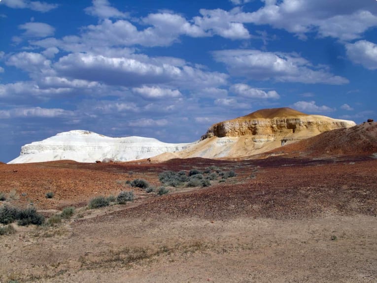
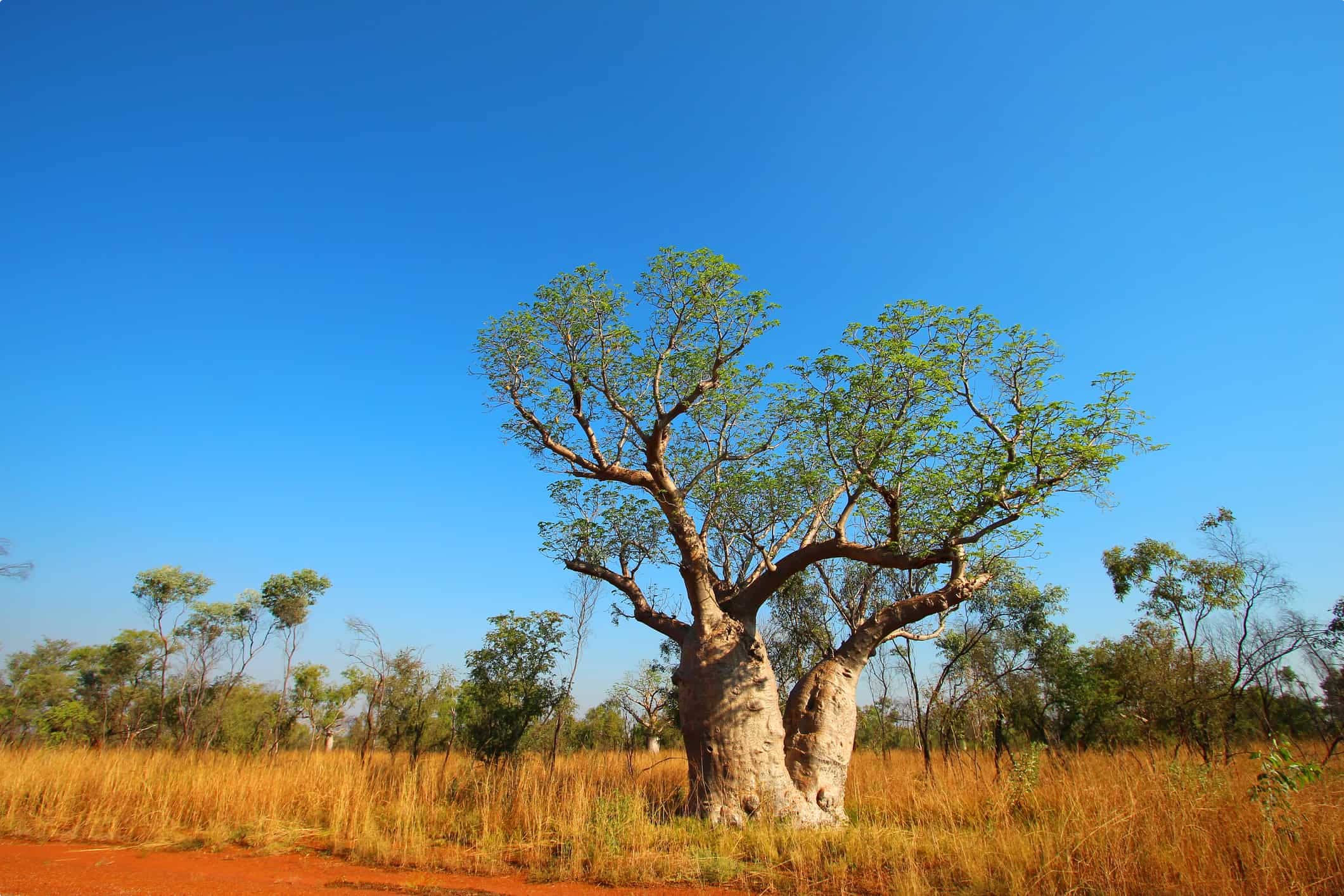
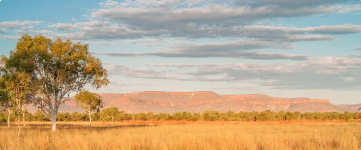
Red sands, strange limestone formations, boab trees, and stunning gorges: Western Australia‘s Kimberley region epitomises the remote grandeur of the Australian outback. The lands from Broome to Darwin are among the world’s most sparcely populated, with settlements such as Fitzroy Crossing, Halls Creek, and Kununurra among the world’s remotest – making travel in the Kimberley a genuine adventure! The region’s national parks and wildlife regions – Tunnel Creek National Park, El Questro Station (and El Questro Wilderness Park), Piccaninny Creek, Gantheaume Point, and Galvans Gorge – are home to landscapes virtually untouched by humans.
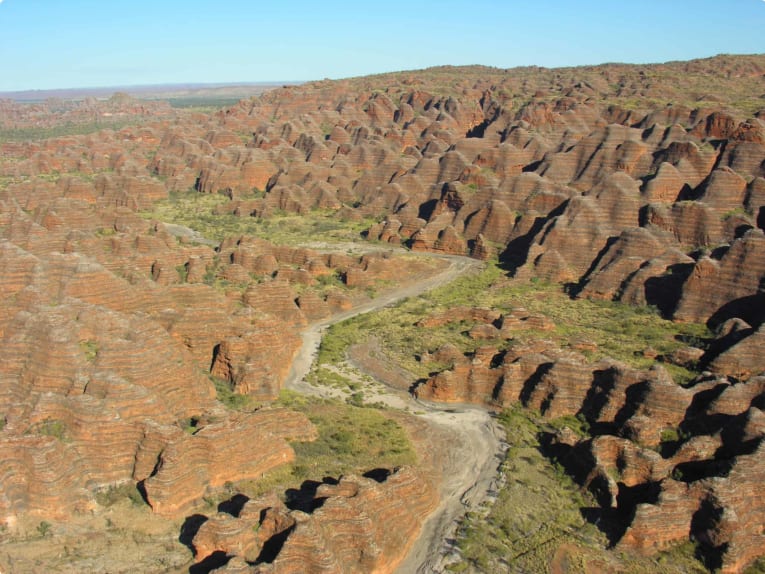
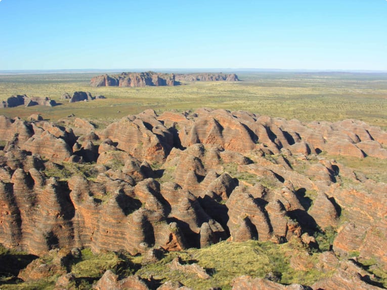
This article is intended as background information for Odyssey’s tour of the Kimberley. Beginning and ending in Broome, our tour takes you through some of Australia‘s most stunning scenery, including El Questro (home to the Emma Gorge and Chamberlain Gorge), Windjana Gorge National Park, Geikie Gorge, Drysdale River Station, spectacular Mitchell Falls, and Purnululu National Park, with the beehive-like Bungle Bungle formations, eerie Echidna Chasm, and stunning Cathedral Gorge. Our tour also explores the rich history of the region, with a fascinating settler, indigenous and multi-cultural past. There has never been a better time to travel Australia – so why not join one of our outback tours for a truly unforgettable experience?
About the Kimberley, Western Australia:
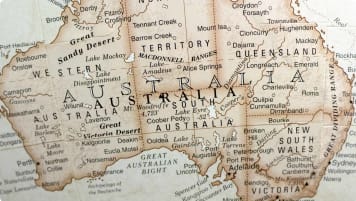
The general area covered in this section is north of a line through Broome and Fitzroy Crossing to the Northern Territory border. The total area is some 420,000 square kilometres – about twice the size of Victoria.
Its white history begins in 1644 when the Dutch explorer Abel Tasman (who had discovered Tasmania in 1642 – but called it Van Diemen’s Land), charted much of the Kimberley Coast on his second voyage when his mission was to discover whether New Guinea and Australia were joined and to determine whether Arnhem Land was part of Australia or New Guinea.
William Dampier, in 1688, was the first Englishman to set foot in the Kimberley, near Buccaneer Archipelago north of Derby. His second voyage in 1699 explored the coast more minutely, especially in the King Sound (Derby), and Roebuck Bay (Broome) areas. On early maps the large bulge between Broome and Derby was called Dampier’s Land (from which we get the term ‘Dampier Peninsula‘). Here he made his infamous and much published statement that the natives were the “miserablest people in the world.”
Nicholas Baudin, between 1800 and 1804, left many of the French names along this coast. Sailing north from Shark Bay in 1801 in Geographe he named Lagrange Bay, Cape Bertholet, Cape Leveque, the Lacepede Islands and the Bonaparte Archipelago.
Like Dampier, Baudin was unimpressed with the area saying “the soil is naked” and all islands in the Lacepede group were “hideous characters of sterility” and as far as he could see “the continent displayed the same sterility”.
Phillip Parker King (1818 to 1821), undertook three voyages in the area in the Mermaid and the Bathurst. He explored and named many of the features between Cambridge Gulf (Wyndham) and Roebuck Bay (Broome). The name “Mermaid” was carved into the trunk of a large Boab tree at Careening Bay on the Kimberley coast in 1820, and it is still there today – probably Australia’s oldest living graffiti.

King’s brief was to examine closely all areas between Arnhem Bay and North West Cape – “all gulfs and openings should be the objects of particular attention, as the chief motive is to discover whether there be any river on that part of the coast likely to lead to an interior navigation into this great continent”. He sailed up the Prince Regent River to the falls now called Kings Cascades. He, like earlier explorers, was deeply unimpressed with the land.
Wickham and Stokes, in the Beagle, 1838, surveyed Disaster Bay in King Sound – so named to highlight King’s narrow escape from the notorious tidal race in this area. They also had two narrow escapes with this phenomenon. Anchored at night in the Fitzroy River, discovered by Stokes (Feb 1838), they were awakened by a sound like thunder as a wall of water over a metre high struck the boats. Later Stokes was almost trapped in the mangroves by the speed of the rising tide.
Land exploration began with Lieutenant George Grey (later Governor of South Australia, New Zealand and Cape Colony), who was met by the “Beagle” expeditions in 1838 at Hanover Bay. He was the first white man to see the Wandjinas – the mystical Aboriginal rock drawings of “space men”. Grey, unlike previous explorers, enthused about the pastoral possibilities describing the area as “having the best grazing land in Western Australia.” He had seen the area at the height of the wet season.
A.C. Gregory, 1855 – 1856, explored some 800 kilometres up Sturt Creek to near Lake Gregory, west of the Tanami Desert before setting off east on his epic overland trip through Northern Territory and Queensland. He defined the eastern boundary of the Kimberley region.
Attempts were made in the 1860s to establish sheep stations in the Broome area, but they were miserable failures. Settlers were beaten back by incredible tides which destroyed their provisions, hostile natives, searing temperatures of 40°C+, fever, sunstroke, lack of water, and poisonous weeds which killed their stock.
Alexander Forrest opens up the Kimberley:
In 1879, Forrest set out from Beagle Bay and explored the West Kimberley along the Fitzroy River. He moved north to discover the Oscar and King Leopold Ranges, reaching the sea near Collier Bay. Retracing his steps to the Fitzroy, he moved east and discovered the Ord River before dashing frantically to the Overland Telegraph Line in Northern Territory to save his party.
Following the publication of his reports there were land rushes in both West and East Kimberley along the Fitzroy and Ord Rivers. Nat Buchanan took up Ord River Station in 1883, and after exploring the Ord River area in 1882, the Duracks and Emanuels arrived in 1885 to take up Argyle Downs, Ivanhoe, Dunham, and Lissadell. In 1886 William & Charles MacDonald took up Fossil Downs, near Geikie Gorge. The incredible sagas of these early settlements are told in Mary Durack’s Kings in Grass Castles and Sons in the Saddle. Nat Buchanan’s exploits are related by his son Gordon in Packhorse and Waterhole – with the first overlanders to the Kimberleys. These first settlers suffered the same hardships as those around Broome – lack of water, hostile natives, heat, fever, poisonous weeds, isolation, and lack of access to markets – a recurring theme in Kimberley settlement
Gold at Hall’s Creek:
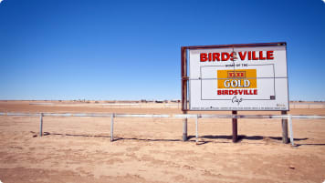
A nearby market seemed assured when Charley Hall and Frank Slattery found Western Australia’s first payable gold at Old Halls’ Creek in 1885. Wyndham (400 kilometres away) and Derby (480 kilometres away) grew as entry ports for miners. By 1886 there were some 2,000 men on the field, but success was short-lived and life incredibly hard. By 1890 there were only 300 hardy miners left and an assured beef market was gone.
Other Developments:
Frank Hann, 1898, “never seen better watered country”, and Frederick Drake-Brockman, 1901, “6,000,000 acres of excellent pastoral land”, opened up the Northern Kimberley of the Durack, Drysdale, King Edward, and Mitchell Rivers areas, but despite all this activity, the area remained remote and isolated with only a few cattle and a very small population. By 1921 there were only 945 males and 186 females in this vast area.
By the late 1920s, when Broome had become the pearling capital of the world (4,000 to 5,000 people and 400 pearling luggers), there were some 2,000 whites and 7,800 “others”, mainly Japanese and Malaysian pearlers. Aborigines were not counted in any statistics before the late 1960s. The pearlers of these days were, of course, concentrating on harvesting the shell, a most important commodity for button making, and actual pearls were just a valuable “windfall”.
Most of these people were in and around Derby, Wyndham, and Broome, emphasising further the isolation of station properties recorded in Mary Durack’s books of Kimberley station life.
Transport was a severe handicap to settlement and reasonable movement. Until after World War II, roads were mere goat-tracks. The road between Broome, Derby, and Wyndham was not completely bituminised until 1987 and the Gibb River Road is still unsealed. Air links developed in the 1920s when Wyndham was linked with Geraldton via Fitzroy Crossing and Halls Creek. The Royal Flying Doctor Service came to the area in the 1930s e.g. to Wyndham and Port Hedland in 1935. Tracks into the Mitchell Plateau area were opened up as late as the 1960s.
Aborigines of the Kimberley:
Nobody knows when the first Aborigines came to the Kimberley, but it was probably over 50,000 years ago. During the last Ice Age, Australia was linked with New Guinea and almost linked with Sunda, the greater Asia. Three routes for migration are likely – one via New Guinea, the others from Timor, either east into Arnhem Land or south to the Kimberley Coast. At the time of lowest water levels there were only 50 to 100 kilometres between Asia and Australia.
Recent research is showing that with a sea level 60 metres below the present level, there would have been broken tongues of land extending from the coast of northwest WA to the east and west of Joseph Bonaparte Gulf, as well as stepping stones to Northern Australia such as Ashmore Reef and Cartier Islet. The craft they used were probably bamboo rafts which served as one way boats as there was no bamboo growing in Australia. Recent research indicates that both the watercraft and ‘sailing skills’ used by the Aborigines were much more sophisticated than previously thought.
How did the Aboriginal people know land existed here? It is believed that the vegetation on the Sahul Shelf (that part of the continental shelf which was exposed during the periods of lower sea levels) was composed of savannah species which are prone to fire by lightning strikes with smoke billows up to 5,000 metres high – these could be seen from islands such as Timor and Seram. A very interesting description of the Sahul Shelf and Aboriginal art of the Kimberly etc. is contained in Prehistory of Australia, and fascinating information on routes of arrival, archaeology etc. in Archaeology of the Dreamtime.
Two occupation sites northeast of Derby are dated at 28,000 years. At Lake Argyle there are carbon-dated vestiges of human habitation dating back 21,000 years before the present. At Yampi Sound and Collier Bay traces go back 24,000 years and on Koolan Island 27,000 years. Evidence of occupation at Carpenter’s Gap, near Windjana National Park, goes back 40,000 years, but earlier occupation sites in the Kimberley are now 250 kilometres offshore and 150 metres below present sea level. Language also suggests early settlement, as 15 of Australia’s 29 major Aboriginal language groups appeared in the Kimberley. By 1979 six of these had disappeared.
For thousands of years the Aborigines lived undisturbed in this area until white penetration in the 17th century. The only other known visitors were Macassans from Sulawesi who came after trochus shell and beche-de-mer. By the end of the 18th century at the latest, they were making annual visits along the whole northern coast of Australia from the Gulf of Carpentaria to the Lacepede Islands near Broome.
Some estimates were of fleets of 200 prahus each with a crew of 30 or 40 men. Trade probably took place and the Aborigines learnt the more complex boat technology of dug-out canoes from them. It is also clear that the Aborigines resented the Macassans and hostilities took place over women and boat stealing.
This small scale inter-racial conflict could not be compared with the impact of permanent white settlement, which, in less than 100 years, supplanted and suppressed 50,000 years of gradual and continuous evolution.
Most accounts of the conflicts have been given by the oppressors, but in 1995 an excellent account from the point of view of the Aboriginal population is given in the book Jandamarra and the Bunuba Resistance, by Howard Pedersen and Banjo Woorunmurra. The book pays particular attention to Jandamarra, known in Eurocentric literature as Pigeon, and his efforts to hit back at the invasions and impositions that were being inflicted on Aboriginal land and sacred sites, particularly against the Bunuba people in, and to the west of, the Napier and Oscar Ranges.
Early explorers were attacked by Kimberley Aborigines. George Grey was wounded in 1838 and early cattlemen were constantly picked off in ambushes. Real hostility and conflict escalated in the 1880s with the arrival of big herds of cattle. It was exacerbated with the arrival of some 10,000 often unscrupulous miners in the Hall’s Creek area in 1886 – 1887. There quickly arose a hatred of the “treacherous nigger” and terrible reprisals took place for killings of white settlers. The Boab Prison Tree – one of the region’s distinctive boab trees located by the road to Derby, is rumoured to have gotten its name because its hollow centre was used as a prison for local indigenous people in the 1890s. Whether true or not, the rumour clearly indicates the cruel treatment of Aboriginal Australians in the area.
Gordon Broughton, a bookkeeper on Argyle Station put it succinctly:
“The basic philosophy of men living in the Kimberley was that the cattlemen had battled their way into the empty land with great hardship and at high cost in lives and money: that they were there to stay, and if the wild blacks got in the way – in other words speared men or killed and harassed cattle – they would relentlessly be shot down. It was as simple and brutal as that.”
Broughton also touched on the subject of “black velvet”. “For the greater number” he wrote, “intercourse with the younger and more comely black women was purely a physical matter, devoid of emotional involvement.” White men who lived with “gins” were contemptuously known as “Combos”, and sex-driven men in the outback did not think about the half-caste problem growing up around them. Even outback heroes like Nat Buchanan treated Aborigines cruelly. Both he and Alfred Canning chained Aboriginal guides who were helping guide them through difficult country. There was a Royal Commission into Canning’s exploits in 1906, but while condemning the use of chains, the Commission found him innocent of any wrongdoing. George Hales, a prospector, writing home, reported that “having bailed up a large number of blacks in a gully who showed fight, they proceeded to slaughter them with repeating rifles. It is certain a great many of them were killed, some say at least a hundred”.
Massacres like this certainly continued well into the 20th century. As late as 1926 a group of police killed between 20 and 100 Aborigines, burned and buried the bodies. Public outcry forced a Royal Commission but the two police, arrested and tried, were acquitted.
By 1900, people like Daisy Bates, were talking of “smoothing the pillow of a dying race”, and this view was widely held.
Some white settlers valued Aborigines and treated them very well (the Duracks were among these), even if by modern standards in a paternalistic way. Trained and valued black stockmen were, of course, well cared for and protected, and the women became much loved domestic servants. Loyal stockmen even came to the Kimberley from far away Queensland to serve the Duracks. This was officially acknowledged by M.P. Durack (Mary’s father) in 1950, when he erected a plaque tohis ancestors at Argyle and, at the same time, erected a similar plaque for “Pumpkin” and “Ulysses”. The plaque to Pumpkin read “who from boyhood served Patrick Durack of Thylungra, Western Queensland, following his sons to the West in 1887 and rendering faithful service and devotion to the day of his death in 1908.”
Missionaries tried to “civilise” the Aborigines with very little success. Missions were set up near Derby in 1885 but these failed. Later attempts by Anglicans and Catholics up to 1913 met with little success. In 1908 the New Norcia Benedictines established Pago, later Kalumburu, and succeeded. Good work, by white standards, was done in later years. It is interesting to note that Abbot Torres at Pago in 1908 wrote: “we are in the chapel saying our prayers, with the Rosary in one hand and the revolver in the other.”
Attitudes to Aborigines began to change in the 1960s. They were counted as part of the Australian population for the first time in 1966. The Pastoral Act of 1968 stated that Aborigines had to be paid award wages and not “in kind” (tobacco and food), as previously was the custom. This was a mixed blessing, as, with higher wages and lower meat prices, many Aborigines were no longer kept as stockmen and were forced into towns to live on social welfare.
Gradually land rights for Aboriginal people have been recognised. In 1972 the Western Australian Government set up Aboriginal Land Trusts and in 1976 the Commonwealth Aboriginal Councils and Associations Act gave them control over their own land and special access to it. They have the right to exclude whites from their land, and special permission has to be sought to enter these reserved areas. Today, Aborigines control some 6.5 million hectares in the Kimberley Region. Recent High Court Mabo and Wik decisions have given grounds for far more territory to pass into Aboriginal hands. In 1999, for example, a major set of three properties just west of the Pentecost River was transferred to Aboriginal ownership.
Old ideas and prejudices die hard, and many whites in the Kimberley resent these changes. A very enlightened Albert F. Calvert, writing of The Aborigines of Western Australia in 1892 said:
“There are those who flatter themselves that they belong to a higher order of created beings than the Western Australian aborigines, who have been represented as mere baboons possessing an innate deficiency of intellect. [They were still being referred to as “Rock Apes” by some in the 1980s] . . . It will be well for such persons to reflect that a similar opinion was at one time held by the cultured Romans concerning the aborigines of Great Britain, . . . Cicero saying in one of his epistles . . . ‘they are so stupid and utterly incapable of being taught’”.
Rather than dying out, Aboriginal numbers are on the increase and today make up 40% of the Kimberley population.
Aboriginal Art of the Kimberley:
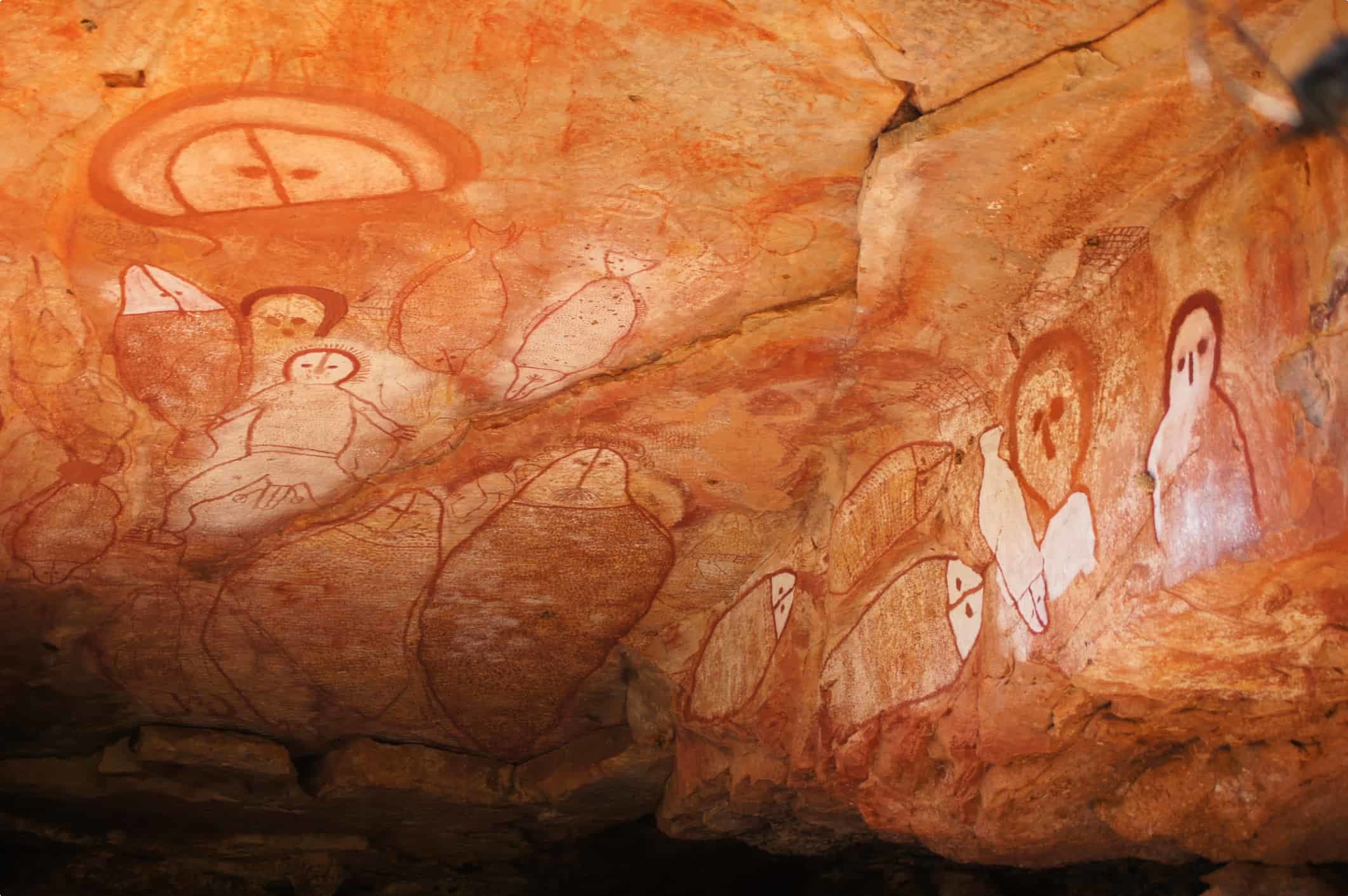
On our journey we will see two types of Aboriginal art unique to the Kimberley and nearby islands. These two types of paintings are not simple – they have a variety of features which we will study.
The Art of the Wandjina is an integral part of the Kimberley and is the more recent of the two types. Wandjinas are ancestor beings and cloud spirits but are also seen by Aboriginal people as having human form. They are depicted in striking paintings with huge heads and eyes, no mouths, beak-like noses, elaborate headdresses, and rays of lightning or feathers radiating from the head. Stark white backgrounds portray the clouds. Important Wandjina animal spirits sometimes accompany the human forms. The mythology associated with Wandjinas is similar to that of Lightning Man which we saw in Kakadu. Wandjinas are responsible for bringing the storms and life giving rains.
Bradshaw, or Gwion, paintings are small dynamic figures also similar to the dynamic figures we saw in Kakadu. There are possibly 25 different types of Gwions distinguished by different shapes and ornamentations. Quartz grains in a mud wasp’s nest plastered over a Bradshaw painting has recently been dated at 17,000 years old (meaning that the art work was there before the wasp’s nest)
Primary Industry:
Industry in the Kimberley has had a chequered history. Early attempts were made to establish a sheep industry but these failed for many reasons. Disease, poor lambing, land degradation, and the wet season contributed to the failure. However the cattle industry has survived, under difficulties, the last of which was the eradication of tuberculosis and brucellosis.
The Cattle Industry utilises about 64% of the Kimberley area (approx 200,000 square kilometres) only 10% of which is classed as good grazing country. It is considered that a cattle station needs a herd of at least 12,000 to survive. As a result of this, the number of pastoral leases has declined. Live cattle are sent out of the area each year to overseas markets and to meatworks in Australia.
The Ord River Scheme was first mentioned in 1941. Twenty one years later the dam holding back Lake Kununurra was finished and between 1969 and 1972, Lake Argyle was completed. It is reputed to be 13 times the size of Sydney Harbour. Lake Argyle, to the south, is the major dam of the Ord River. When full, it covers 200 square kilometres, making it one of the largest dams in the Southern Hemisphere. The dam has also played a role in preserving natural wildlife: while the Ord River was home to around 350 freshwater crocodiles, Lake Argyle is now home to a population of over 35, 000 freshwater crocodiles.
Kununurra, a custom-built town to service the area, emerged in 1961. The irrigation system that was envisaged has never flourished as intended. Rice, cotton and sorghum were all trialled but failed. Recent crops, such as bananas, cashews, rock melons, chickpeas, beans, sugar cane, peanuts, and cattle fodder, have been more successful. In the early days, serious problems arose from insects, Magpie Geese devastating the crops, and the long distance to southern markets restricting the type of cash crop grown. Bananas, melons, and sugar cane are now major products.
Mining is booming, with iron ore mined at Yampi where about 4 million tonnes are extracted annually. Current operations are under review.
The big money comes, however, from the diamonds of the Argyle Mine, about 80 kilometres south of Kununurra. In 1979 the 1600 metre long Argyle diamond “pipe” was discovered. The mine went into open- cut operation in 1986. The mine produces mainly industrial diamonds but is also producing a unique lustrous delicately pink gem, now much sought after. The mine, which is to the south and east of the area visited on this tour, is the biggest producer of diamonds in the world. About five percent are top quality, forty five percent second grade, and the remainder, industrial diamonds. The company expects to produce at the current rate of 6 tons (some 30 million carats) per year for the next twenty years. A deep pink diamond, of top quality, is worth up to one million dollars per carat. A white diamond is worth approximately $18,000 per carat. Diamonds are also mined from several pipes at Ellendale in the Western Kimberley.
Other smaller mining ventures include zinc-lead at Cadjebut, rare earth minerals at Hall’s Creek, and a small oil field is situated east of Derby. Huge deposits of bauxite have been proven in the Mitchell Plateau.
The Pearling Industry has changed over the last hundred years. In the early days, pearls were, in fact, a bonus to the Mother of Pearl (MOP) industry which was the main source of revenue. MOP was used for button making. Today the cultured pearl is the main industry with over 20 companies operating Australia wide. As in the past, the Japanese have a major interest in this industry. Two of the largest groups are at Kuri Bay in King Sound, north of Broome, and at Eighty Mile Beach to the south. In 1994 Australia had a $109 million turnover from the pearl industry. The MOP is still sought from the cultured pearl industry.
The death rate was particularly high with the natural pearl divers in the early days, due to the great depths at which they worked (up to 26 metres). Rapid ascents, because of bad weather and other causes, were responsible for the deaths which were mainly attributable to the bends or nitrogen narcosis. Many of the earlier divers were Japanese and it is no coincidence that there are many Japanese graves in the Kimberley cemeteries dating back to the early and tragic days of the pearling industry.
A particularly poignant period in the history of the pearling industry was in 1912 when the “White Australia” policy forced the industry to replace Asian and Aboriginal divers and their handlers with British (ex-Royal Navy) divers. The “experiment” went horribly wrong and of the nine white divers, three died of the “bends”, two left in disgrace, and the rest stayed on in Broome, but not as divers.
Tourism probably creates the most important cash flow in the Kimberley area these days, and is slowly changing the isolation of the Kimberley. Companies have moved in to market Kimberley outback tours, often a day tour by scenic flight (given the remoteness of the region). Broome, home to the iconic Cable Beach, has become a major draw for tourists, though locals bemoan the changes, rightfully claiming that the town has lost some of its distinctive flavour. The El Questro Wilderness reserve epitomises the changes to the region: once a operating cattle station, it was bought in 1991 by owners who recognised the tourist potential of beautiful Emma Gorge and Chamberlain Gorge. Today El Questrooffers a mix of tented cabins and luxury accommodation in the old El Questro station. The region’s many national parks – Windjana Gorge, Purnululu, and Tunnel Creek – have also become a major draw for national and international visitors, as has the iconic 4WD trail along the Gibb River Road, passing the scenic Gibb River gorges of Bell Gorge, Manning Gorge, and Galvans Gorge.
Geology & Geomorphology
This section begins with an overview of the geology of the Kimberley region. This is followed by a description of the physiographic regions we traverse between Darwin, Kununurra, and Broome across the Kimberley.
Kimberley Geology:
There are six major elements to the Kimberley geology – the Hall’s Creek Province and five basins. In general, basins are regions formed over varying periods of time following subsidence and subsequent infilling over millions of years. They are recognised by being made up of layers of sedimentary materials such as sandstone, siltstone, limestone, shale, and dolomite. The sedimentation to form these basins may have occurred in a range of freshwater or marine conditions. The sediments would have been carried from the surrounding higher areas by river, gorge, and stream. They may have come from glaciation or could have resulted from the growth of organisms including coral and algae.
Subsequent, mainly physical and chemical, processes have weathered (broken down) these sedimentary rocks with the removal (erosion) of the softer materials so produced. Following deep weathering, laterisation may occur to produce distinctive formations including bauxite and layered lateritic profiles including a resistant surface crust of rock (a duricrust) covering a mottled zone which is underlain by a deep pallid zone.
While remaining relatively horizontal, the rocks of the basins may be influenced by igneous activity. They may be intruded from beneath by molten magma to form granites, dolerite, or gabbro, or covered by basalts formed from cooling lava flows. In some cases the basalts may have been added to the surface whilst it was covered by a sea or ocean, in other cases the basalts themselves have been covered by deposition.
The Hall’s Creek Province has, in comparison to the basins, been tectonically active: there has been substantial tectonic (mountain building) activity and igneous activity in this province. In addition to mountain building, both of these activities can create conditions of great heat and pressure which may bring about metamorphosis of the original rocks. The province is divided into the Hall’s Creek and the King Leopold Mobile Zones – reflecting the topsy-turvy nature of the rocks following movements and metamorphosis.
Related Tours

days
May, Jun, Jul, Aug, SepSmall group tour of Australia's Kimberley
Visiting Western Australia
Escorted small group tour of the Kimberley. We explore and visit The Bungles, Bell Gorge, Mitchell plateau & Halls Creek in the dry season. Amazing landscapes intertwined with Aboriginal communities resident more than 45,000 years.
days
Apr, May, Jul, Aug, Oct +2Small group tour of Australia's Flinders ranges
Visiting South Australia
Escorted small group tour of the Flinders range in South Australia from Adelaide. Learn about Coober Pedy, Wilpena pound and water system of Lake Eyre as we explore and learn also about the history of the people who explored the Flinders.