Highlights of Devon and Cornwall
Article for small group tour of mature and senior couples or single travellers interested in the key places of Devon and Cornwall such Tintagel, St Michaels Mount, Penzance, the Scilly isles and more.
16 Jul 21 · 28 mins read

Join Odyssey Traveller on this tour of the West Country of England and the fascinating areas of Somerset, Devon and Cornwall. This is an escorted small group tour for mature and senior travellers who are travelling with partners or as a solo traveller. This is a journey filled with stories of wreckers and ship wrecks, smugglers, pirates, medieval treasures, charming fishing villages along the Cornish coast, stunning cliff-top coastal views of the blue Atlantic, castles and romantic destinations traditionally linked to the legends of King Arthur, and the delights of ‘cream teas’ and Cornish pasties.
The tour starts and ends in Bristol, which is situated on the River Avon in South West England, and was once a medieval trade centre and busy maritime port for explorations into the New World. Bristol is a great first stop for our own adventure as we travel west and south, even venturing beyond the Cornish coast and across the Atlantic to the Isles of Scilly.
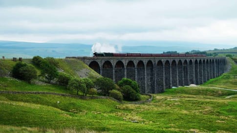
We will spend nights in Bristol, Exeter, St Austell, Penzance, Hugh Town, Newquay, Lynton and Bristol exploring top attractions in the British mainland dating from the medieval and industrial ages: from the medieval strong hold believed to be where King Arthur was conceived (Tintagel Castle in Tintagel) to the last castle constructed in England (Castle Drogo); from the highest and steepest water powered railway in the world (Lynton and Lynmouth Cliff Railway) to the longest passenger ship of its time that once travelled from Bristol to New York (SS Great Britain).

Related Articles

10 Books to Read If You Are Planning to Visit Britain
10 Books to Read If You Are Planning to Visit Britain For Odyssey Travellers, Britain has and remains a key destination in the organisation’s collection of escorted small group educational tours offered each year. For…
15 books on Britain's Industrial Revolution
Fifteen books on Britain’s Industrial revolution This reading list on Britain’s Industrial revolution complements Odyssey Travellers escorted small group tour that traces via the canal and railway network, the evolution of this monumental change in…
Atlantic Ocean and How it Shaped Ancient Communities In Europe
Article of interest for senior couples and mature solo travellers joining a small group European tour to Faroe Islands, Scottish Isles, Morocco or Portugal. Focus is on the early exploration of the Atlantic.

Dartmoor, England
Article about Dartmoor a unique landscape setting in England. Learn more before joining a educational small group tour for senior couple and mature solo travellers visiting Britain's England, Scotland and Wales.
Exploring Cornwall
Short article about Cornwall for senior couple and mature solo travelers on a escorted small group tour of England. Join a discovery or a walking tour to learn more about St Michael's Mount, Tintagel the Scilly isles or Penzance within Cornwall.

Exploring Devon
Article about Devon for senior and mature small group tours couple and solo travellers interested in stone circles, the Romans or English history including the Industrial revolution.
Isles of Scilly, England
The Scilly isles form part of a day trip on the escorted small group tour of Devon and Cornwall for seniors and mature travellers. Whilst on this tour the group also visit St Michaels Mount, Penzance, Glastonbury and Tintagel.
Landscapes of Medieval England
Article about Medieval England supporting Britain's history from the Roman's to Queen Victoria and the industrial revolution.

Lumps and Bumps: How to Read the British Landscape
The British landscape has been worked and re-worked. It is secrets of this palimpsest landscape is revealed through drainage patterns and prehistoric features all the way through to the modern day. These small group tours for mature and senior travellers examine the landscape from the Neolithic, to Roman, through the seven ages of Britain in walking tours and history tours of Britain.

Lynton and Lynmouth, England
Article about Lynton and Lymouth for senior couples and mature solo travellers. Explore Devon and Cornwall as part of a small group tour of England by coach or on a walking program.

Newquay, England
Newquay, part of the heritage of Devon and Cornwall is explored on an Educational small group tour for senior couples and mature solo travellers seeking to learn about ancient Britain through to the Victorian era.

Penzance, England
Penzance Article for senior couples and mature solo travellers seeking to explore Devon and Cornwall. Explore our range of Educational small group tours.
St Michael's Mount, England
The counterpart to Mont St Michel. On the Devon and Cornwall escorted small group tour for senior and maturer travellers the group learn about the abbey of St Michael's mount built in the middle ages complete with gargoyles and grotesques.
Tintagel, England
Tintagel, article explores the place in Cornwall that encourages the senior couple or mature solo traveller on a small group tour to follow the legend of King Arthur.

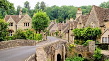
Touring England's villages
Touring England’s villages For many travellers, London is synonymous with England. This lively, cosmopolitan capital is a must see, of course, but there is more to England than booming cities and industrial centres. Instead, what…
Articles about Britain
Sites Visited
The tour departs from Bristol, through magnificent countryside, towards Exeter and two very special places along the way – Glastonbury and Taunton.
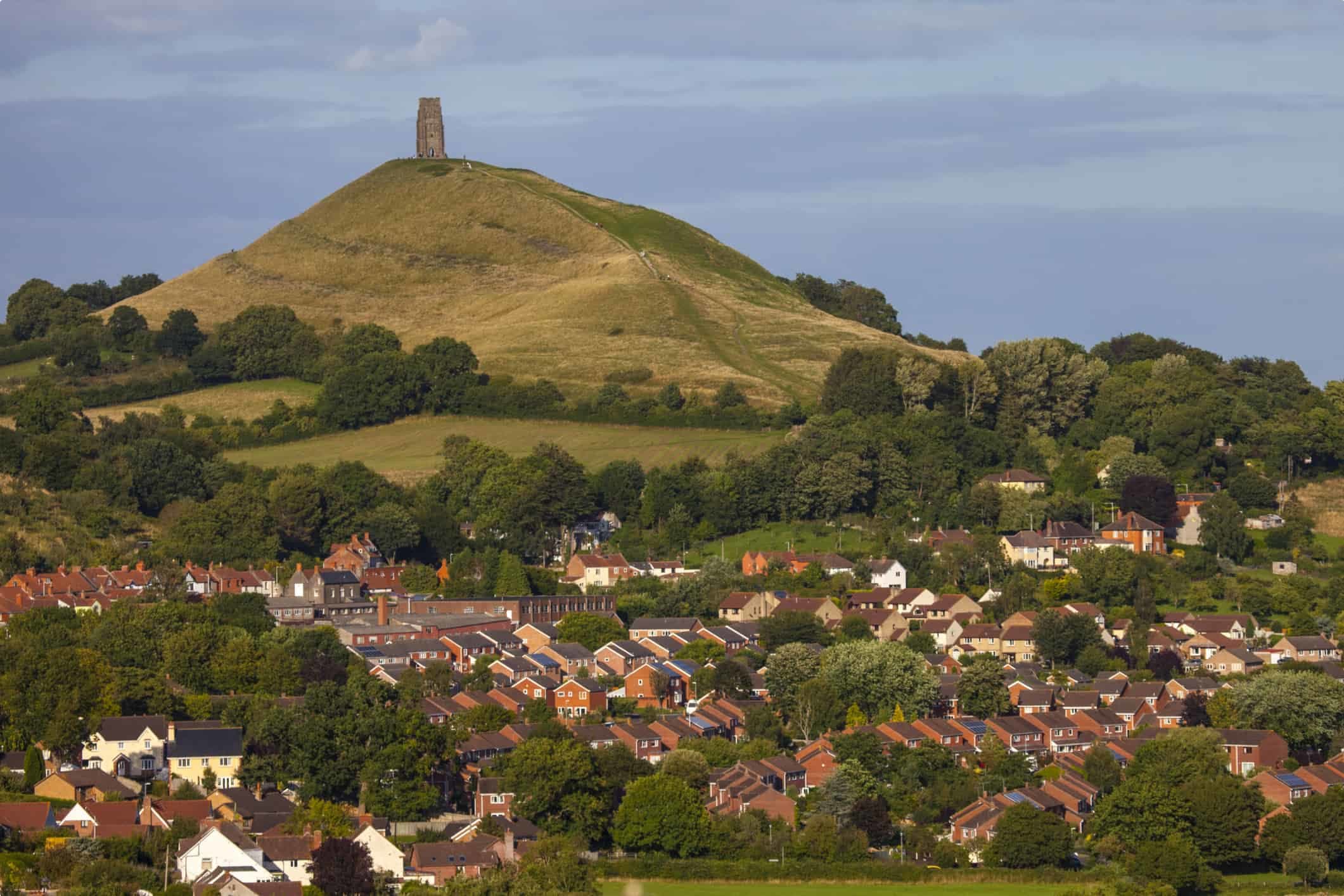
Glastonbury.
Glastonbury as an important pre-Christian centre and the cradle of Christianity in England but is also reputed to be the burial place of King Arthur, and is now the world famous site of the Glastonbury Festival. Glastonbury town is wonderfully strange with its cleverly named and quirky shops selling crystals, tarot, witches’ supplies and potions. Glastonbury is thought to have been a site for pre-Christian worship, perhaps because of cation by the Tor, the highest of the hills surrounding Glastonbury and a superb natural viewpoint. The Tor is topped by a roofless tower, said to hide an entrance into the fairy realm, and is thought to be the location of the Holy Grail. Glastonbury Tor is thought to be the Avalon of the Arthurian legends. In Arthurian legends Avalon stood in the midst of a shallow lake, which in those days the Tor did – the Somerset Levels. The slopes of the hill are terraced, but the method by which they were formed remains unexplained. The Somerset Levels are a coastal plain and wetlands running from the Mendips to the Blackdown Hills. People have been draining the Levels from before the Domesday Book which is a manuscript record of the ‘Great Survey’ of much of England and parts of Wales completed in 1086 by order of King William the Conqueror. Later draining was instigated by the monasteries of Glastonbury, Athelney and Muchelney.
Glastonbury Abbey was founded in the 7th century, but Christian legends suggest that the Abbey was founded by Joseph of Arimathea in the 1st century. The Glastonbury Thorn tree is believed to have grown from his walking staff struck into the ground. It is true that genus of the thorn tree is not from Britain, but intriguingly from the East. Sceptics argue that medieval monks added the Arthur stories to embellish the reputation of Glastonbury to attract pilgrims away from rivalling abbeys. It was all about wealth and power. By 1066 Glastonbury Abbey was the wealthiest in Britain. Today it is an attractive ruin.
Taunton and Hestercombe House and Gardens
Taunton is a large town in Somerset and in the 2011 census, the population was 69,570. The town has over 1,000 years of religious and military history, including a 10th century monastery and a castle with origins in the Anglo Saxon period. In 1685 the Duke of Monmouth crowned himself King of England in Taunton during the Monmouth Rebellion which culminated in the Battle of Sedgemoor. Judge Jeffreys, Hanging Judge Jeffreys, lived in the town during the Bloody Assizes (the trials of more than 1,000 rebels from Monmouth’s rebellion) conducted in the Great Hall of Taunton Castle (now the Museum of Somerset). The Grand Western Canal reached Taunton in 1839 and the railway in 1842.
Close to Taunton is Hestercombe House and Gardens – an 18th century park with a 19th century house and a great 20th century garden which is a unique combination of three centuries of garden design: Coplestone Warre Bampfylde’s Georgian landscape garden, the Victorian terrace and shrubbery and the stunning Edwardian formal garden design by Sir Edwin Lutyens and Gertrude Jekyll. The Hestercombe estate dates to at least the 11th century when it was owned by Glastonbury Abbey. The current manor house dates to the 16th century and was built for the Warre family. The house was extended in the 18th century, then comprehensively rebuilt by Edward Portman, 1st Viscount Portman in 1875. The Victorian facade hides the earlier historic core of the building.
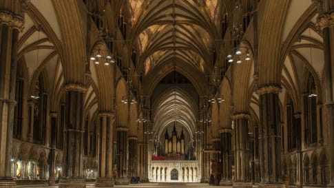
The city of Exeter
Exeter is a city in Devon on the River Exe 58 km northeast of Plymouth and 105 km southwest of Bristol. It is the county town of Devon, and home to Devon County Council and the University of Exeter. In Roman Britain, Exeter was established as the base for the second legion of Emperor Augustus under the leadership of Vespasian who later became Emperor himself.
Exeter became a religious centre in the middle Ages. Exeter Cathedral, founded in the mid-11th century, became Anglican in the 16th-century English Reformation. In the late 19th century, Exeter became an affluent centre for the wool trade, although by the First World War the city was in decline. After the Second World War, much of the city centre was rebuilt and is now a centre for business and tourism in Devon and Cornwall.

Exeter Cathedral is one of England’s most beautiful medieval cathedrals and one of the finest examples of decorated Gothic architecture. Dating back 900 years, it is most famous for its two Norman towers, impressive west front carvings and the longest unbroken stretch of Gothic vaulting in the world. Of note are the Minstrels’ Gallery, the 15 Century Astronomical Clock, a complete set of Misericords (hinged seats for perching on) and highly decorated tombs, bosses and corbels. The library contains the famous Exeter Book of Anglo-Saxon verse, the Exon Domesday and many other historical documents.
The Exeter Book, MS 3501, also known as the Codex Exoniensis, is a 10th century book or codex which is an anthology of Anglo-Saxon poetry. It is one of the four major Anglo-Saxon literature codices, along with the Vercelli Book, Nowell Codex and the Cædmon manuscript or MS Junius 11. The book was donated to the library of Exeter Cathedral by Leofric, the first Bishop of Exeter, in 1072. It is believed originally to have contained 131 leaves, of which the first 8 have been replaced with other leaves; the original first 8 pages are lost. The Exeter Book is the largest known collection of Old English literature still in existence.
Dartmoor and Castle Drogo – the last castle to be constructed in England.
Dartmoor is an upland area in southern Devon, England. The moorland and surrounding land has been protected by National Park status since 1951. Dartmoor National Park covers 954 square kilometres. The granite which forms the uplands dates from the Carboniferous Period of geological history. The landscape consists of moorland capped with many exposed granite hilltops known as tors, providing habitats for Dartmoor wildlife. The highest point is High Willhays, 621m above sea level. The entire area is rich in antiquities and archaeology.
Parts of Dartmoor have been used as military firing ranges for over 200 years. The public is granted extensive land access rights on Dartmoor (including restricted access to the firing ranges). The Neolithic village of Grimspound is situated on one of the highest points of the moor. Once, this now abandoned settlement was home to dozens of people and their livestock. At the base of Hound Tor are the remains of a medieval village, long deserted, but used as the setting for Sir Arthur Conan Doyle’s novel The Hound of the Baskervilles. Another strange, but popular, attraction on Dartmoor is the little place of worship, Bretnor, dedicated to St Michael and situated at the very top of an extinct volcano. The church is dedicated to the Archangel Michael like so many churches in the area. Other St Michael Churches can be found on St Michael’s Mount and at Rame Head.
High up on the expanses of Dartmoor, in the town of Princetown is Dartmoor Prison which is still a working prison. The prison dates back to 1809 and was constructed by Napoleonic and American prisoners of war. Associated with the prison, is the Dartmoor Prison Museum.
Castle Drogo near Drewsteignton in Devon, is the last castle to be built in England. It was constructed between 1911 and 1930, for Julius Drewe, founder of the Home and Colonial Stores. Drewe chose the site in the belief that it formed part of the lands of his supposed medieval ancestor, Drogo de Teigne. Edwin Lutyens was the architect chosen and he rather lamented Drewe’s determination to have a castle but nevertheless produced one of his finest buildings. The castle was given to the National Trust in 1974, the first building constructed in the twentieth century that the Trust acquired. The castle is a Grade I listed building, and the gardens are Grade II listed on the National Register of Historic Parks
The architectural critic, Christopher Hussey, described the result: “The ultimate justification of Drogo is that it does not pretend to be a castle. It is a castle, as a castle is built, of granite, on a mountain, in the twentieth century”.
Greenway House
Is National Trust estate on the River Dart neat Galmpton in Devon. This Georgian House was built late in the 18th Century for a successful sea merchant, but there has been a house on this site for over 400 years. The garden has been accredited by the International Camellia Society as a ‘Garden of Excellence’. It is the first National Trust garden to receive this accreditation and is one of only seven in the UK. In the garden there is a woodland that drifts down the hillside to the River Dart, a walled garden as well as an allotment cared for by local school children. Agatha Christie and her family would spend summers and Christmases in this house with friends, relaxing by the river, playing croquet and clock golf, and reading her latest mystery aloud to guests. The family were great collectors and the house is filled with an important and varied collection of ceramics, Tunbridge ware (decoratively inlaid woodwork, usually ornate wooden boxes), silver and books. There are also artefacts acquired in the Middle East where Agatha accompanied her husband, archaeologist, Max Mallowan on excavations. There is a frieze in the library, painted in 1944 when the house was requisitioned by the US Coastguards as part of the preparations for D Day.
Coletone Fishacre is now a National Trust house that was built in 1925 by Dorothy and Rupert D’Oyly Carte. Rupert was the son of Richard D’Oyly Carte, impresario of Gilbert and Sullivan’s operettas, founder and owner of the Savoy Theatre and Savoy Hotel. This is probably the finest Art Deco house in Britain, an outstanding example of early 20th Century manufacture and design. The architect Oswald Milne was a protégé of Sir Edward Lutyens, the foremost architect of early 20th Century design. The gardens were designed by the owners, and the moist Devon climate makes it ideal for plants that like it wet, such as bamboos, mimosa, and subtropicals. In addition, there are walled and terrace gardens, a circular pool and stream gardens, and scented plants and herbs. A gazebo provides excellent sea views. There are 30 acres of gardens, accredited by the Royal Horticultural Society. The tree canopy and the moist climate make this a perfect environment for tender plants from South Africa, New Zealand and the Mediterranean. At the bottom of the garden, a gate gives access to the South West Coast Path, running along the coast, and to a trail leading down to the shore at Pudcombe Cove. On the shore you can see the D’Oyly Carte family’s tidal swimming pool.
Cornwall
Cornwall is the most remote of English counties. Its eastern boundary, on the River Tamar, is some 320 km distant from London. Cornwall’s westernmost town, Penzance, lies another 130 km farther from London and close by Land’s End, the traditional southwestern extreme of Great Britain. The Isles of Scilly lie an additional 56km southwest of Penzance in the Atlantic Ocean.
During the early Stone Age period, there was little sign of human habitation in Cornwall, although there are signs of occasional visitors from elsewhere. The Mesolithic era – the Middle Stone Age from about 10,000 BC- was the end of the last glacial period when water levels began to rise. Hunter-gatherers began to settle around the coastline of Cornwall and evidence can be found around the Lizard, for example, and on upland areas such as Bodmin Moor.
Between 4,000 and 2,500 BC in the Neolithic or new Stone Age there was great social and agricultural development. Farming began and there was increased monument construction, as the population increased. Settlements began to be fortified.
The Early Bronze Age between 2,400 and 1,500BC saw the introduction of metal working. The use of bronze exploited Cornwall’s natural resources of tin and copper. These metals were found by tin-streaming and open-cast mining. During this period there were many more ceremonial and burial monuments: the stone circles, rows and standing stones or menhirs, and the barrows with their “cist graves” hollowed out of stone or timber.
From 1,500 – 600 BC during the Late Bronze Age, the climate became wetter causing movement of the settlements to lowland sites such as Trethellan, Newquay. The nature of farming changed to less intensive grazing on the uplands. As a result, a more warlike society evolved which often sacrificed weapons to their gods. Although it has long been believed that the first Brythonic Celts (ie, from Gaul or France, and not from Spain or Portugal) arrived in Britain around 600BC, some recent scholarship suggests this possibly happened as early as 2000 BC. Today Cornwallis recognised as one of the six Celtic nations, along with Ireland, Wales, Scotland, Brittany, and the Isle of Man
Iron gradually replaced bronze for weapons and farming tools during the Iron Age from 600 BC to 43AD. People started to live in defended settlements known as rounds which were bank-and-ditch enclosures around a number of round-houses. Economic and social centres, for manufacturing and trading, were established on hill-tops and headlands, such as Trevelgue Head, near Newquay.
During the late 1st century AD, Roman military occupation of Britain began. At this time the part of Britain annexed by Rome was divided among various tribes. The south west was occupied by the Dumnonii, Iron Age Celts who had been in the area for centuries. The rural society in Cornwall was largely unchanged by the Roman influence. Trade in tin increased during the 3rd and 4th centuries AD, not only for bronze, but also to combine with lead for pewter objects. Courtyard houses appeared at this time in villages such as Chysauster, Penzance.
During the 6th and 7th centuries there was an English invasion of Cornwall. This was the period of Arthur, Doniert & other Celtic kings including King Mark. It was also known as The Age of the Saints.
Many legends associate King Arthur with Cornwall. He was said to have been born in Tintagel, at the home of Gorlais, Earl of Cornwall. It was here that Uther Pendragon seduced Igerna or Igraine, Arthur’s mother. The castle ruins at Tintagel are 11th century, but there are signs of a much earlier settlement. There is a cave below the castle known as Merlin’s Cave as the magician is said to haunt it. Arthur is said to be reincarnated as a Cornish chough.
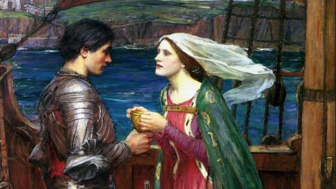
King Mark was said to have lived at Castle Dore, Fowey. Legend says that Mark sent his nephew, Tristan, to Ireland to bring back the fair Iseult to be Mark’s queen. However the young couple accidentally swallowed a love potion and fell passionately in love. Iseult married Mark and the story inevitably had a tragic ending. It is interesting that this story parallels the story of King Arthur sending his most loyal knight, Lancelot du Lac, to collect his new bride Guinevere from her home in Scotland. They, too, fall in love with tragic consequences.
In 577, the Battle of Deorham Down near Bristol resulted in the separation of the Cornish (known as the West Welsh) from the Welsh by the advance of the Saxons. By this time, the Saxons had destroyed the remains of Roman civilisation and it was almost forgotten in the west. The Saxons were established and they were converting their conquests to Roman Christianity. Not long after this the earliest Christian church opened at St. Piran’s Oratory.
St Piran became the patron saint of Cornwall and of tin miners. His flag is a white cross on a black background. St Piran’s Day is celebrated on March 5th. He is the most famous of the Irish saints who came to Cornwall and is said to have discovered tin and to have founded the monastery of Clonmacnois. Legend says the heathen Irish tied him to a mill-stone, rolled it over the edge of a cliff into a stormy sea, which immediately became calm. The saint floated safely over the water to land upon the sandy beach of Perranzabulo in Cornwall, where his first converts were animals.
In 936 Athelstan’s (King of the Anglo-Saxons and then King of England) settlement had fixed the east bank of the River Tamar as the boundary between Anglo-Saxon Wessex and Celtic Cornwall. The river still marks the division between Cornwall and Devon.
The county’s isolation aided the survival of the Celtic language known as Cornish, although it has not been spoken as a living language since the 18th century. Celtic place-names are much in evidence. After the Norman Conquest (1066) the indigenous manors of Cornwall were taken over to form the basis of an earldom; since 1337 they have belonged traditionally to the eldest son of the English sovereign, who acts as duke of Cornwall – currently Prince Charles.
Tin was mined in Cornwall for at least 3,000 years. Since ancient times, Cornwall has been closely linked to the outside world, thanks to the export of tin. Historians suggest that Cornish tin powered the advancements of the Bronze Age, as tin was necessary to the smelting of bronze. In the Classical Era, tin from Cornwall reached the Mediterranean, while the Early Middle Ages saw tin exchanged for luxury goods from North Africa and the Middle East. In the 19th century, tin mining expanded rapidly, as the Industrial Revolution allowed for mining deep under the ground. . Despite periodic depressions in the industry, Cornish tin mining continued profitably until the 20th century, when the shallow tin deposits were exhausted and the deeper and more costly workings fell victim to cheaper foreign tin production. The number of working mines dwindled, and, with the world collapse of tin prices in the 1980s, the last few tin mines in Cornwall were allowed by the British government to close. In 2006 the copper and tin mines in Cornwall and West Devon were designated a UNESCO World Heritage site. Kaolin, the product of eroded granite, is still mined around St. Austell and used to make medicine to stop bleeding and diarrhoea.
Cornwall was also closely associated with pirates in the Early Modern Period, inspiring The Pirates of Penzance. The Cornish were often accused of the villainous practice of luring ships to the cliffs to be wrecked and so their cargo could be salvaged. This has since been disproved, but those who lived along the coast of Cornwall assumed the rights to salvage goods from wrecked ships. In the past, Cornwall was a centre for smuggling of illegal contraband such as brandy, port and gin to avoid excise. Smuggling was an acknowledged Cornish pastime and reached its peak during the 18th century. At one time the Isles of Scilly were totally reliant on the smuggling trade. The only legal business was fishing, but at best that was seasonal. Mousehole is one of the many west Cornwall villages steeped in smuggling history.
The Cornish in Australia. There was a Cornishman who travelled to Australia with Captain James Cook and at least two convicts from Cornwall on the First Fleet. Cornish Australians are thought to make up around 4.3 per cent of the Australian population and are thus one of the largest ethnic UK groups in Australia and as such are greater than the native population in the UK of just 532,300. The Australian gold rush commenced at Ophir in May 1851, quite close to the Cornish Settlement, whose official name was Byng (on the Great Western Highway between Bathurst and Orange). These Cornish miners formed the first mining union in Australian and Cornish miners were instrumental in the formation of the Australian Labor Party.
Sites Visited in Cornwall
After crossing the Tamar River, the tour enters Cornwall and stays overnight at one of Cornwall’s largest towns, St Austell, with a population in the 2011 census of 19,958. It is famous for ‘white clay’ for making china. From St Austell, the tour visits Megavissey and Lost Gardens of Heligan.
Lost Gardens of Heligan
Heligan is one of the most mysterious estates in England. Lost to the brambles of time since the outbreak of WW1, this Sleeping Beauty was re-awakened in 1990 to become Europe’s largest garden restoration project. Today Heligan’s 200 acres are a paradise for the explorer, wildlife, plant lover and garden romantic. Heligan was the thriving estate of the Tremayne family for more than 400 years. It was neglected for years as its workforce left to fight in World War I, with many dying or unable to return. Jack Tremayne was one of the first landowners outside London to offer his home as a convalescent hospital for wounded officers of the Royal Flying Corps. In February 1990, John Willis, the contemporary representative of the Tremayne family had just taken responsibility for the estate. There had been a great storm and Willis and friend, Tim Smit, visited to investigate the damage and his new inheritance. It became like exploring a jungle in afar-off land as they discovered the remains of an amazing garden, hidden and protected for decades. The restoration project has made the gardens an absolute treasure of beautiful and rare plants.
Walking through gardens of Heligan will remind travellers of the gardens at Coleton Fishacre where the climate has allowed similar plantings.
The Eden Project
Tim Smit (later Sir Tim Smit KBE) was involved in the rediscovery and restoration of the Lost Gardens of Heligan, and realised that plants could be made far more interesting by weaving human stories around them – tales of adventure, emotion and derring-do. There was a big story to be told: plants that changed the world. A summer sunset on a china clay tip reminded him of ancient civilisations in volcanic craters; and of putting the largest greenhouses in the world in a huge hole. Funds had to be raised and the Millennium Commission helped. Fledgling teams grew thousands of plants, mapped them on to the site and started planning the stories. The whole site opened on 17 March 2001. To achieve it, they took an exhausted steep sided clay pit some 60m deep, the area of 35 football pitches, with no soil and 15m below the water table. They carved the pit into a flat-bottomed bowl and landscaped the sides. They mixed and added 83,000 tonnes of soil made from recycled waste, added superb architecture that draws inspiration from nature to remind us of human potential, colonise with a huge diversity of plants, many that are used every day, but not often seen by many, harvest the water draining into the pit and use it to irrigate the plants and flush the toilets, season with people from all works of life who share the passion.
Two Furthest Points and an Island
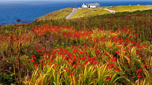
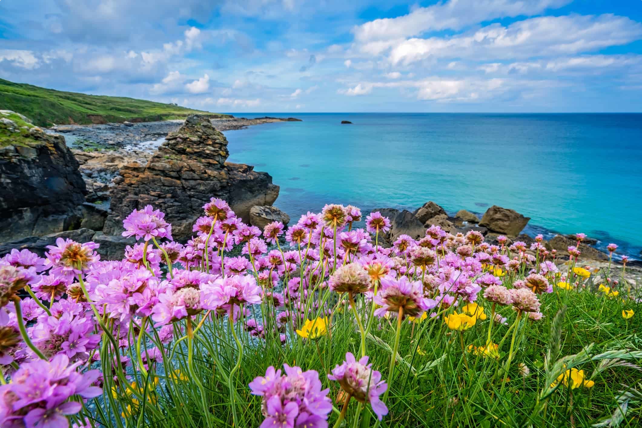
Heading for Penzance, the Odyssey tour visits The Lizard, with Lizard Point the most southerly point on mainland Britain. The Lizard is not named after some mythical dragon, but probably from the Cornish word “lezou” or headland. It is famous for its serpentine stone – a unique, dark-green-veined metamorphic rock. It has also been the site of several maritime disasters because of its treacherous coastline. The peninsula has been designated as an Area of Outstanding Natural Beauty and as a site of special scientific interest. A large proportion is owned by the National Trust and is protected against development and exploitation. With the sea on three sides and the Helford River to the north, the peninsula is almost an island – a high plateau surrounded by the sea, with numerous hidden coves and beaches. The villages along the headland were once the haunt of smugglers and pirates, but now attract windsurfers and divers who come to explore the many shipwrecks.
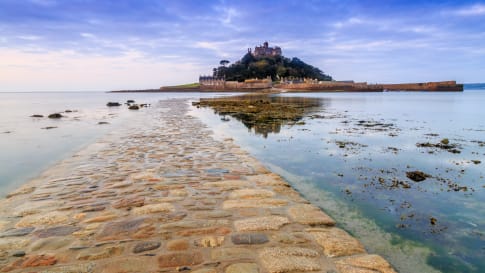
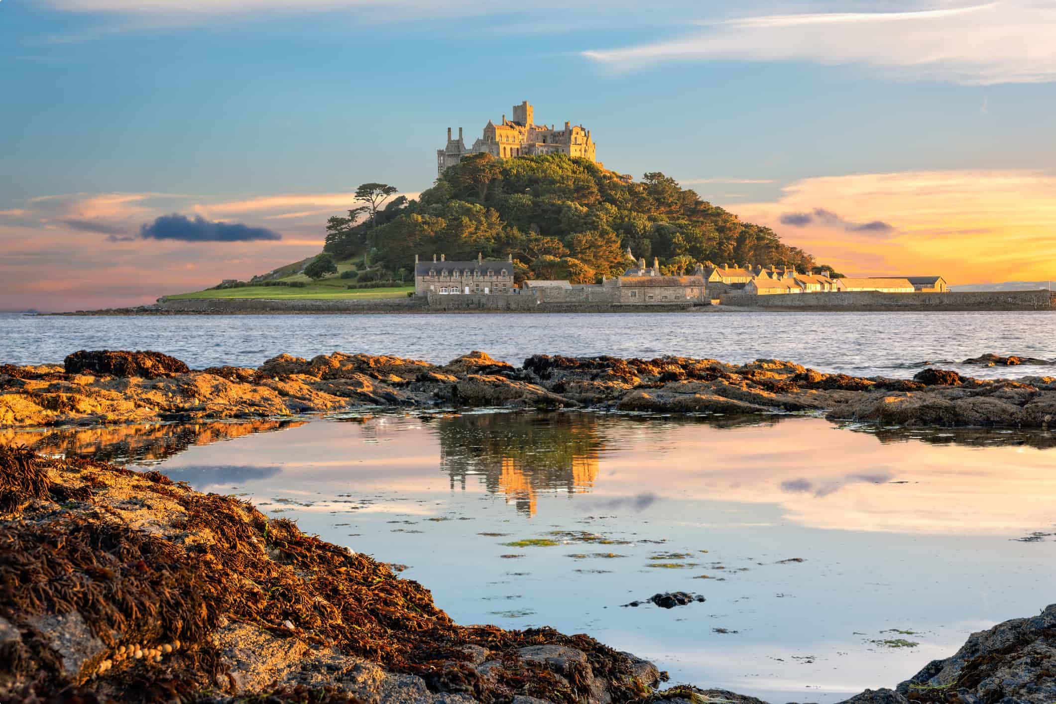
St Michael’s Mount
is a tidal island in Mount’s Bay, Cornwall. The island is a civil parish and is linked to the town of Marazion by a man-made causeway of granite setts (like cobbles), passable between mid-tide and low water. It is managed by the National Trust, and the castle and chapel have been the home of the St Aubyn family since approximately 1650. Historically, St Michael’s Mount was a Cornish counterpart of Mont-Saint-Michel in Normandy, France (with which it shares the same tidal island characteristics and the same conical shape, though it is much smaller, at 57 acres, than Mont St Michel which covers 247 acres). St Michael’s Mount may have been the site of a monastery from the 8th to the early 11th centuries. Edward the Confessor gifted the site to the Benedictine order of Mont Saint-Michel and it was a priory of that abbey until the dissolution of the alien houses as a side-effect of the war in France by Henry V, when it was given to the Abbess and Convent of Syon at Isle worth, Middlesex, in 1424. This was the end of its association with Mont St Michel, and any connection with Looe Island (dedicated to the Archangel Michael). It was a destination for pilgrims, whose devotions were encouraged by an indulgence granted by Pope Gregory in the 11th century. The earliest buildings on the summit, including a castle, dated to the 12th century.
Little is known about the village before the beginning of the 18th century, save that there were a few fishermen’s cottages and monastic cottages. After improvements to the harbour in 1727, St Michael’s Mount became a flourishing seaport.
In 1755 the Lisbon earthquake caused a tsunami to strike the Cornish coast over 1,600 km away. The sea rose 2 metres in 10 minutes at St Michael’s Mount, ebbed at the same rate, and continued to rise and fall for five hours. The 19th-century French writer Arnold Boscowitz claimed that “great loss of life and property occurred upon the coasts of Cornwall.”
The Mount was fortified during World War II during the invasion crisis of 1940-41. Three pillboxes can be seen to this day. Sixty-five years after the Second World War, it was suggested based on interviews with contemporaries that the former Nazi Foreign Minister and one-time ambassador to London, Joachim von Ribbentrop, had intended to live at the Mount after the planned German conquest. Archived documents revealed that during his time in Britain in the 1930s, when he had proposed an alliance with Nazi Germany, von Ribbentrop frequently visited Cornwall.
In 1954, Francis Cecil St Aubyn, 3rd Baron St Levan, gave most of St Michael’s Mount to the National Trust, together with a large endowment fund. The St Aubyn family retained a 999-year lease to inhabit the castle and a licence to manage the public viewing of its historic rooms. This is managed in conjunction with the National Trust. St Michael’s Mount is one of 43 unbridged tidal islands that can be walked to from mainland Britain.
Penzance (or Pennsans in Cornish meaning ‘holy headland’)
Penzance is the most westerly major town in Cornwall. It was occupied early and briefly by the Romans and coins from Vespasian and Constantine periods have been found. In medieval times it was raided by raiding pirates or corsairs and privateers of Barbary or Ottoman descent out of Tunis, Algiers and Tripoli. Penzance is the home of the pirates in Gilbert and Sullivan’s comic opera, The Pirates of Penzance. At the time the libretto was written, 1879, Penzance had become popular as a peaceful resort town, so the idea of it being overrun by pirates was amusing to its citizens.
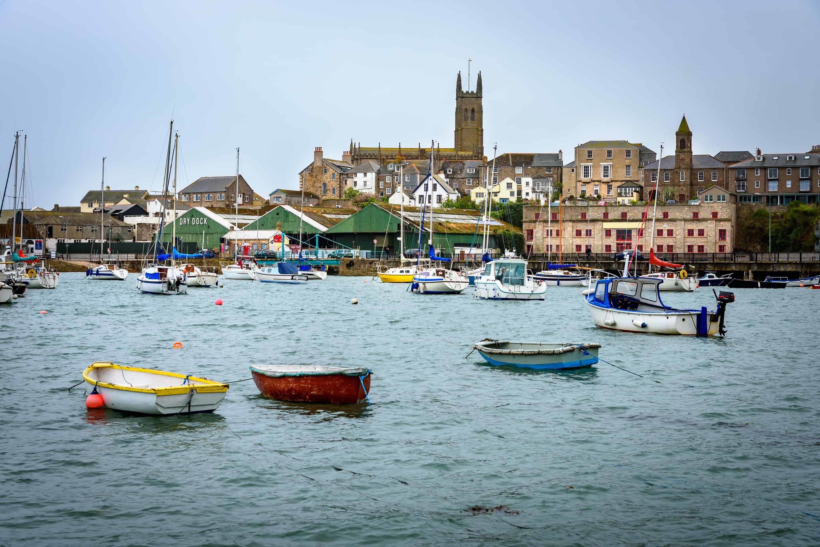
In Chapel Street, Penzance, is the Admiral Benbow Pub, found by accident on a cold and wet New Year’s Eve, and tempting because of its fire, laughter and music. In Robert Louis Stephenson’s book Treasure Island, Jim Hawkins meets Long John Silver in a pub named The Admiral Benbow. Stephenson used to visit Cornwall. The pub houses a fascinating collection of maritime artefacts rescued from numerous shipwrecked vessels which foundered on the Cornish coast during the last 400 years. Many of its treasures are incorporated into the fabric of the building and the Captain’s Cabin restaurant is an amazing example of this with its fine woodwork from a Portuguese Man O’ War. The Lady Hamilton lounge is home to a magnificent cannon and ship’s figure head. The upstairs bars have extensive views over Penance harbour towards St Michael’s Mount. One of the oldest drinking houses in Penzance, the Admiral Benbow has been in existence since the 17th century. Popular too with the famous, its visitors have included Gregory Peck and the Rolling Stones and recently the lead singer from Madness.
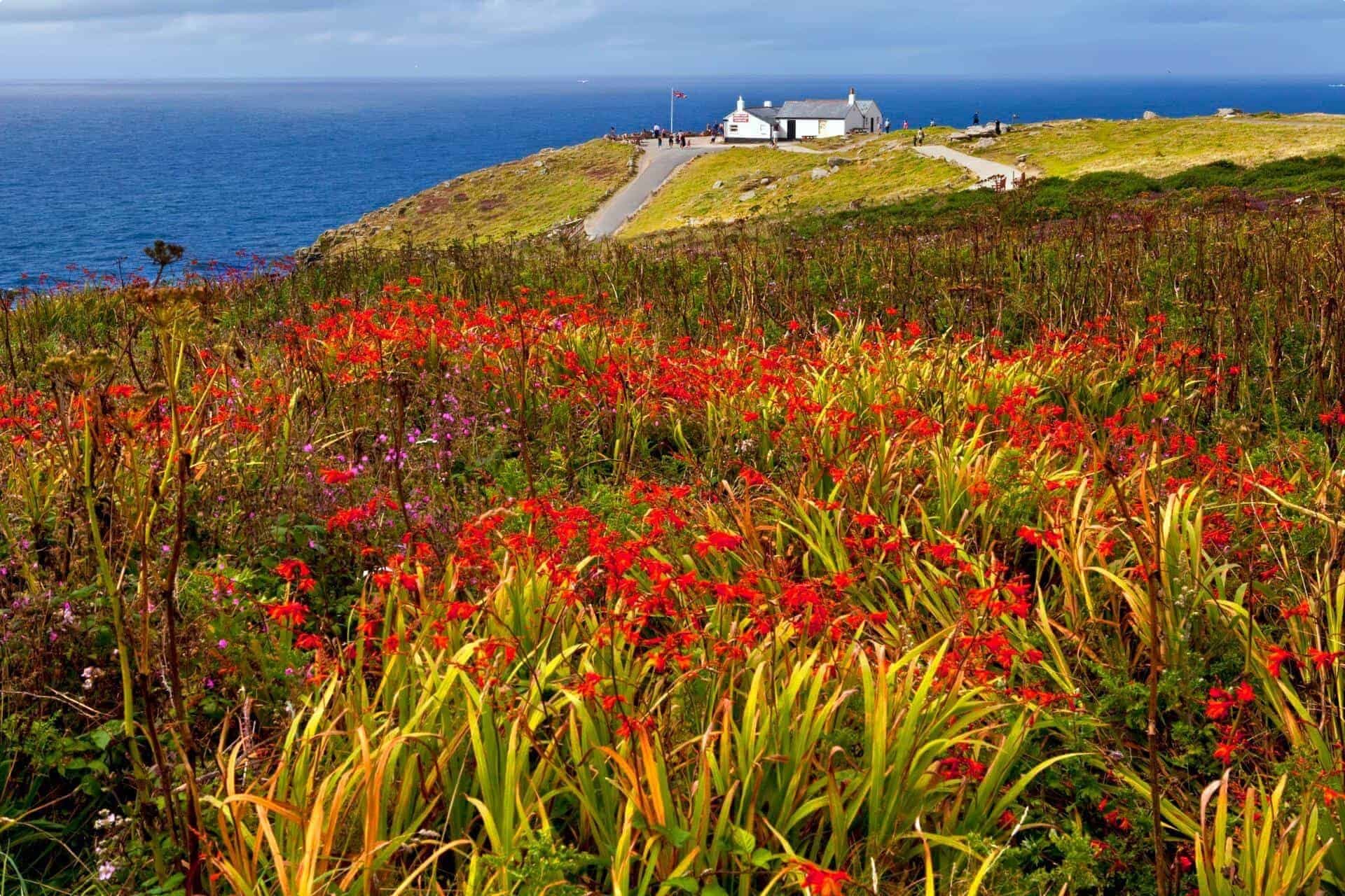
Land’s End is the westernmost point of mainland Britain, located in western Cornwall. To the east of Land’s End is the English Channel, while to the west is the Celtic Sea. Land’s End is a headland and holiday complex in western Cornwall, England, situated within the Penwith peninsula about 13 km west-south-west of Penzance at the western end of the A30 road. Land’s End is the most westerly point of mainland Cornwall and England, but not Scotland
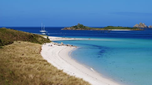
The Isles of Scilly
Penzance is the port from which travellers cross to Hugh Town on St Mary’s Island – a trip of about 2 hours 45 minutes. Hugh Town is the capital of the Isles of Scilly, sitting on a sandy peninsula in southwestern St Mary’s. Hugh Town only has a thousand or so residents, and has an economy centred on fishing and tourism. The freehold land in Hugh Town belongs to its residents, but that of the rest of Isles of Scilly belongs to the Duchy of Cornwall. The current duke is Prince Charles and when he becomes King will pass to the next heir to the Crown, probably Prince William. Isles of Scilly, also called Scilly Isles, is a group of about 50 small islands and many more islets lying southwest of Cornwall, England, 40 to 58 km off Land’s End. Administratively, the islands are a distinct unit within England, though they form a part of the historic county of Cornwall.
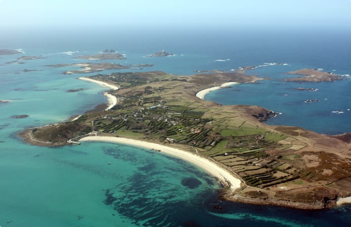
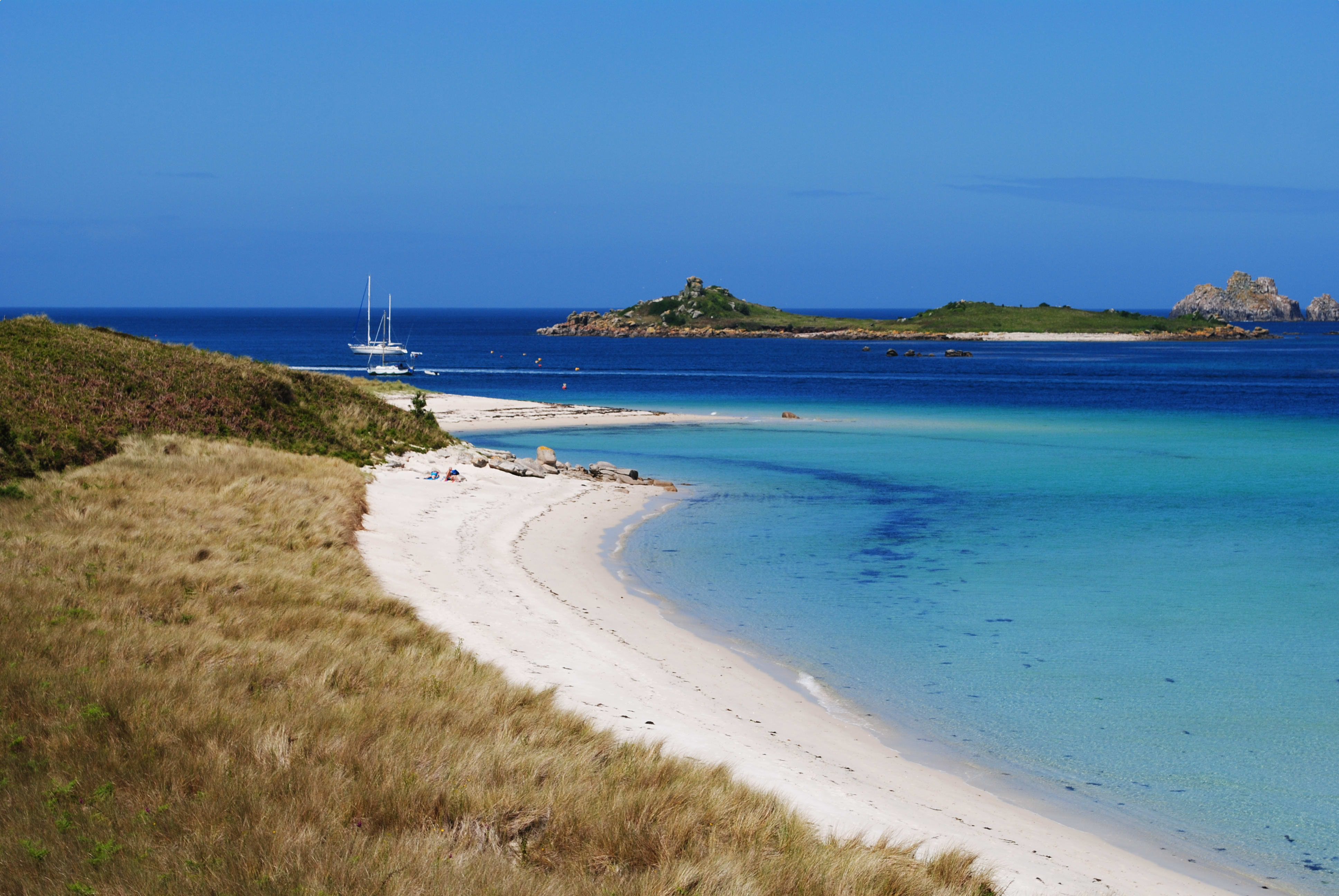
The islands are composed of granite and are a continuation of the granite masses of the Cornish mainland. They reach an elevation of 50 metres on St. Mary’s and have dangerous rocky coasts with many reefs. Because the islands’ climate is exceptionally mild-the mean monthly temperatures range from 7 to 16 °C -their fauna and flora are quite different from those on the English mainland. Many subtropical plants flourish. Seals live on the rocks and islets. Among an immense variety of seabirds that visit the islands, the roseate tern is the rarest British breeding tern, and the Manx shearwater has its only British breeding site in the islands.
Only five of the islands are inhabited-St. Mary’s, Tresco, St. Martin’s, Bryher, and St. Agnes. Most of the people live on St. Mary’s, which has a harbour at Hugh Town and a museum of Scilly history and prehistory. Bishop Rock Lighthouse (1858), at the islands’ western end, is a notable example of 19th-century civil engineering. The economy is based on tourism and on commercial flower growing and vegetable farming, the latter made possible by the prevailing mild climate. Fishing is also significant. Tresco Island measures only 3.5ks by 1.5ks and is a car-free island. The tour will visit the Tresco Abbey Gardens, with flora that would not survive on the mainland but thrive there. Red Squirrels were introduced to the woods near the gardens in 2013, hoping they would survive because of no foxes and no grey squirrels. Many little red squirrels have since been noted in the gardens.
St Ives
In 1497 the pretender, Perkin Warbeck, was proclaimed king when he anchored in St. Ives harbour. Warbeck was from Flanders, a pretender and conman who challenged the title of Henry VII, the first Tudor king by claiming to be Richard, Duke of York. Eventually he was caught and hanged. He was yet another pretender who raised an army and then facing defeat fled.
Clustered around the harbour is the old town of winding cobbled streets and colour-washed stone cottages. Fishing and tin mining were important until the late 19th century. Since then the mild climate and sandy beaches-particularly Porthmeor Beach, which is popular with surfers-have attracted vacationers, and tourism has become the economic base. In the early 20th century the town emerged as an artist colony, and it continues to be a centre for art. Tate St. Ives (1993), a branch of the national Tate galleries, is located there and includes the Barbara Hepworth Museum and Sculpture Garden. The name St. Ives has been given to a style of pottery established there by Bernard Leach in 1920. The population of St Ives in the 2011 census was 11,435.
From Godrevy’s Point neat St Ives there will be the opportunity for a very enjoyable cliff walk of about 4km to Hell’s Mouth past craggy beaches and through the Knavocks. This area of high ground provides some stunning views of the Cornish coastline and contains grassland and gorse scrub and is home to many species of butterflied and birds, notable nesting stonechats. This coastal heathland is managed by cutting back the gorse and grazing. Wild ponies were introduced by the National Trust and roam freely. In July and August, the area is awash with purple heath and golden gorse. Atlantic seals can sometimes be seen on the beaches and rocks and porpoises in summer.
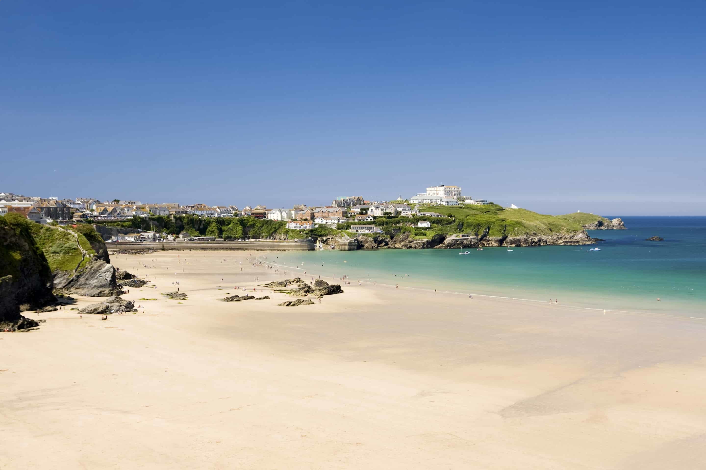
Newquay
Newquay today is almost entirely a modern seaside resort, having grown since the mid-19th century from a small fishing village to a well-loved destination for surfers. Fistral Beach has been described as ‘the home of British surfing’ and even in winter, small fires can be seen on the beach as committed surfers in full wet suits wait, waxing their boards, for sunrise. The town stands on cliffs overlooking sandy beaches and is sheltered from the Atlantic by Towan Head. Situated on Towan Head is the Huer’s Hut, which was built in the mid-19th century but reflects a local fishing tradition that is believed to date to the 14th century. It was the job of the huer to watch for the arrival of shoals offish, alert the town’s fishermen to that arrival by blowing a horn, and then direct them to the fish from his high vantage point by signal.
There are some pre-historic burial mounds and an embankment on the area now known as The Barrowfields, 400m from Trevelgue. There were once up to fifteen barrows, but now only a few remain. Excavations here have revealed charred cooking pots and a coarse pottery burial urn containing remains of a Bronze Age chieftain, who was buried here up to 3,500 years ago. In 1987, evidence of a Bronze Age village was found at Trethellan Farm, a site that overlooks the River Gannel.
The first signs of settlement in the Newquay region consist of a late Iron Age hillfort/industrial centre which exploited the nearby abundant resources (including deposits of iron) and the superior natural defences provided by Trevelgue Head. It is claimed that occupation of the site was continuous from the 3rd century BC to the 5th or 6th century AD. The anchorage was exposed to winds from the north east and in 1439 the local business men applied to Edmund Lacey, Bishop of Exeter for leave and funds raised through the mechanism of an indulgence, to build a “new quay” from which the town derives its name. The new quay itself did not appear until the early 17th century.
The Gannel is a tidal river, but as a silted estuary it is now mainly used for wildlife tours by canoes and kayaks, though larger boats can reach the ocean at high tide. The area’s climate is equable, and tropical plants grow in the Trenance Gardens, established in the early 20th century. The small harbour on the bay is now used only by local fishing and pleasure boats. The 2011 census put the population at 20,243.
Padstow
From as early as 2,500BC, Padstow was used as a natural harbour linking Brittany to Ireland along the ‘Saints Way’. Around 540AD St Petroc, possibly one of the most important of the Cornish Saints arrived from Ireland and built a monastery on the hill above the harbour. The harbour developed in the middle ages as a trading port for copper, tin, lead ores, slate, pilchards and agricultural produce. Welsh coal was imported by sea along with time and fish salt. The Port had a thriving fishing industry and by the 19th century there were six shipyards. During the years when emigration from Cornwall was at its height, Padstow was the centre from where many people left to start a new life in Australia, Canada and the USA. The shipbuilding declined when iron boats replaced timber ones, but by the end of the 1800s the east coast trawlers made Padstow the centre of their winter fishing. The coming of the railway in 1899 gave a big impetus to the tourist trade and tourism has been Padstow’s main industry since then.
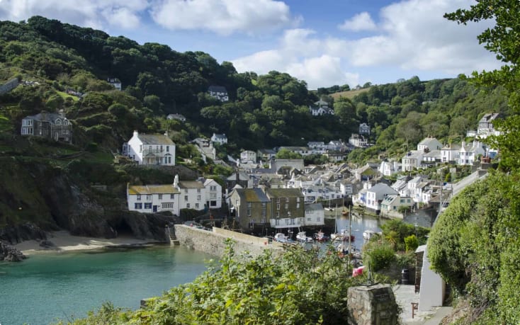
Port Isaac
Port Isaac is familiar as a place, if not a name, to many Australians as Portwenn, home of Doc Martin from the TV show of the same name. Nestled in a small, safe haven bay along the jagged coastline of Northern Cornwall, the small village of Port Isaac is postcard perfect and a quintessentially Cornish fishing village. Port Isaac was a thriving fishing village and community throughout the middle ages, and right up until the 19th-Century. As a result, many of the buildings in the village still find their decor in the sea roots that once dominated local industry. Known as ‘Porthysek’ in Cornish, the name means ‘corn port’ and is a reflection of the village’s thriving trade in corn export. Although parts of the village date back to the 14th century, most of the central sections of Port Isaac were constructed in the 18th and 19th centuries. Many of these buildings are now listed buildings. The town has some of the narrowest streets in the UK and travellers are encouraged to park in the large carpark on top of the cliff and walk or bus into the town. There is even a street named Squeezy Belly Alley because of its narrowness.
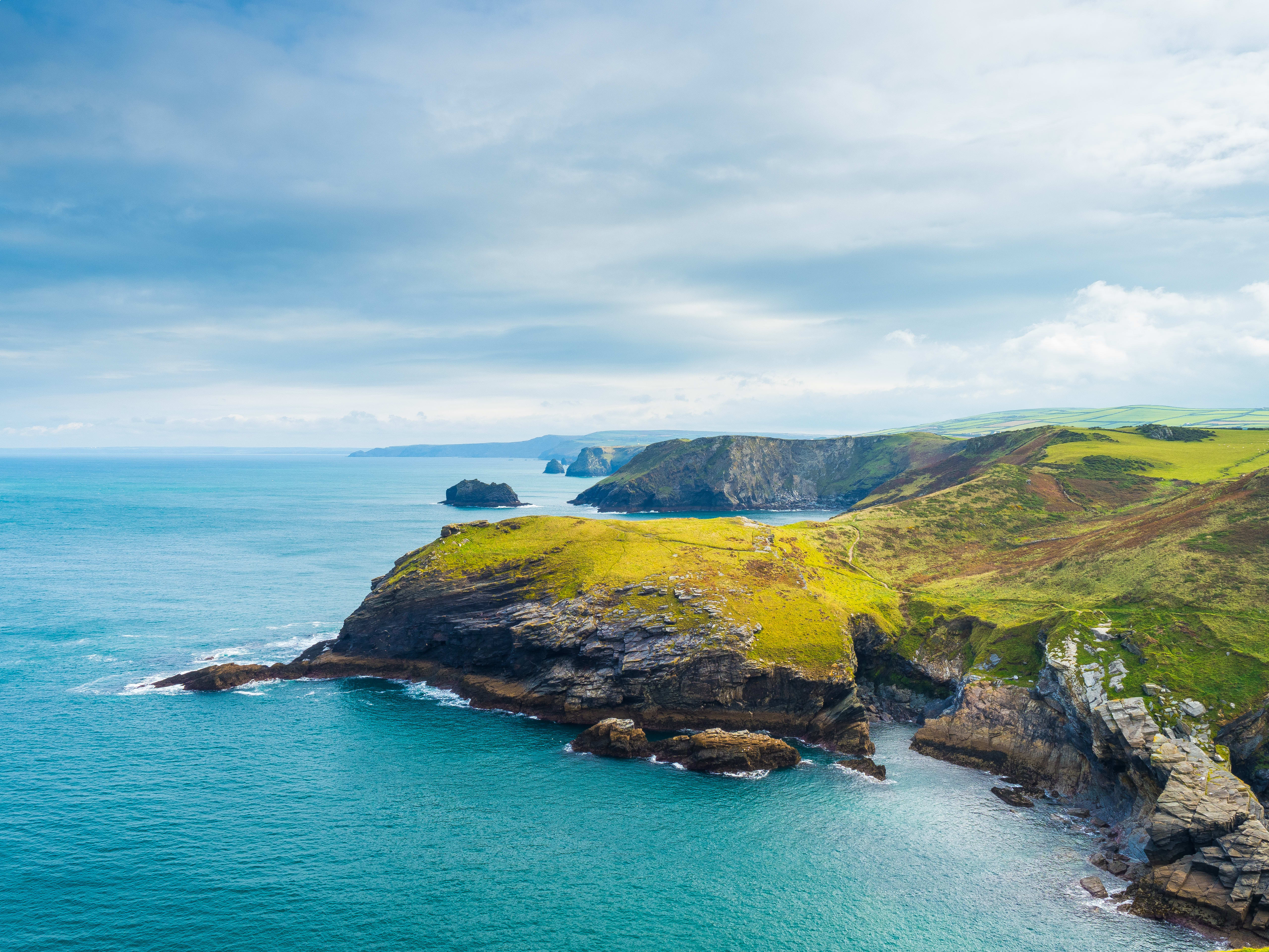
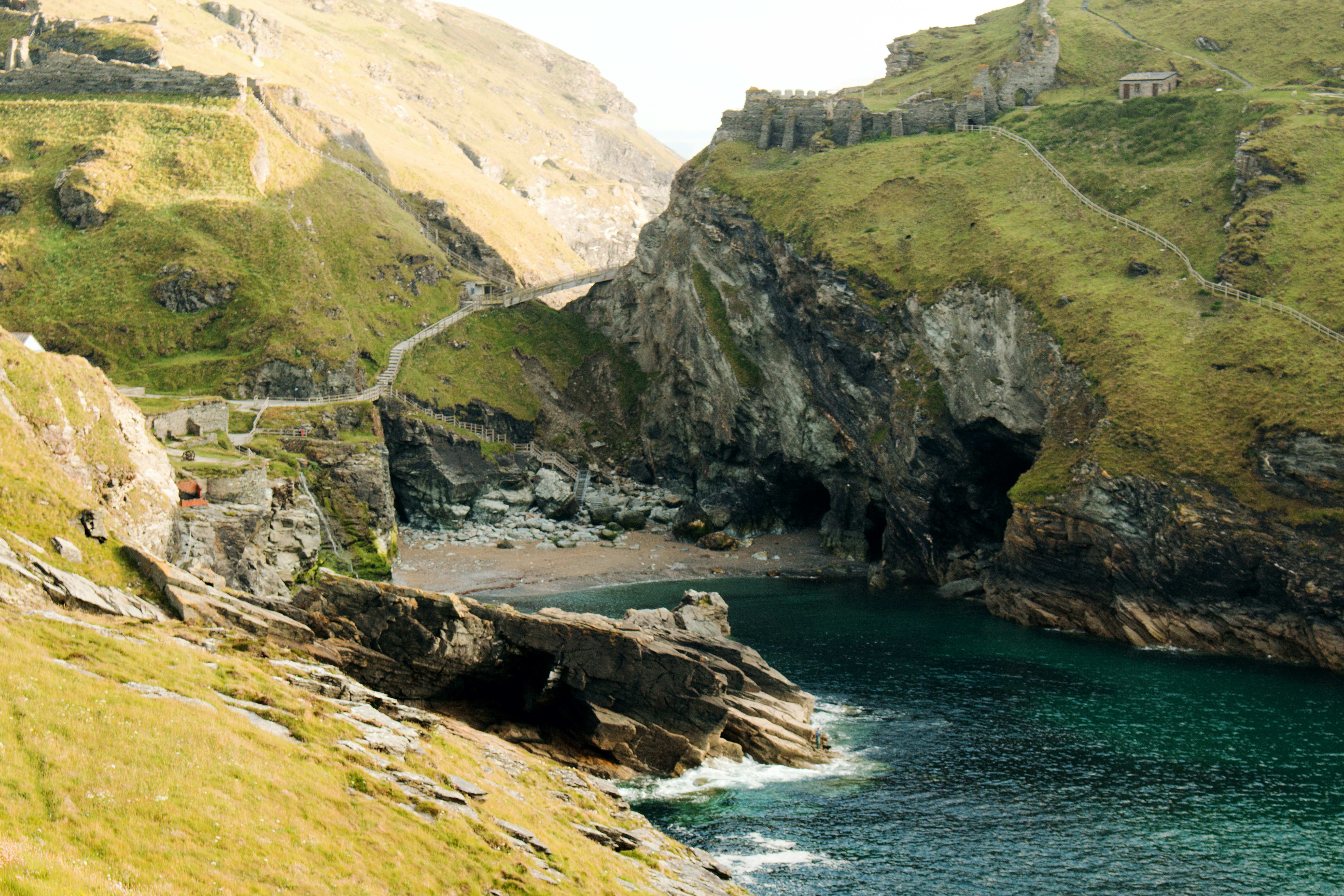
Tintagel
Built half on the mainland and half on a jagged headland projecting into the Cornish Sea, Tintagel Castle is one of the most spectacular historic sites in Britain. Its connection to King Arthur makes it one of the most famous. History and legend are inseparable at Tintagel. From about the 5th to the 7th century AD it was an important stronghold, and probably a residence of rulers of Cornwall. Many fragments of luxury pottery imported from the Mediterranean were left behind by those who lived here. It was probably memories of this seat of Cornish kings that inspired the 12th century writer Geoffrey of Monmouth to name it in his History of the Kings of Britain as the place where King Arthur was conceived, with the help of Merlin. At the same time, Cornish and Breton writers linked the love story of Tristan and Iseult with Tintagel. The story is that Uther Pendgragon coveted Igraine, the wife of Gorlois, the Duke of Cornwall. Merlin disguised Uther to look like Gorlois. Uther as Gorlois entered the castle and took Igraine while Gorlois was away fighting for Uther and Arthur was conceived. In turn, these associations with legend led the hugely rich and ambitious Richard, Earl of Cornwall, to build a castle here in the 1230s. The site was of no military value – legend alone seems to have inspired him to build here. And long after the castle had fallen into decay, its mythical associations kept interest in Tintagel alive, especially as Arthur is known as ‘the once and future king’ who will return in England’s time of need.
Merlin’s Cave is located beneath Tintagel Castle. It is 100 metres long, passing completely through Tintagel Island from Tintagel Haven on the east to West Cove on the west. It is a sea cave formed by marine erosion along a thrust plane between slate and volcanic rocks. The cave fills with water at high tide, but has a sandy floor and is able to be explored at low tide. One of the legends has Merlin living in the cave, waiting for the birth of Arthur, then taking him away to be fostered until he was old enough to be acknowledged by Uther.
Clovelly Village, Devon
Clovelly has been associated with just three families since the middle of the 13th century, a period of nearly 800 years. At the time of Clovelly’s inclusion in the Domeday Book, it was owned by the King and enjoyed many royal associations from the 9th century till 1242 when it was acquired by the Giffard family. The Duke of Giffard was a Norman knight and a close adviser of Duke William. By 1370 as the result of a marriage and purchase the ownership of Clovelly went to Sir William Cary. The Carys were one of the great Devon families, cousins of the Grenvilles. The Carys lived at Clovelly for 11 generations. In 1738 Robert Barber, the widower of Elizabeth Cary, sold Clovelly to Zachary Hamlyn. The current Clovelly Estate Company owns and manages the entire village today. The company is currently run by Hon. John Rous who is a descendant of the Hamlyn family who have owned and managed the village since 1738. This time warp in North Devon really is a place where time has (almost) stood still. Today Clovelly Village is a working fishing village and tourist attraction perched on a sea cliff. Since the 1920s there has been no motorised vehicle access, with the locals using donkeys and sledges.
Lynton
Lynton is the last stop on the way back to Bristol and is a small town on the Exmoor coast in Devon, standing on top of the cliffs above the picturesque harbour village of Lynmouth, to which it is connected by the Lynton and Lynmouth Cliff Railway. In Lynton is the Parish Church of St Mary, which stands overlooking the sea, surrounded by shops and hotel. The tower is mainly 13th century but the church itself has been enlarged and altered – most notably in 1741, when the nave was rebuilt. Evidence of Iron Age activity can be found at the nearby Roborough Castle. The novel Lorna Doone was set in the Lynton area. About 1.5kms to the west of Lynton is the Valley of the Rocks, a dry valley running parallel to the sea and famous for its wild goats that roam freely around the valley, even on the cliff edges.
When the tour returns to Lynton village, there will an opportunity to ride the Lynton and Lynmouth Cliff Railway, the highest and steepest (gradient of 57%) water powered railway in the world. Opened in 1890, the railway connects the twin towns of Lynton and Lynmouth, and offers fantastic views of the coast.
Bristol
After two weeks of exploring magical counties with stunning scenery and wonderful stories, the tour concludes back in Bristol.