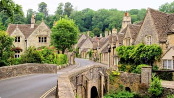
A Journey Through Britain's Roman Roads
Rome's roads constitute the most remarkable culmination of its technological, logistical and bureaucratic achievements. Even a brief understanding of their history and significance can enrich your experience walking tour of Britain.
28 Nov 19 · 14 mins read

Of course, the Romans were far from the first peoples to construct roads.
Most of the great ancient empires, from the Hellenic powers to the old Chinese dynasties, embarked on similar infrastructural projects. The ancient Silk Road once winded its way from the eastern seaboard of modern-day China, through the mountains of the Hindu Kush, before eventually finding the Mediterranean coastline off the Arab peninsular. Though perhaps the most extensive trade route in human history, the Silk Road was not entirely created and maintained by a single power. Neither the Silk Road, nor any other effort of a single power, can compare to the scale, quality and uniformity of Roman roads. When compared to other empires, the sheer scale and longevity of Rome’s roads is one of their finest achievements relative to other great civilizations; the Mongols conquered more land, the Greeks produced greater thinkers and the British had a more global influence.An Introduction to the Romans in Britain
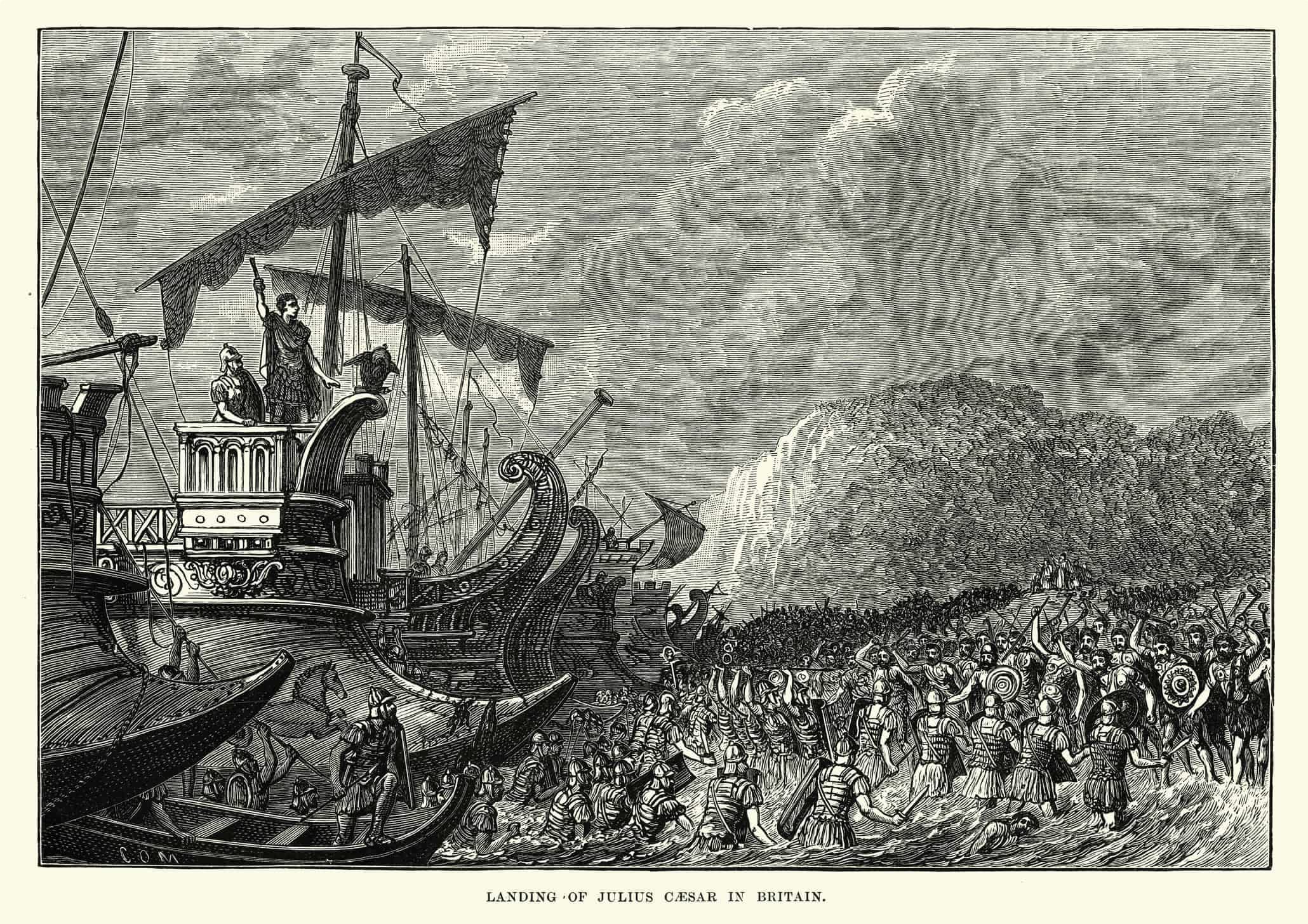
In 55 BC Julius Caesar launched the first Roman invasion of Britain. Landing on the pebbled beaches of Kent with the company of only two legions at his side, Caesar had massively underestimated the strength of the local tribes, and was forced into a swift retreat back to the continent. In 54 BC Caesar tried again with a much larger force, setting out for the island with a fleet of ships supposedly numbering 800. Though this invasion was initially successful, as Caesar’s legions moving swiftly through southern Britain, a wave of new revolts across the continent threatened Roman power in Europe, which, together with strong guerrilla resistance in Britain, made sustained occupation untenable.
The First Roman Roads
The first of these Roman roads had been built in the immediate aftermath of the Roman army‘s victories in 43 AD. As subsequent sieges were conducted further north, roads would quickly follow behind the legions, in order to maintain a flow of supplies from the continent to the fighting men. The first road that the Romans built stretched between London and the port at Dover, in order to speed communications and supplies to the new front line. That road is now known as Watling Street, and though the original Roman road is now paved over with concrete, the original route can still be walked from the coast right through to the heart of London’s financial district. In this most basic sense, the history of Britain’s Roman roads was intimately tied to war, and the needs of an army the size of a town. However, having secured peace in the south, military roads quickly morphed into the key arteries of internal trade, linking the major Roman cities – Londinium, Colchester and Bath – with each other, coastal ports, and by extension, Rome.How Were Roman Roads Constructed?
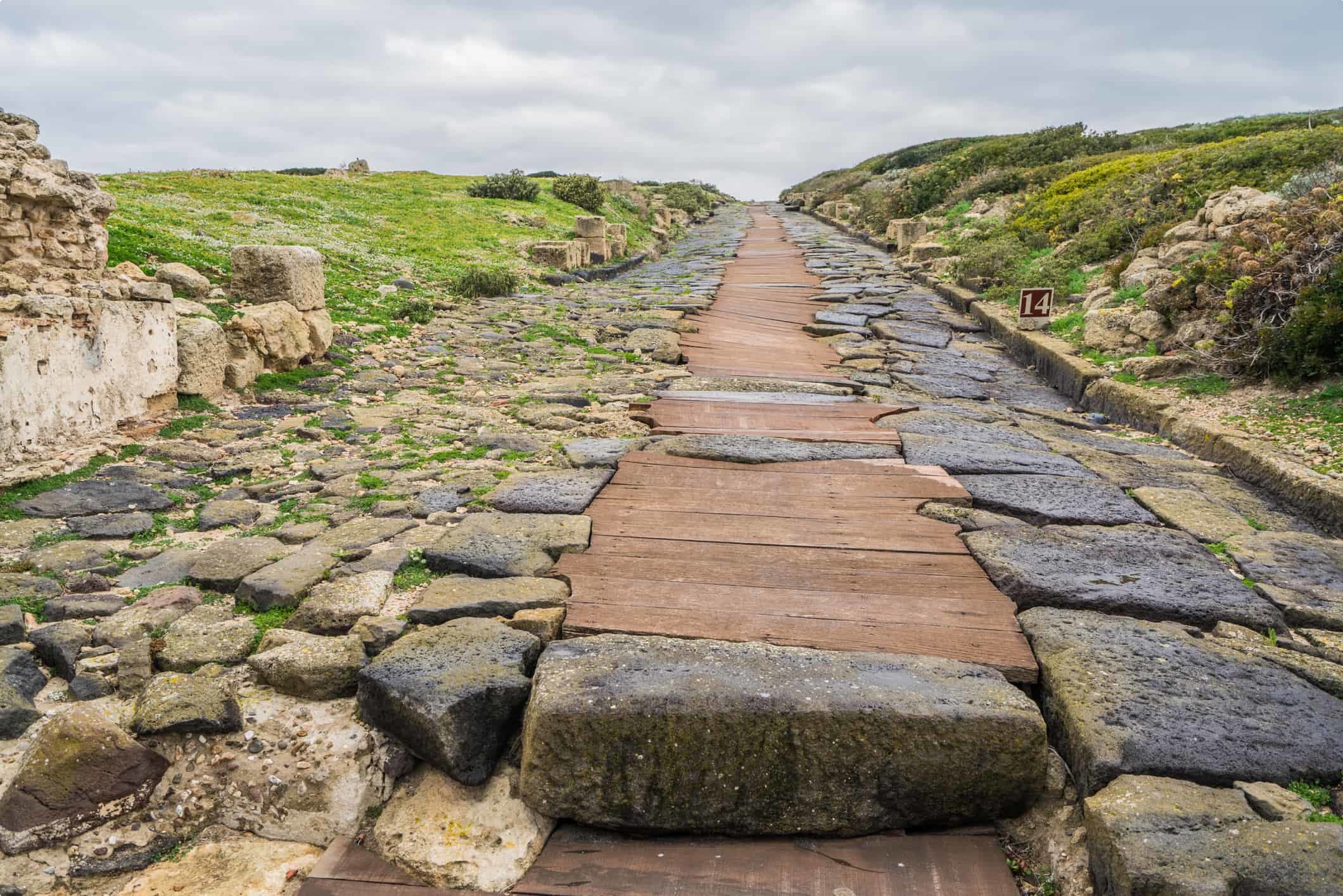
The standard Roman road would first be mapped and planned by a handful of expert engineers using a groma, an instrument resembling a wooden cross, that helped line up the road in a straight line. Then, builders, slaves or soldiers would dig out two parallel drainage ditches, around two meters apart, through which the road would run. The soil from these excavations would then be used to build up the ground between the ditches into a raised section, called the agger. The mounded agger was then covered with metalling, a process whereby large stones would be rammed into the earth. This created a firm base on-top of which smaller stones and gravel would be poured and compacted onto. If the engineers chose to stop construction at this point, then the road would be referred to as a metalled road. Some roads, depending on the local environment, the importance of road and local wealth, were constructed with culverts – basically drainage channels – that ran beneath the road and helped to keep it dry.
Size did matter, and the wider the Roman road the richer the region, and the more important the route. A standard metalled road would be about 20 pedes wide, an ancient measurement that roughly equals two lanes of a modern motorway. This was designed to accommodate two-wheeled horse drawn vehicles, the basis of internal trade in the Roman empire. However, Watling street, the first Roman road that ran to Londinium, was an important route. Not only did it carry most of the trade from the southern ports northwards into the capital, but it also marked the route of the successful campaign of Britain. Therefore, the road was extended in width to 34 pedes in places, the equivalent to five lanes of a modern motorway. Clearly, roads were more than just pathways for trade. Roman roads were designed as a status symbol, a reflection of power and wealth. And so if the Romans used their roads to prove their authority, then it makes sense to take a step back, and try to understand why roads – the most basic form of infrastructure – were deemed to be so important. To answer this question, it helps to first understand why none of Rome’s successors could match their roads.
Why Did Road-Building Stop with the Romans?
Rome’s exit from Britain was a painful and slow process. Towards the end of the 4th century, much of the empire was under attack, and so most of the legionaries in Britain were sent back to defend the Italian heartlands. Eventually, the steady shipments of pay, in the form of imported gold, to the remaining soldiers ceased, and with it the central Roman authority collapsed. The roads were generally left to crumble away, and by the 6th century it was common to see of travelers walk on either side of an old roman road, at that point preferring the soft grassy banks to the central rubble.
Roman technology, like roads, dissipated so quickly from Britain because road building demanded a complex and well-developed web of socio-economic structures and processes. Many of Rome’s roads were centrally paid for by the empire’s coffers. Hard-wearing roads were the luxury of a wealthy empire, and simply not seen as a necessity in Anglo-Saxon Britain. More than wealth, the construction of large networks of roads required an organised bureaucracy, which can co-ordinate the scale of a national project, rather simply abiding to parochial interests. This enables the construction of roads that connect richer regions to poorer ones, or sprawling metropolises to military outposts, rather than simply aligning roads with the specific demands of a local elite.
Similarly, the society must be confident in the security of an army, wherein the state has a monopoly on violence, to allow the extension of roads into a barbaric wilderness. For any empire, finance and security are mutually reinforcing, and therefore equally important. The fort at Vindolanda on the northern border in Britain both provided the security which maintained the roads behind it, but was equally dependent on those same roads for the finances to maintain a standing garrison. When the income and trade from Rome dried up during its decline in the 4th century, so the garrison at Vindolanda could not be maintained, and so the imperial presence collapsed. Such is the challenge of road-building. Without a network of security and wealth, the means to construct expensive roads quickly disappears. The roads that the Romans left behind were the final fruits of a youthful empire, and the first losses of a fading power. Even as late as the Victorian period, Britain’s government could not provide for roads in such a manner, relying on a multitude of private turnpike firms to maintain the key national roads. To contrast, the Roman imperial machine had met these demands in areas as remote as the Antonine Wall and Northumberland national park, both more than a thousand miles from its capital in Rome, and each a seven week journey to their roads in Constantinople at the other edge of the empire. Many modern states would struggle with such a task. Clearly, the Roman empire was a truly remarkable machine, and its roads provide the first route into a greater understanding of its prowess.Two Common Myths
Such is the remarkable nature of Roman roads that nearly everyone has been told two things about them at some stage in their life, regardless of their actual desire to hear so. The first maxim dictates that all roads lead to Rome, and the second that all road lines up straight as the crow flies. The first maxim is rarely taken at face value, and although the second is often accepted as a rule, it is even less true. Apart from anything else, the Romans were a pragmatic people, and so rarely would you find them bulldozing through miles of steep rock for the satisfaction of a perfectly straight road. Instead, surveyors would perform a detailed study of the relevant terrain between two points. They would then divide the route into multiple sections, each a couple of miles long, typically divided between major geographical features. Each individual section would form a straight line, but consecutive sections could run off each other at gentle angles, sometimes paving a mild zig-zag through the countryside.

Two Must-See Examples of Roman Roads in Britain
Britain is home to two Roman roads that are particularly non-straight, meandering through the countryside in a particularly non-Roman manner. These roads were, however, deliberate and very strategic. The first, the Stanegate Road, was constructed in Cumbria across the northern frontier between the River Tyne in the east, and the River Solway in the west. The second was the Military Way, built a century later further north.
Both examples highlights the centrality of roads within the strategic approach of Roman military commanders. The roads were integral to the defense of the northern frontier against attack from the fearsome Picts, a confederation of tribes who maintained their independence from the Romans in what is now modern-day Scotland. The hard-wearing surface ensured that troops could march across the frontier to deal with attacks at any point across the region, enabling the maintenance of a strong border with minimal resources. The construction of the road was dictated by the local topography, as its architects prioritized the strategic need to hug the high ground in unstable regions. This explains why both roads curve beyond the traditional idea of a roman road.
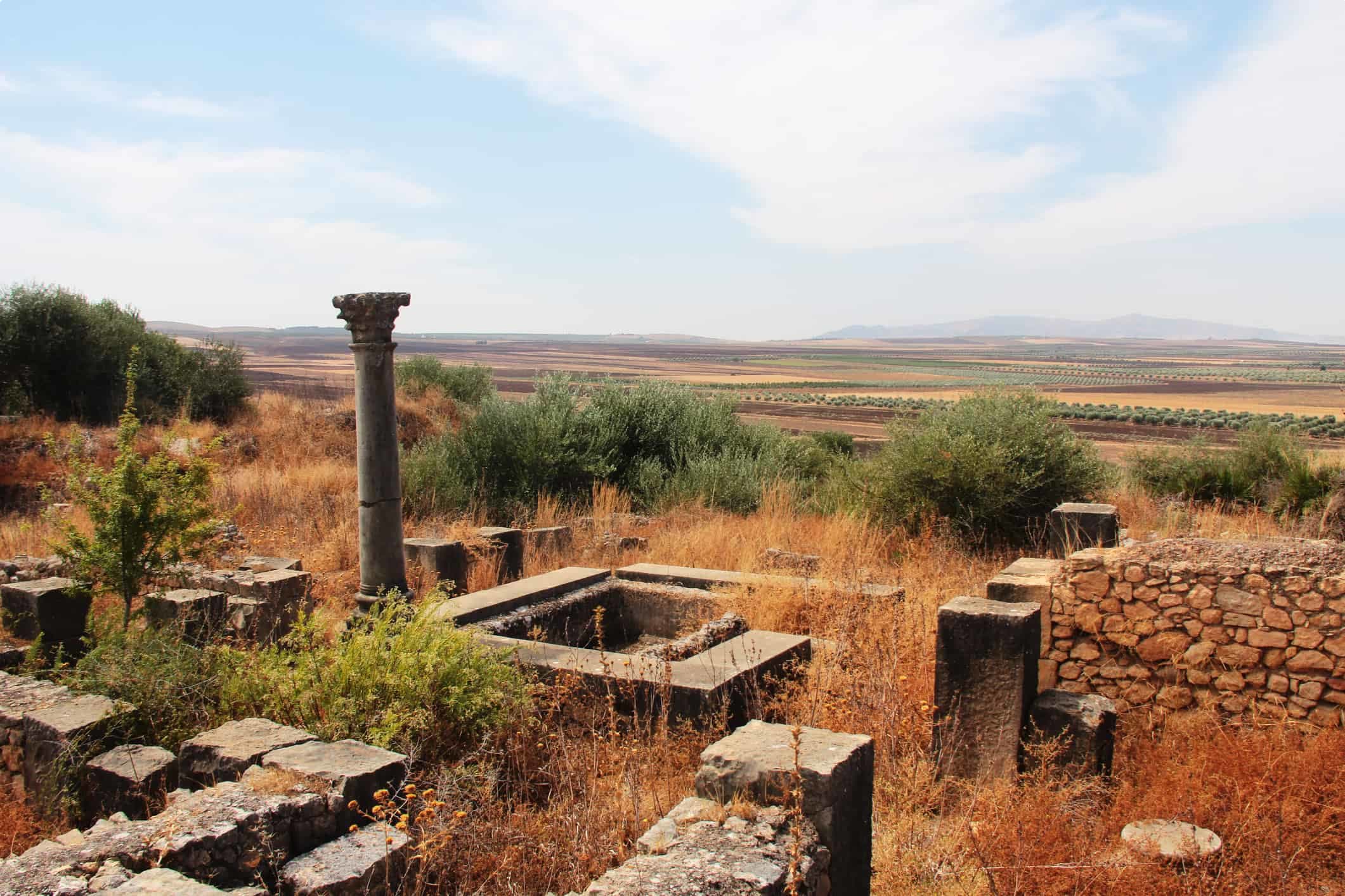
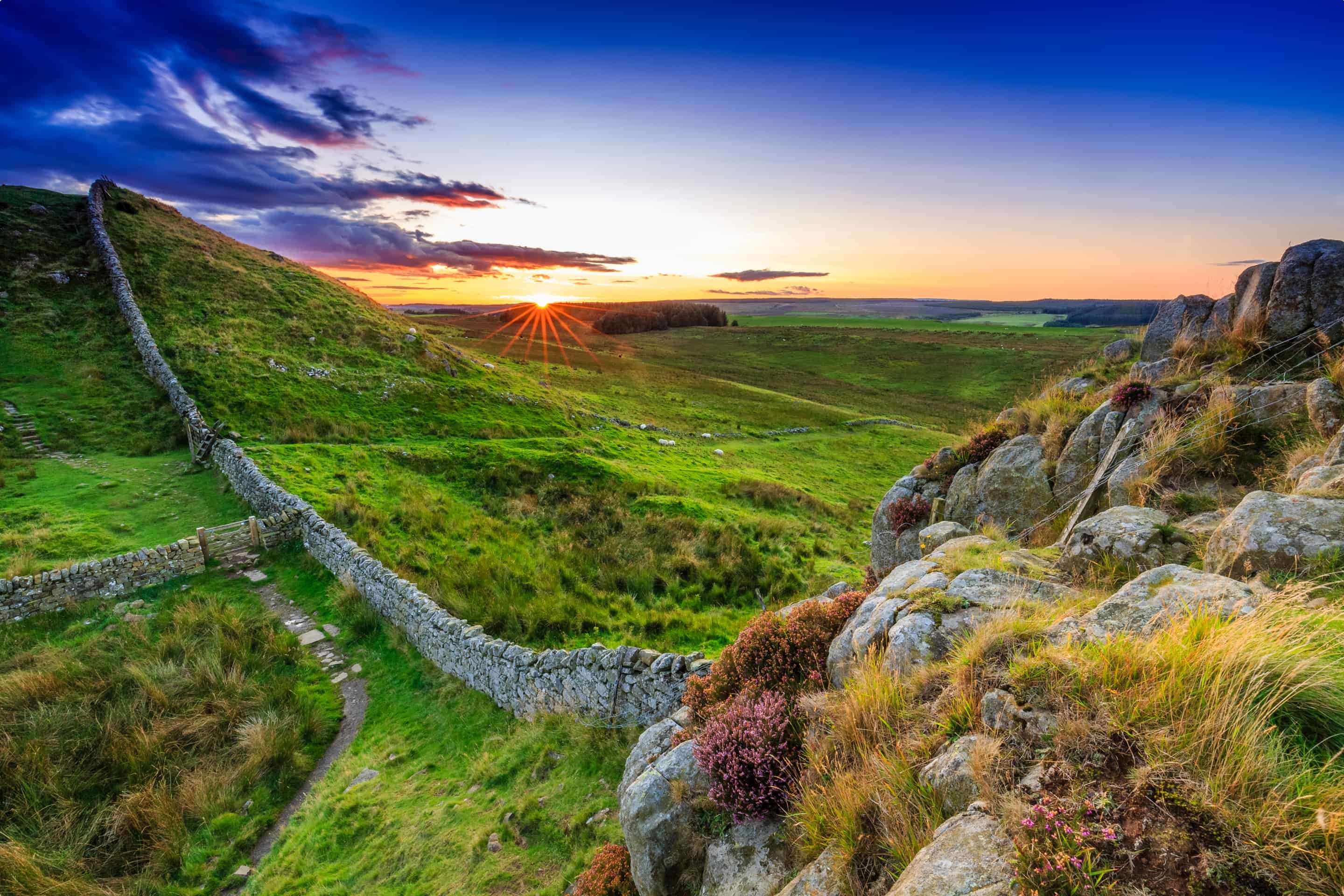
The two roads were used as the basis for two of the most imposing roman constructions in Britain. Hadrian’s Wall runs across the breadth of the Stanegate Road. Built around 122 AD on the orders of Emperor Hadria, the defensive fortification ran a total of 117 kilometres across the north, and was guarded by a range of Roman buildings, settlements and forts. Many spots along its route have been excavated become popular tourist attractions, like the defensive fort at Vindolanda, which is home to some remarkable archaeological finds, including a roman temple, roman gardens and late roman church. The museum at Vindolanda gives a rare insight into the life of a roman legionary in Britain, as the archaeological excavations include a range of very personal finds, from writing tablets to boards games.
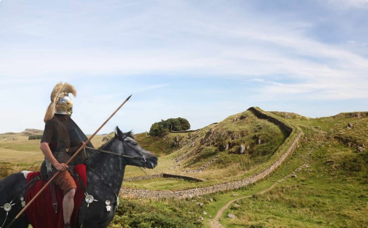
The Antonine Wall was built several decades later, and marked the high-water mark of Roman conquest against the Picts barbarians in the north. However, these gains were proven to be short-lived, as the roman garrisons retreated southwards to Hadrian’s Wall barely 20 years later. Underlying all this history is the roads and infrastructure that enabled the provision of goods, the speed of transport and the strength of borders required to maintain peace in the provinces. The two roads were used as the basis for two of the most imposing constructions built by the roman army Britain. Hadrian’s Wall runs across the breadth of the Stanegate Road. Built around 122 AD on the orders of Emperor Hadria, the defensive fortification ran a total of 117 kilometres across the north, and was guarded by a range of Roman buildings, settlements and forts. Many spots along its route have been excavated become popular tourist attractions, like the defensive fort at Vindolanda, which is home to some remarkable archaeological finds, including a roman temple, roman gardens and late roman church. The museum at Vindolanda gives a rare insight into the life of a roman legionary in Britain, as the archaeological excavations include a range of very personal finds, from writing tablets to boards games.
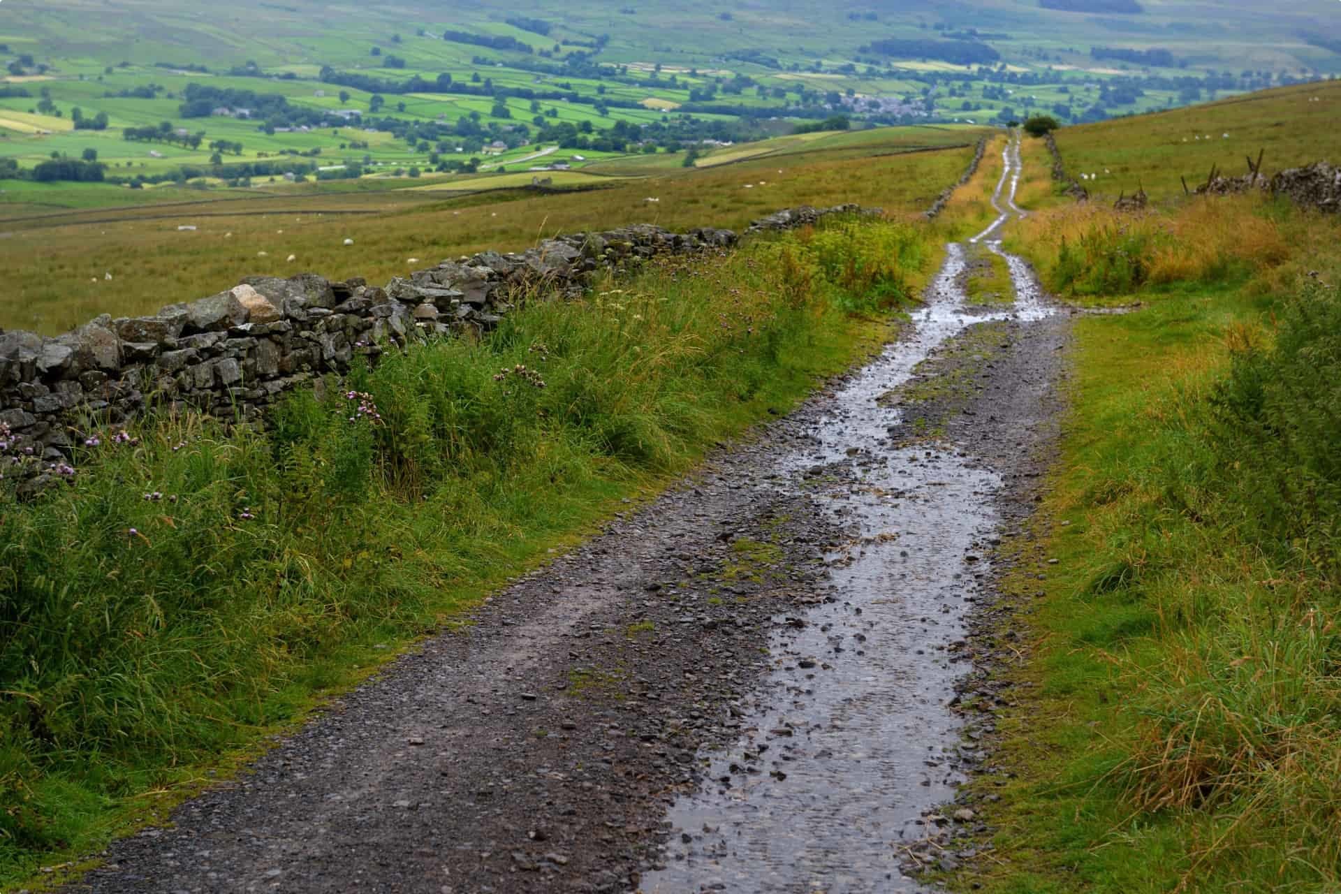
How to Spot a Roman Road
Tours of Roman Britain are incomplete without a stop off for a Roman road. However, finding these roads, and really making the most of them, can be difficult in practice. Outside of major archaeological sites, it can be hard to distinguish the straight outline of a roman road from the faded marks of a forgotten train line. Whether planning a walk individually or with a small group, embarking on a long walking tour or simply a day tour, there are a few great tips to improve your experience of Roman roads.
Related Tours
21 days
SepRoman Britain
Visiting England
On this small group tour explore with a tour director and local guides the world of Roman Britain. The Romans occupied Britain for some 400 years and left behind a lasting legacy from roads Hadrian's wall to Roman Baths many are UNSECO World heritage listed.
From A$14,545 AUD
View Tour
22 days
Aug, AprSeven Ages of Britain, snapshots of Britain through the ages.
Visiting England, Scotland
This guided small group tour starts in Scotland and finishes in England. On Orkney we have a day tour to the UNESCO World heritage site, Skara Brae, before travelling to city of York. Your tour leader continues to share the history from the Neolithic to the Victorian era. The tour concludes in the capital city, London.
From A$17,450 AUD
View Tour
20 days
Jun, SepWalking Ancient Britain
Visiting England
A walking tour of England & the border of Wales. Explore on foot UNESCO World Heritage sites, Neolithic, Bronze age and Roman landscapes and the occasional Norman castle on your journey. Your tour director and tour guide walk you through the Brecon beacons, the Cotswolds and Welsh borders on this small group tour.
From A$14,725 AUD
View Tour
21 days
AugPrehistoric Britain small group history tour including standing stones
Visiting England, Scotland
This guided tour invites you to explore UNESCO World heritage sites at Skara Brae in the Orkneys, Isle of Skye, and Stonehenge in a prehistoric tour. This escorted tour has trips to key sites in Scotland, and the Irish sea in Wales such as Gower Peninsula and National Museum in Cardiff and England. Each day tour is supported by local guides.
From A$16,750 AUD
View Tour
days
Sep, JunRural Britain | Walking Small Group Tour
Visiting England, Scotland
A walking tour into England, Scotland and Wales provides small group journeys with breathtaking scenery to destinations such as Snowdonia national park , the UNESCO world heritage site Hadrians wall and the lake district. each day tour provides authentic experiences often off the beaten path from our local guides.
From A$16,675 AUD
View Tour
28 days
May, AugVikings in Britain; small group tour
Visiting England, Ireland
Vikings in Britain, escorted educational small group tour for senior couples and mature solo travellers who for 27 days explore Ireland, the isle of Man, Scotland and England and the viking history.
From A$22,250 AUD
View Tour