The Ord River, Western Australia
Article about the Ord river for senior couples and mature solo travellers joining a small group tour in Western Australia, Kimberley region. Read and learn more about the Aboriginal history and colonial exploration of Australia as well as the river system of Australia.
30 Aug 21 · 11 mins read
The Ord River
By Marco Stojanovik
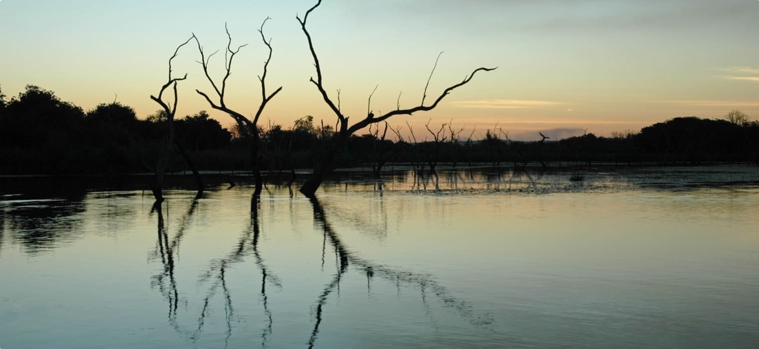
The mighty Ord River in the eastern Kimberley region of Western Australia is one of the country’s most significant waterways, home to spectacular scenery. Rising in the Albert Edward range, it flows in an easterly and northerly direction 650km. Its course runs around the edge of the Purnululu National Park, through Lake Argyle, along the western edge of Kununurra and on to the Cambridge Gulf, where it bends and curves through flat wetlands before opening out into the Timor Sea.
Two man-made barriers constructed as part of the Ord River Irrigation Scheme dam the river on its lower reaches, capturing the monsoonal water that falls backs up in the ranges during the wet season. The Diversion Dam, completed in 1963, created Lake Kununurra to channel water to farmland on Ivanhoe Plain. While the Ord River Dam was completed in 1972, creating Lake Argyle (Australia’s largest artificial lake) and bringing a reliable water supply to Packsaddle Plains.
Odyssey Traveller conducts a tour of the Ord River and Lake Argyle as part of our small group tour of Australia’s Kimberley. Our tours of mature and senior travellers for couples and solo travellers of up to 12 people leave at the best times to visit the Kimberley: the dry season, June to September, or at the end of the wet season in April and May when the landscape is lush and the gorges – Bell Gorge, Cathedral Gorge – and rivers – Ord River, Gibb River, Fitzroy River, and Tunnel Creek – all flow with water. This article explores the history of the Ord and its irrigation scheme to assist your tour.
Information for this article was sourced from Ian Hoskin’s book Rivers: The Lifeblood of Australia, as well as web sources linked to throughout.

Traditional Owners of the Ord River
The traditional owners of the Ord River and surrounding lands in the east Kimberley region are the Miriwoong and Gajerrong peoples. They have a continued habitation in Western Australia dating back roughly 60,000 years, since Aboriginal Australians arrived on the continent. The East Kimberley region could possibly even be one of the original points from which Aboriginal Australians arrived, with different theories proposing this site, as well as others in the Northern Territory as the most likely landing points from the islands of southeast Asia.
The Miriwoong and Gajerrong peoples used to live in harmony with the land stretching from Molly Spring in the west, to most of the grand Ord River including parts of Lake Argyle, and way beyond the Northern Territory border across Keep River National Park and up to the coast. Along the Ord River, places of ceremony created during their Dreaming sustained them during the dry season,
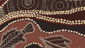
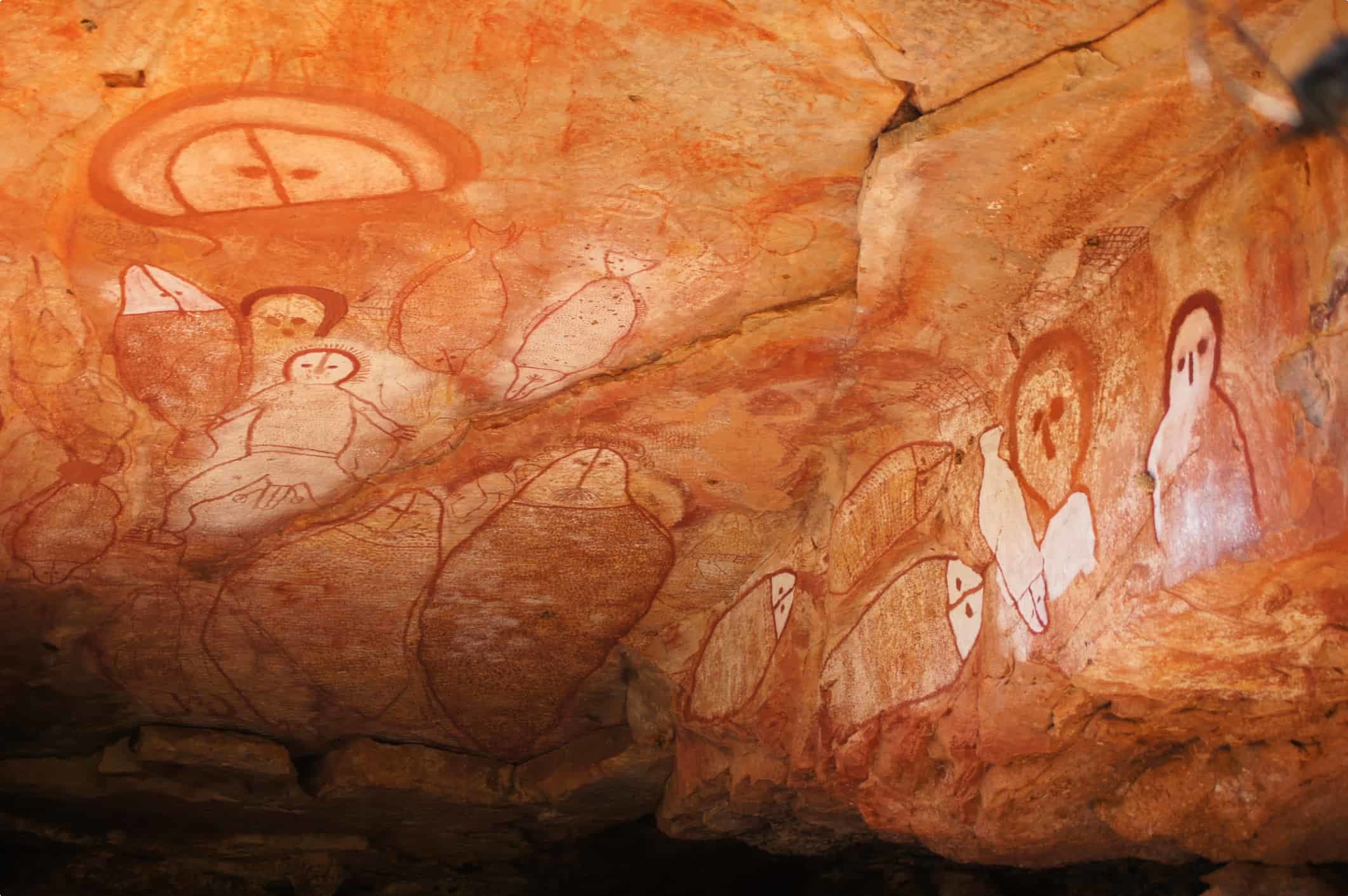
The wider Kimberley region showcases a rich cultural legacy of Aboriginal habitation. It is home to what is believed to be the world’s oldest examples of rock art, dating back at least 16,000 years. One example, the Gwion Gwion rock paintings, display distinctive spindly stick figures, ornamented with accessories such as bags, headdresses, and tassels.
Another major form of rock painting in the Kimberley are the Wandjina, believed by the local Mowanjum people to be the supreme creator, depicted with huge eyes but no mouth. The first Wandjina are believed to have been painted 4000 years ago, with the figures continuing to be painted today, making it the world’s oldest continuous sacred painting movement.
First European Contact: Alexander Forrest and the Duracks
The first European to discover the Ord River was Alexander Forrest in 1879 during his six-month expedition in the Kimberley region. He named the river after Sir Harry Ord, Governor of Western Australia (1877-80).
Forrest boasted of the Kimberley’s permanent water supply and grass in abundance, appearing to be the best pastoral proposition in Western Australia. His reports came at the right time, just as investors in in Melbourne and Brisbane were looking for new worlds to conquer in northern Australia. To capitalise on this interest, he set himself up as land agent for prospective investors, even though as a Survey Department official he was not expected to profit from his find.
When applications were invited for pastoral leases in the Kimberley district in October 1880, it attracted an immediate response. Over the next three years, applications were lodged for leaseholds totalling more than 20m hectares. Applicants included speculators vying for a piece of land with river frontages without ever actually setting eyes on the country, as well as members of Western Australia families who had established themselves in the south-west and were looking for opportunities for their younger generation.
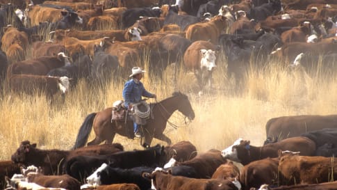
One of the more significant applications for land were made by members of the Durack family and associates. Seeking land for their sons, Patrick ‘Patsy’ Durack and his brother Michael travelled from Queensland to Perth to meet Forrest. At Forrest’s home, some 2,500 km from the land of promise, the men pored over a map and selected just under 162,000 hectares of land along the banks of the Ord and more than 60,000 hectares around other rivers. Paying a fortune at the requisite of 10 shillings an acre, the Duracks became the leases of a number of station properties, including Argyle, Rosewood and Lissadell on the lower Ord.
The family could afford the payment as they were already vastly wealthy. They had emigrated from to New South Wales in 1853, escaping the harsh life of tenant farming in Ireland, made increasingly untenable by crippling land rent and potato blights. Here led by Patrick, they quickly accrued massive amounts of wealth, pioneering into apparently empty land for livestock. Having established successful business enterprises in New South Wales and then western Queensland, they turned their attention to the west.

In 1883, Patrick took on the immense challenge of droving 7,250 head of breeding cattle and 200 horses 4,828 km from Queensland to the Ord River . The longest overland trek any Australian cattle drovers had undertaken until that time, it took an incredible 2 years and 4 months to complete. But it was no easy feat. Financially, the Duracks had to fork out £72,000 ($11 million today), while also suffering the loss of several men and half the cattle.
In her biographical snapshot of her grandfather, Patrick, Mary Durack explains the impetus for such a trek as ‘land hunger’. Ian Hoskins adds that “probably avarice, entitlement and insecurity go some way to understanding the amazing quest… [and] there was, of course, the perennial ‘thirst’ for reliable water that accompanied most European quests for agricultural land in Australia.”
Indeed, pastoral settlers like the Duracks were attracted to the Kimberley but its splendid rivers, fine pastures, and reliable rainfall. Along the Ord River especially, these conditions would be exploited into the next century and beyond with the Ord River Irrigation Scheme.
Early Plans to Dam the Ord River
The new pastoral settlers quicky noticed that although there was extremely heavy rainfall on the Ord in the ‘wet’ seasons, during the ‘dry’ season it was reduced from a fast-flowing river to a series of waterholes. As such, aspirations soon turned to harnessing the waters of the wet seasons; irrigated pasture could save the precarious Kimberley cattle industry, and cropping might provide another source of wealth.
To do this, the Ord River would have to be dammed. By capturing much of the 2500 gigalitres of water that flowed into the ocean each day during the wet season storms, the semi-desert cattle country could be transformed into a luscious, year-round agricultural area.

It was Michael Patrick Durack – son of Patrick Durack – who first observed the agricultural potential for the region, as early as the 1920s. Then in the late 1930’s, during a drought in the region, his son Kimberley Michael (Kim), having recently completed a course in agricultural science, conducted experiments in irrigation and wrote a report on the possibility of harnessing water.
As a result, in 1941, the Western Australian government sent its State Director of Works, the experienced dam and irrigation engineer Russell Dumas, to survey the Ord River dam sites with Kim’s help. The following year, Kim was appointed manager of the Ord River Experimental Station to to carry out investigations into tropical agriculture.
The Kimberley Research Station was then established in 1945 by the Council for Scientific and Industrial Research (later CSIRO) and the Western Australian Department of Agriculture, as part of a plan to develop a national irrigation policy. The start here was modest compared to the Snowy Mountains Scheme, with inconclusive evidence into suitable crops and little work done on the economic viability of the project. Nevertheless, momentum was maintained, and interest continued.
Ord River Irrigation Scheme Stage One
Experimental farming continued at the Kimberley Research Station into the late 1950s, testing the viability of growing cash crops in the fertile tropical climate. This ultimately culminated in the Ord River Irrigation Scheme, with the goal of creating an Ord River Irrigation Area by damming and redirecting the flow of one of Australia’s fastest flowing rivers during the summer wet season.
In 1959 a grant from the Commonwealth Government was finally approved, and in 1960 the Western Australian Government committed to Stage One of the project – the Diversion Dam across the Ord River.
The Diversion Dam, completed in 1963 at a cost of £4 million, backed the river up sufficiently to create Lake Kununurra and feed irrigation canals across the Ivanhoe Plain – 14,000 hectares of land. Commercial cropping had begun.

Kununurra town was also built nearby at this time as the residential and service centre for the scheme. Its name was Westernised from the local Aboriginal name for the Ord River – ‘Cununnurra’, meaning ‘big waters’.
A larger dam – the Ord River Dam – was built in 1970-72, 40km south of Kununurra where the Ord River meets the Carr-Boyd Ranges, to support irrigation expansion. Its construction formed a major storage reservoir called Lake Argyle. One of the world’s largest man-made water bodies and the largest freshwater storage on mainland Australia, the lake has a capacity of 10 760 million cubic metres (equivalent to nearly 20 times the water volume of Sydney Harbour).
Water stored year-round in the enormous Lake Argyle not only supplies irrigation to sustain agriculture in dry periods but is also used for hydroelectric power generation, supplying renewable energy to the Argyle Village, Wyndham, Kununurra and the Argyle Diamond mine.

Stage One Commercial Crops
Initially, a number of commercial crops were planted on the newly established agricultural farmlands created by the two dams in Stage One, such as rice, cotton, sugar as well as some experimental crops. Cotton soon became the preferred crop for the area, with some 17,500 bales of Ord River cotton marketed between 1963 and 1973. However natural pests made growing the crop expensive, requiring the spraying of costly chemicals to curb insect attacks. Then the withdrawal of commonwealth subsidies made the already expensive crop unprofitable and it was abandoned.
Neither were other early products economically viable, causing some early farmers to leave the region. Tobacco failed due to an emerging negative community attitude towards smoking and tobacco use. Rice crops were regularly attacked and consumed by large numbers of native Australian magpie geese. Meanwhile, later research determined that other experimental crops were simply not suited to the soil types and the region’s specific environmental conditions.
By the 1980s, only ten percent of the possible irrigation area was under cultivation and the Ord River Irrigation Scheme had become Australia’s most costly and controversial irrigation project. Bananas, mangoes, and melons were the main crops during this time, grown to compete with Queensland and Northern Territory farmers ‘out of season’.
Sugar was then trialled again in the 1990s, making money before prices collapsed. With the end of sugar, chickpeas were planted out in broadacre fields fed by the long, straight canals full of Ord River water.

Ord River Irrigation Scheme Stage Two
Between 2013 and 2015, 7400 hectares of land around the Ord River were cleared of remnant vegetation to grow a wide range of new crops. On the back of extensive research and development in agricultural technology, several new crops were identified as being suitable with appropriate management. These included high-value horticultural and seed crops, some specialty pharmaceutical crops, sugar cane, sandalwood, GM cotton, and grains.
The grain has been used in intensive feedlots to satisfy the growing demand for animal protein in South-East Asia. The north’s proximity to these export markets has become a virtue, with the port of Wyndham handling 10% of Australia’s live cattle exports.
More than 50 crops are now grown in the area, including sandalwood, melons, mangoes, citrus, sugarcane, sorghum, chickpeas, pumpkins, chia, and much more, proving the irrigation efforts to have been a successful endeavour.
A New Ecosystem
The operation of the Diversion Dam and Ord River Dam has moderated the natural flow cycle of the river to such an extent that a new ecosystem has evolved along the lower Ord. It now possesses many characteristics of a river from the Wet Tropics, with dry season flows higher than the natural level and reduced flood frequency,
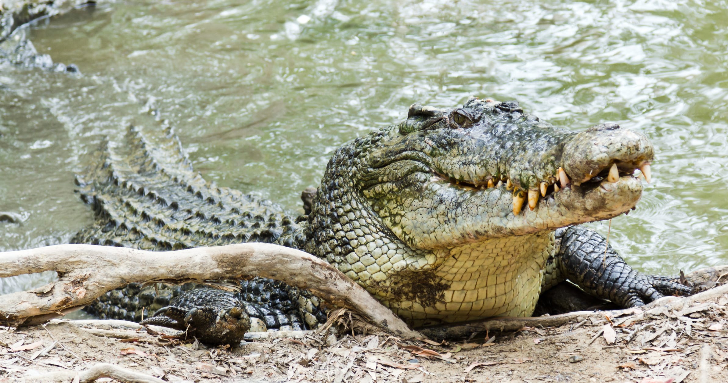
This has created a protected wetland area known as the Ord River Floodplain. Recognised as an internationally important wetland area, it contains numerous mangrove forests, lagoons, creeks, flats, and extensive floodplains that support saltwater crocodiles and many water birds.
Over 240 bird species – almost 1/3 of Australia’s known species and including significant breeding and migrant populations – can be found along the river. Birds found in the region include magpie geese, Australian bustards, wandering whistling-ducks, Australian pelicans, black swans, egrets, and wedge-tailed eagles.
The river is also home to several forms of fish – including barramundi, southern saratoga, archer fish, forktail catfish, mouth almighty, long tom, bony bream and sleepy cod.
Tour of the Ord River and Kimberley Region
If you’re interested in learning more about the fascinating Kimberley region, why not join one of our Kimberley outback tours? Odyssey Traveller’s tour of the Kimberley begins in the Indian Ocean town of Broome, before winding up the beautiful (Timor Sea) Kimberley coast to Cape Leveque and the Dampier Peninsula, home to several Aboriginal communities and pearling towns. We then head inland on the infamous Gibb River Road, visiting Windjana Gorge National Park, Tunnel Creek National Park, Galvans Gorge and Bell Gorge. We make a side trip to the remote Mitchell Plateau, home to Mitchell Falls, one of the area’s most spectacular waterfalls.
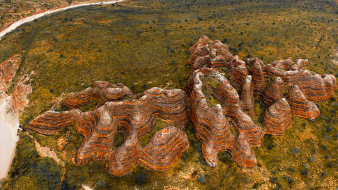
Back on the Gibb River Road, we spend the night in El Questro, a former cattle station converted into a wilderness park centred around Emma Gorge, Chamberlain Gorge, and the Pentecost River. El Questro offers a variety of accommodation, from tented cabins to luxury suites in the old El Questro homestead. The next day, we take a short journey into Kununurra and surrounds where we embark on a half day tour of the Ord River and Lake Argyle via boat, returning to Kununurra just after a colourful east Kimberley sunset. Finally, we head to Purnululu National Park, where we see the Bungle Bungle Range, Echidna Chasm, Cathedral Gorge, and the Piccaninny Creek Lookout, before heading back to the west Kimberley.
What sets an Odyssey Tour apart is that we don’t just jump from tourist site to tourist site, but take the time to uncover the hidden histories and quirkly local culture of our destination. On our Kimberley tour we delve into the history of the area at the towns of Halls Creek and Fitzroy Crossing (on the Fitzroy River). We have the privilege of viewing Aboriginal rock art believed to be among the oldest works of art in the world. We also learn about the tragic impacts of colonisation at the Boab Prison Tree.
Our tour ends in Broome, giving you the opportunity to explore Cable Beach, Roebuck Bay and Gantheaume Point, and delve into the fascinating history of this pearling town before you get back to daily life, wherever that might be.
Odyssey Traveller has been serving world travellers since 1983. Our tours are designed especially for mature and senior travellers. We move in small groups, and are led by tour guides chosen especially for their local knowledge. Contact us to find our more information about our tour of the Kimberley, or our Australia outback tours.

Articles about Australia published by Odyssey Traveller:
- The Kimberley: A Definitive Guide
- Appreciating Australian River Systems
- Lake Argyle
- Purnululu National Park
- Strahan and Gordon River
For all the articles Odyssey Traveller has published for mature aged and senior travellers, click through on this link.
External articles to assist you on your visit to the Kimberley:
Related Tours

days
May, Jun, Jul, Aug, SepSmall group tour of Australia's Kimberley
Visiting Western Australia
Escorted small group tour of the Kimberley. We explore and visit The Bungles, Bell Gorge, Mitchell plateau & Halls Creek in the dry season. Amazing landscapes intertwined with Aboriginal communities resident more than 45,000 years.
days
Sep, Apr, May, Jun, Jul +2Kimberley, Purnululu, Tiwi Islands and Arnhem Land
Visiting Northern Territory, Western Australia
Small group tour touring most of the Australian territory, travelling through the outback and visiting many of the famous sights as well as off the beaten track locations, giving you the opportunity the explore and meet our people in the most remote locations and far north Kakadu and the Kimberley.

days
Apr, Jul, SepKimberley and Pilbara explored by air
Visiting Northern Territory, Victoria
Small group air charter tour of the Kimberley and Pilbara for senior and mature couples and single travellers. Learn about Purnululu, Bradshaw art, visit Derby, Broome and Alice Springs.
Related Articles

Aboriginal Art
Senior and mature couples and solo travellers remain curious but often informed about the role Aboriginal art plays in the indigenous community and the various styles. This article seeks to provide a platform for this collection of small group tours of upto 15 people into the Australian outback where often Aboriginal art styles are encountered.
Alexander Forrest & Early Development of the Kimberley Cattle Industry
Article about Alexander Forrest, a cattleman who made a difference in the Kimberley. Forms part of a small group tour for mature and senior travellers into Outback Australia for couples and solo travellers.

Broome, Australia
Broome an introduction. Brome is the beginning and end of the Kimberley small group tour offered by Odyssey in the dry season. With its own history read on to learn more about this coastal frontier town. For mature and senior travellers this is a great tour examining all aspects of the Kimberley from the indigenous community, the landscapes and the wildlife. Designed for couples and the solo traveller.

Derby, Western Australia
Article about Derby, Western Australia. Important settlement for mature and senior travellers to explore on a small group tour for couples and solo travellers in outback Australia.

George Grey's Kimberley Expedition
Article on Western Australia about the Colonial explorer George Grey. Supports small group tours for mature couples and solo travellers of the Kimberley and places of interest such as Wyndham and its pastoral history. The Kimberley is where the first Australian arrived.

Halls Creek, Western Australia
Halls Creek an important stop on our Small group tour of the Kimberley. We learn about the gold rush on this tour for mature and senior travellers, couples and singles.