The Franklin River, Tasmania
Article about the stunning Franklin river that flows on to the Gordon river and Strahan on the West coast. Learn about the Aboriginal settlement in the last ice age and the importance of Cape Grim. Supports a small group educational tour for senior couples and mature solo travellers to Tasmania.
9 Sep 21 · 10 mins read

Tasmania’s Franklin River
By Marco Stojanovik
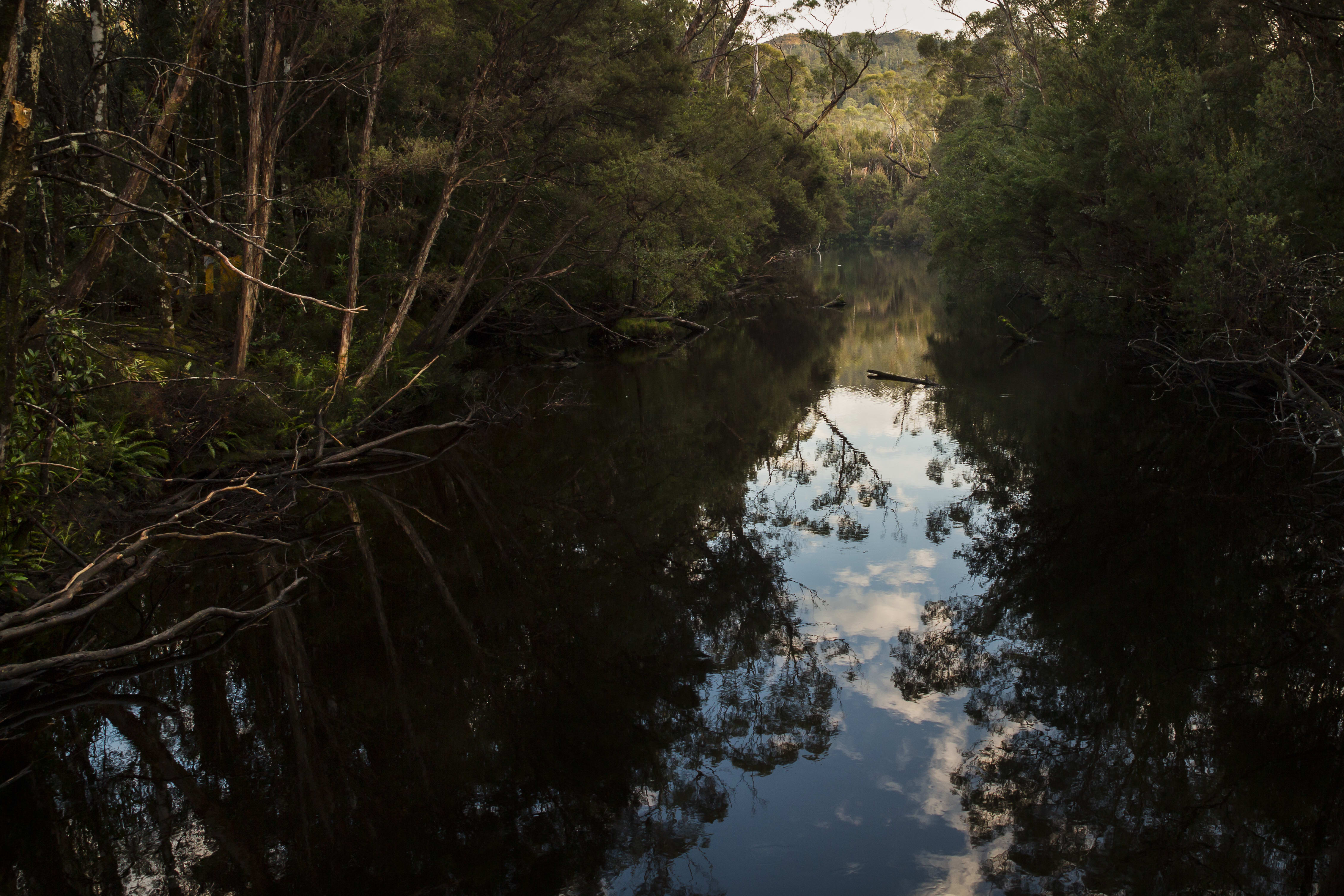
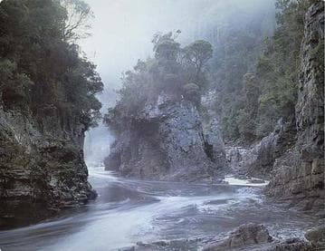
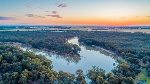
Franklin-Gordon Wild Rivers National Park, at the heart of the Tasmanian Wilderness World Heritage Area, is valued for its dramatic peaks, beautiful temperature rainforest, deep valleys, spectacular gorges, and pristine, twisting rivers. The Franklin River itself winds its way 125km south-west through the wilderness national park, from its source in the alpine lakes of the Cheyne Ranges to its confluence at the Gordon River.
Surveyor James Calder named the river in 1840 after Sir John Franklin, Governor of Tasmania (1837-1843). Calder had been sent to blaze a trail that would allow Sir Franklin to explore the land he governed. But these explorations were not the first time humans had traversed the rainforest areas of western Tasmania. Aboriginal Australians had in fact inhabited the area, sheltering in the caves above the Franklin River, during the last Ice Age (20,000 – 13,000 years ago). A number of archaeological discoveries towards the end of the twentieth century speaks to the region’s importance.
This cultural significance, in addition to its spectacular untouched scenery, lies behind the region’s World Heritage status. Even so, its recognition has been hard fought for, the Franklin River placed at the centre of Australia’s most famous conservation movement, taking place in the late 1970s and early ‘80s.
This article details the course of the Franklin River, its history of Aboriginal inhabitants, as well as the successful campaign to save the Franklin River from being destroyed by the Franklin Dam project. It is intended as background reading for Odyssey Traveller’s tour of Tasmania‘s wildlife and history, during which we visit Franklin-Gordon Wild Rivers National Park. Much of the information used in this article is sourced from Ian Hoskin’s Rivers: The Lifeblood of Australia.

The Franklin River’s Course
The Franklin River rises in the high country of central-western Tasmania, on the western slopes of the Central Highlands, twisting and turning through remote and rugged mountainous country down to meet its confluence with the Gordon River in the south-west. During its course it runs through bare quartzite mountains, button-grass plateaus, alpine lakes, and forested valleys.
In its upper reaches, the river supplies and drains two high waters: Lake Undine and Lake Dixon. It is also here crossed by the Lyell Highway.
It then descends with rapids and water flows that can increase many times overnight with heavy rain. When this occurs, instant waterfalls are created on its steep sides. Snow melting on the surrounding peaks meanwhile adds to the volume.
The river then descends below Frenchmans Cap, moving slowly, deeply, and narrowly through the near vertical rock walls. Following this, it twists and turns with bends, rocky rapids, and cascades through its middle and lower passages.
From source to mouth, sixteen tributaries join the river, including the Surprise, Collingwood, Lucan, Loddon, Andrew, and Jane rivers.
Aboriginal History
Aboriginal Tasmanians (Palawa kani) have inhabited Tasmania for more around 40,000 years. Sometime during the Last Glacial Period, when the sea was at its lowest, tribes began crossing into Tasmania from mainland Australia via a land-bridge spanning the Bass Strait. This land bridge was of desert and woodland and supported emus and other game.
Archaeological, geographic, and linguistic records show that Tasmania was occupied in waves and that over time three ethnic of language groups coalesced into one broad group. Then, when the glaciers retreated and sea levels rose again around 8,000 years ago, Tasmanian Aboriginals became isolated from the mainland, developing their own unique and rich culture.
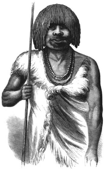
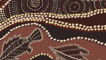
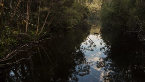
Until the late 1970s, consensus was that the rainforest areas of western Tasmania were a ‘true wilderness’, the only part of the Australian continent to never be inhabited by Aboriginal peoples. Discoveries were soon made, however, in the limestone caves above the lower Franklin that upended this assumption.
In 1977, a group of cavers led by Kevin Kiernan were systematically exploring the area in the hope of aiding the campaign to save the Franklin River from being dammed (see next section). By 1979, over a hundred caves had been found and mapped.
One particular cave, above a bend in the river some 10km north of the junction with the Gordon, was littered with artefacts and bones over an area of around 100 square metres. Kutikina Cave, as the site would be named, was to become one of the most important archaeological sites ever found relating to Ice Age human culture – representing the southernmost human habitation on earth during that period.
A subsequent excavation unearthed 40,000 stone artefacts and almost 250,000 bone fragments, indicating that the site might hold a total of 10 million artefacts. Radiocarbon dating then later revealed that the rock shelter was first inhabited at the beginning of the Ice Age, 20,000 years ago, reached its peak 17, 000 years ago, and ended suddenly due to changing climatic conditions at the end of the Ice Age 13, 000 years ago. It was further evidence of the vast antiquity of Aboriginal culture in Australia.
Twenty more dwelling cave sites containing archaeological remains have since been found in the six valleys of the Franklin-Gordon River System. Occupation of each cave began around 20,000 years ago, and ended around 13, 000 years ago, at the end of the Ice Age.
At Deena Reena Cave, similar collections of Ice Age tools, charcoal and bones were found, while paintings (likely from the Ice Age) were found at Ballawinne Cave on the Maxwell River. In total, the Tasmanian World Heritage Area is home to approximately 1000 Aboriginal heritage sites.
The number of sites suggest that the occupation of the lower Franklin area was systematic and prolonged. Early occupation may have been a summer activity, with bands living further north, on the Bassian Plain (now Bass Strait) or even present-day Victoria. The tools of the deposit closely resemble those found near Lake Mungo, indicating extensive cultural exchange with mainland Australia.

The inhabitants of the cave would have lived in a very different environment from the one found today. At the end of the Ice Age, Tasmania was roughly the same distance from the polar ice sheet as Patagonia is today. The west Tasmanian mountains would have been home to glaciers; while, because so much water was locked in polar ice, the climate would have been much drier, supporting alpine herb fields rather than rainforest. Though much colder, this open habitat would have been much better for hunting.
Their main diet would have consisted of wallabies, possums and other land animals, from which they’d also source skin for clothing. The icy river meanwhile would have provided reliable drinking water.
At the end of the Ice Age, the rainforest would have spread back through the lowlands, making the place less easily negotiated by humans and the game they depended on. Aboriginal people were at this point forced to leave the ice-age caves and the cold river valley and move to the edge of the landscape. Their descendants returned to a more turbulent river and its thick temperate rainforest centuries later, but it is unclear whether there were visits or more permanent residencies
The area continues to be of great spiritual significance to today’s Tasmanian Aboriginal community, and many sites have been returned to Aboriginal ownership under the Aboriginal Lands Act 1995, including Kutikina Cave. Far from a wilderness, the wild landscapes of Western Tasmania are a place of ancient human habitation, with an enduring spiritual and cultural importance.
Saving the Franklin Campaign
For many Australians, the Franklin River is best known as the site of the largest conservation battle in Australian history. In 1978, the Tasmanian Government announced its decision to dam the lower Gordon River for the purpose of generating hydroelectricity. It was hoped that this would create jobs and encourage economic growth with the sale of electricity. However, plans were met with resistance from environmentalists.
They were concerned that the dam would flood the Franklin River, which joins the Gordon nearby. This would have in turn drowned the surrounding forest – home to 3000-hyear-old Hyon Pines and many rare and endangered species. After a long fight, dams built on the upper Gordon in 1972 had already destroyed Lake Peddler. Many Tasmanians were now determined to protect another natural treasure from being destroyed.
The environmentalist opposition that had first emerged to protect Lake Peddler now consolidated itself into a small green movement to save the Franklin River. Thousands of people protested, with hundreds arrested for blockading the river and construction roads.
The movement was led by the Tasmanian Wilderness Society (TWS), which grew into a cohesive and powerful pressure group as the issue grew to polarise Tasmanian society. Several public identities were involved with the group, including Bob Brown – one of their founding members.
Brown’s experience on the campaign would help him enter the Tasmanian parliament as an independent on an environmental platform in 1983. He later became a founding member of the Australian Greens and is widely considered Australia’s most famous and respected conservationist.
On the other side of the debate, proponents of the dam considered the Franklin in its natural state a wasted resource. It needed to be ‘tamed’ as the Snowy and Ord Rivers had been. At the forefront of this position was was the Tasmanian government headed by the conservative Robin Gray, who famously described the river as ‘a brown ditch, leech-ridden, unattractive to the majority of people’.

Gray’s Liberal party had come to office in 1982 with a specific mandate to complete the dam. Their rise to power followed the internal collapse of the Australian Labor Party in Tasmania, which was partly due to divisions caused by the Franklin dispute.
The Labor Party had been supportive of both hydro-electric schemes and the preservation of the Franklin, and so backed a site elsewhere on the Gordon and created the Franklin-Lower Gordon Rivers National Park. Determined to build the Gordon-below-Franklin Dam, Gray excised key river areas from the new national park and vested them with the Tasmanian Hyrdro-Electric Commission (HEC) in charge of building the dam.
A key boost to the campaign to stop the dam came later in 1982, when the Franklin and Gordon Rivers – along with Cradle Mountain and a number of other wilderness areas on Tasmania’s West Coast – were listed as part of the Tasmanian Wilderness UNESCO World Heritage Site. The listing emphasised both cultural and natural values: the significance of the southernmost Ice Age human habita Malcom Fraser tions and the importance of rare surviving temperate wilderness.
Despite the World Heritage status, the dispute continued, and by the following March had become a federal issue. A campaign in the national print media, assisted by pictures of photographer Peter Dombrovskis, fostered widespread backlash against the proposed dam. This in turn impacted the 1983 federal election. The Liberal-National Party coalition government of Malcom Fraser was brought down in favour of Australian Labor Party leader Bob Hawke, who had promised to stop the dam from being built.
The new Prime Minister swiftly passed legislation forbidding further construction. Nevertheless, the Tasmanian government continued to build. A legal battle between the state and federal governments ensued, resulting in a landmark High Court ruling in the federal government’s favour.
Finally, the Tasmanian government’s intent to build the dam was overruled, with the Franklin conserved as the Franklin-Gordon Wild Rivers National Park. A new president for Commonwealth intervention in environmental matters had been set.
Franklin-Gordon Wild Rivers National Park
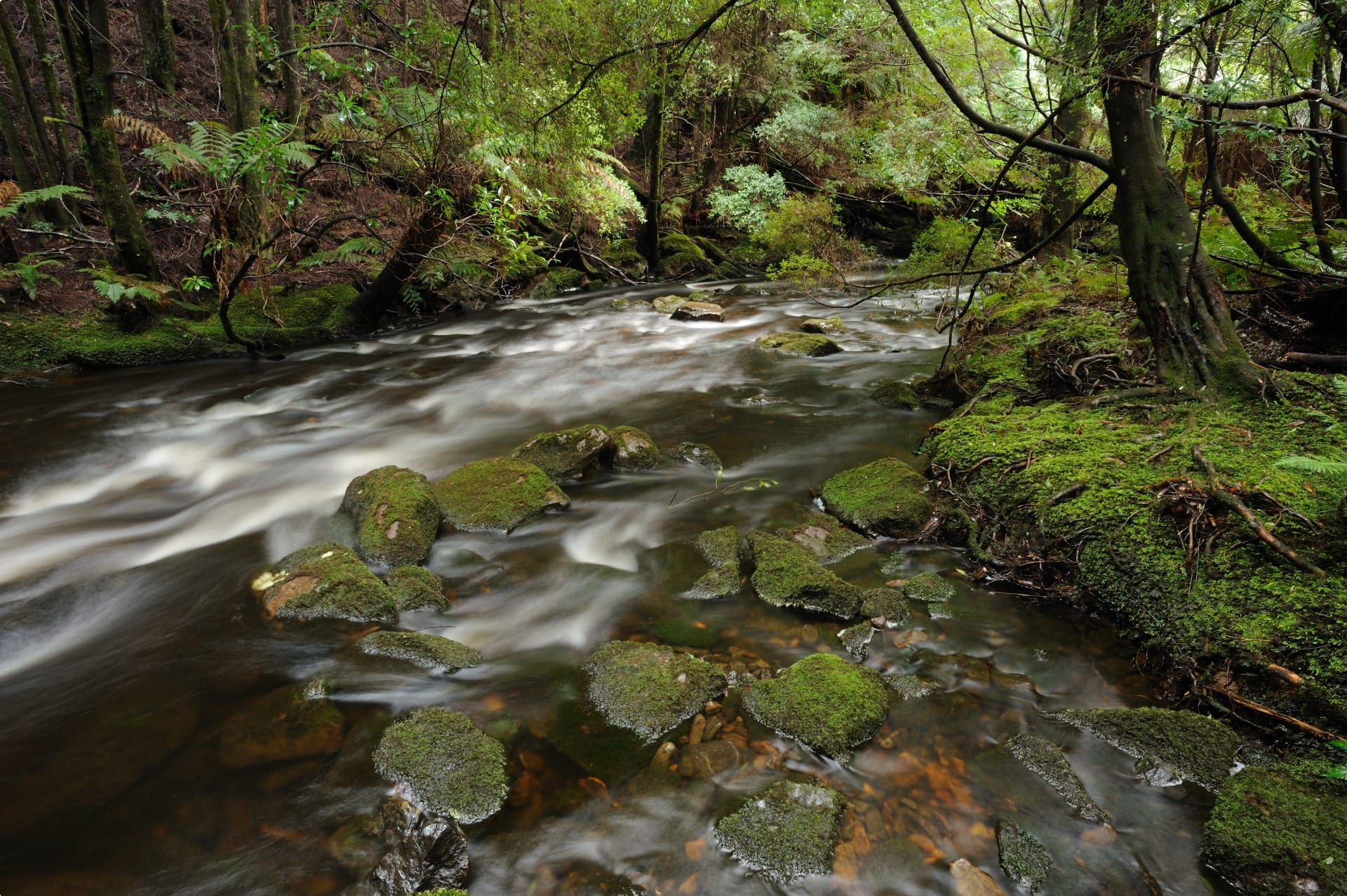
The Franklin-Gordon Wild Rivers National Park preserves the catchments of the Franklin, Olga and Gordon Rivers, and is as rugged and wild as its name suggests. The rugged landscape was carved by ancient glaciers, forming the many creeks that twist through steep rock gorges on their way to forming the powerful Franklin and Gordon Rivers.
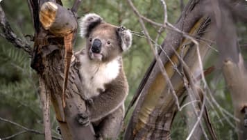
Located in the wettest part of Tasmania – with an annual rainfall of over 1900mm – the park supports a range of flora, including 3000-year-old Huon pines, wet temperate rainforest, and eucalypt forest. These form habitats for a wide variety of native animals, including the Tasmanian devil, spotted-tail quoll, and eastern quoll.
Today, the National Park is a major draw for visitors to Tasmania. A white-water rafting trip on the Franklin River is an iconic Tassie adventure activity, while the less adventurous can see the Gordon River on a cruise leaving from Strahan or take a short walk from the Lyell Highway.
Tour of Franklin-Gordon Wild Rivers National Park
Odyssey Traveller visits the Franklin-Gordon Wild Rivers National Park as part of our tour of Tasmania‘s wildlife and history. Beginning and ending in Hobart, our Tasmania tour begins with a day trip to Port Arthur. We then travel up the east coast – stopping for a day tour of Maria Island – and visit the dramatic coastlines of Wineglass Bay, Coles Bay, and the Freycinet Peninsula.
Heading inland, the tour stops in Launceston, before exploring the rugged and pristine west coast. We see the glacial lakes (including Dove Lake) of Cradle Mountain National Park, before a stay in Strahan, on edge of Franklin-Gordon Wild Rivers National Park. During the groups time in Strahan, we take a guided tour across the bay to Sarah island and along part of the Gordon river, viewing the temperate forests and gaining an understanding of the importance of Huon pine from the local Huon valley. After Strahan and the Gordon River, we head to Lake St Clair, before returning to Hobart, where we mark the last day of the guided tour with a trip to Bruny Island.
Travellers with an interest in visiting Tasmania may also be interested in our colonial history tour and our walking tour of Flinders Island.
Odyssey Traveller has been serving global travellers since 1983 with educational tours of the history, culture, and architecture of our destinations designed for mature and senior travellers. We specialise in offering small group tours partnering with a local tour guide at each destination to provide a relaxed and comfortable pace and atmosphere that sets us apart from larger tour groups. Tours consist of small groups of between 6 and 12 people and are cost inclusive of all entrances, tipping and majority of meals. For more information, click here, and head to this page to make a booking.
Articles about Australia published by Odyssey Traveller:
- Uncovering the Ancient History of Aboriginal Australia
- Aboriginal Land Use in the Mallee
- Understanding Aboriginal Aquaculture
- The Australian Outback: A Definitive Guide
- The Eyre Peninsula: Australia’s Ocean Frontier
- Ancient Aboriginal trade routes of Australia
For all the articles Odyssey Traveller has published for mature aged and senior travellers, click through on this link.
External articles to assist you on your visit to Australia:
Related Tours
19 days
Nov, FebDiscovering Tasmania’s Wildlife
Visiting Tasmania
Small group tour of up to 15 mature and seniors travellers visiting and learning about Tasmania's wildlife and history. Visit Maria Island, Freycinet peninsula, Cradle Mountain, Strahan, Lake St Clair and Bruny Island over 16 days.
From A$13,650 AUD
View Tour
days
Mar, Aug, Sep, Oct, Nov +3Tours of Tasmania; exploring colonial history
Visiting Tasmania
Escorted program for couples and single travellers visiting Hobart, Launceston through the Tamar Valley along the rugged coastline of the north coast and heading back south to the pristine wilderness around Cradle Mountain and then on through Strahan, Queenstown and past Lake St Clair, before arriving back in Hobart. This 18 day small group tours to Tasmania for mature and senior travellers interested in the colonial history of Tasmania. We follow the footsteps of the colonists, visiting the churches where they worshipped, the houses in which they lived, the taverns where they drank and some of the mills in which they worked.

9 days
Oct, MarSmall group tour of Flinders Island
Visiting Tasmania
Explore and learn about Flinders Island on an escorted small group tour for mature and senior travellers who enjoy a walking holiday. For couples or solo travellers. We also explore Cradle Mountain and Launceston.
From A$8,150 AUD
View Tour
days
Feb, Mar, Apr, Nov, JanMotorcycle tour of Tasmania for mature riders
Visiting Tasmania
Escorted Small group tour of up to 8 mature and seniors Motorcycle riders visiting and learning about Tasmania's wildlife and history. Visit Maria Island, Freycinet peninsula, Cradle Mountain, Strahan, Lake St Clair and Bruny Island over 14 days.
Related Articles
Appreciating Australian River Systems
Appreciating the linking of the river network into the Australian, history, culture and landscape on a small group tour for mature and senior travellers of couples or solo travellers is an integral part of understanding the continent of Australia and Aboriginal settlement.

Atmospheric Measurements at Mauna Lao & Cape Grim
Climate change and the Industrial world. For mature and senior Travelers couples or solo, being aware of the journey and learning that they are part of is important when taking a small group educational tour.
Australian Aboriginal Paths of Migration
Article for small group tours of mature or senior couples or solo travellers interested in learning more about Aboriginal history, Kinship, trading routes, songlines and ancient history.
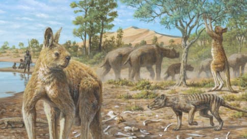
Australian Megafauna
Explore the ancient history and incredible natural heritage of Australia, with a dive into the strange and fantastic story of Australia's ancient megafauna. Odyssey offers small group tours for mature and senior travellers, couples, and solo travelers to Australia.

Bass & Flinders Mapping of Tasmania
Learn about Tasmania history on an escorted small group tours for mature and senior couples and solo travellers interested in Aboriginal, wildlife and colonial history of Tasmania, Australia.
Cradle Mountain, Tasmania
One of Tasmania's most iconic natural wilderness destinations. Explore Cradle mountain on a seniors small group tour of Tasmania designed for active couples and solo travellers or select another iconic Australian or New Zealand tour.
Ice age archaeological sites of the Tasmanian Wilderness World Heritage Area, Australia
Ice age archaeological sites of the Tasmanian Wilderness World Heritage Area, Australia The Franklin-Gordon Wild Rivers National Park is one of the most remote places in Australia, a wild labyrinth of winding gorges, rushing rapids,…

Lake St Clair, Tasmania
Australia's deepest lake; Lake St Clair formed by ice during several glaciations over the past two million years. Visit and learn on a escorted small group tour of Tasmania for seniors. For active couples and solo travellers exploring Australian wilderness.