The Nullarbor Plain: A Definitive Guide
Article for travellers interested in Australia and some of the iconic places in Aboriginal and the short colonial history. The Nullarbor plains adjacent to the great Australian bight are part of this set of icons to explore. Odyssey traveller is an Antipodean travel company serving World Travellers since 1983 with small group educational tours for senior couples and mature solo travellers.
30 Jul 22 · 16 mins read

The Nullarbor Plain
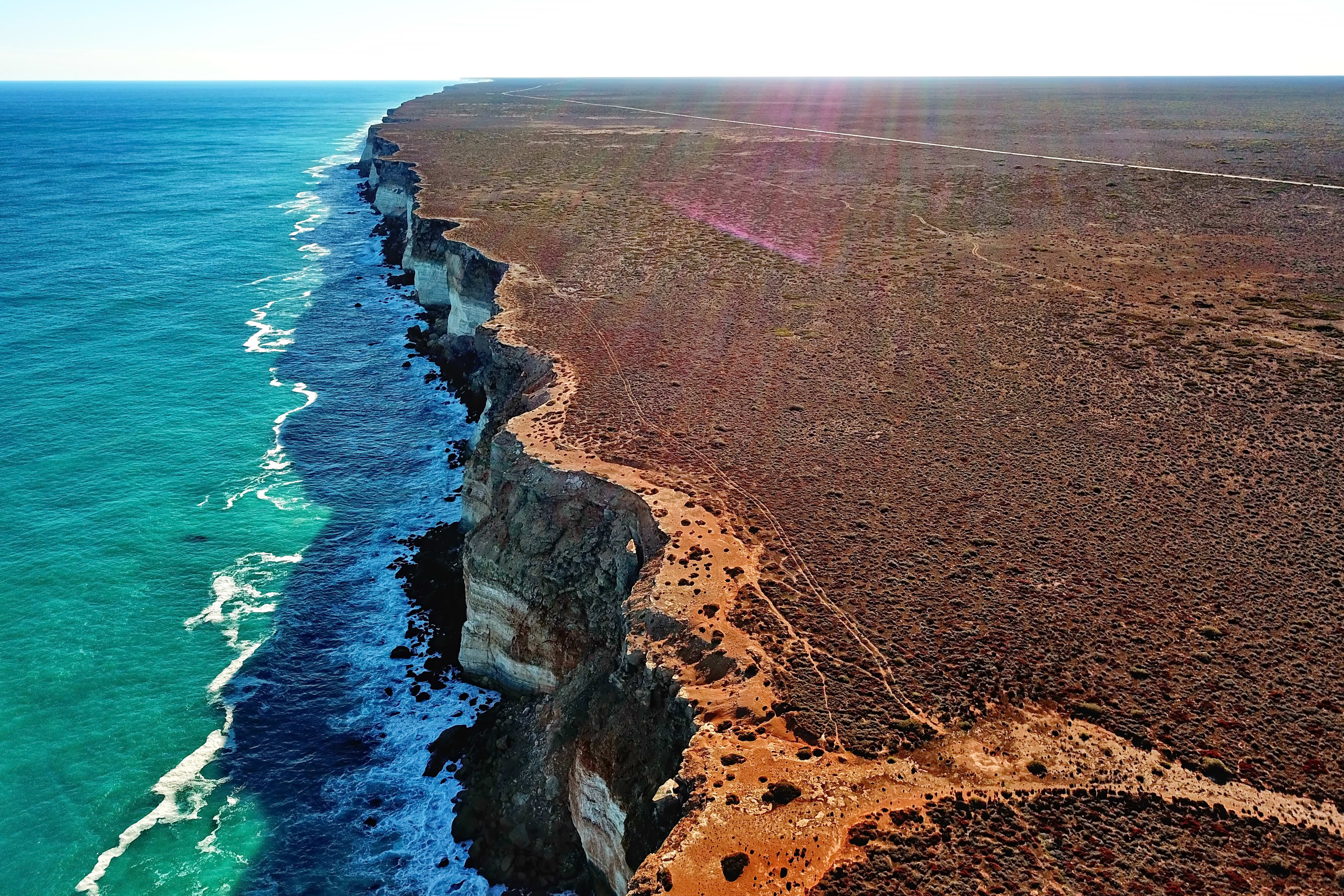
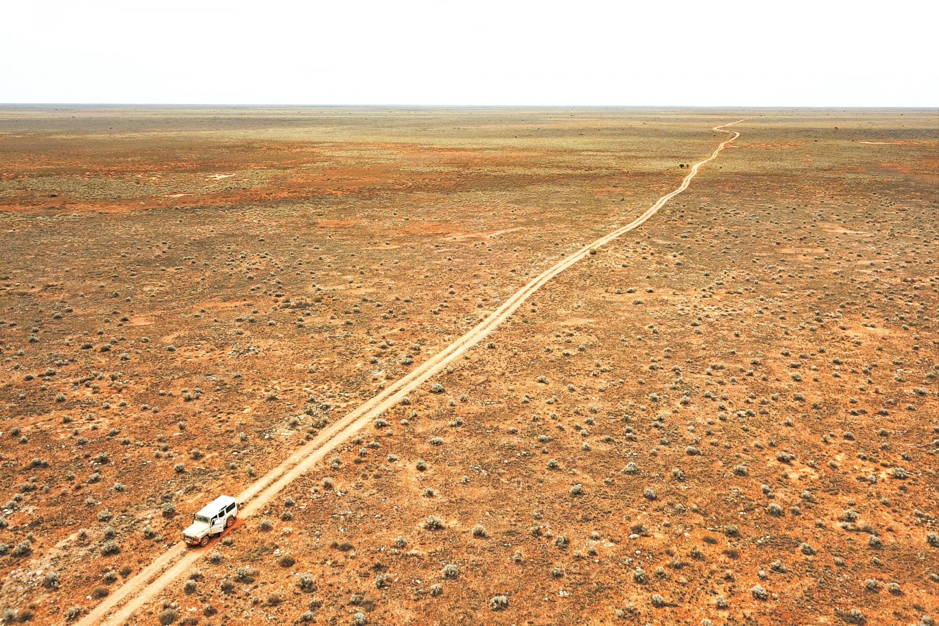
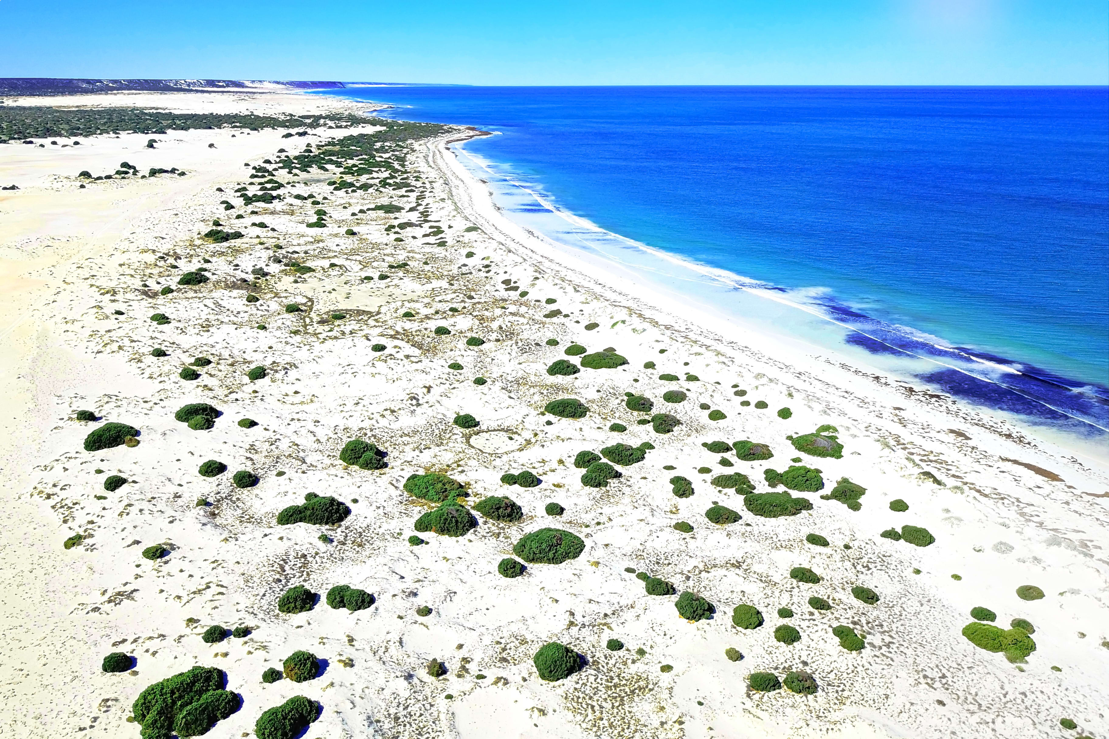
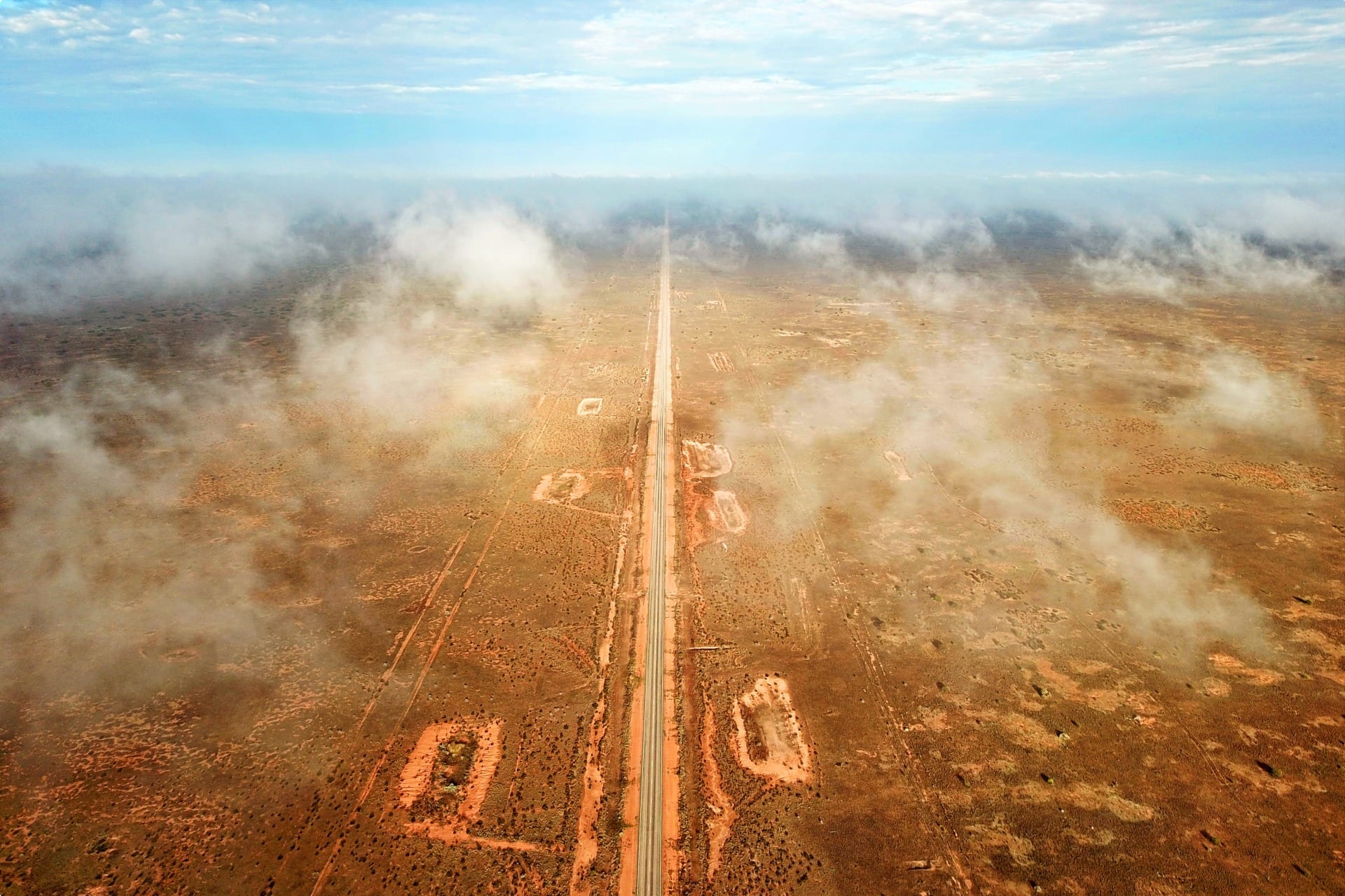
Inland from the Great Australian Bight, straddling Western Australia and South Australia, is the world’s largest limestone plain – the Nullarbor. The flat, almost treeless landscape of semi-arid country stretches about 1,200 kilometres from east to west at its furthest point, occupying an area of about 180,000 square kilometres. In its southern portion, along the Great Australian Bight, stand towering coastal cliffs, ancient limestone caves, and magnificent blowholes. In the north, it meets the shifting sand dunes of the Great Victoria Desert, while its centre is full of varied flora and fauna.
The region has a long human history encompassing Aboriginals, European explorers, pioneers, settlers, and huge construction projects such as the Trans-Australian Railway and Eyre Highway. Nevertheless, the pristine landscape, except for the single road and railway corridors, remains today much as it always was.
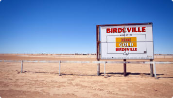
Read on for a comprehensive guide to the location, geography, human history, towns and infrastructure of the Nullarbor Plain. It is intended as background reading for Odyssey Traveller’s small group tours for mature and senior travellers to Western Australia. During our Western Australia Tour and our Wildflowers Tour of Western Australia, we visit the town of Norseman – gateway to the Nullarbor Plain – where we learn more about this unique landscape. Norseman is also home to holes 14 and 15 of the longest golf course in the world, the Nullarbor Links, which is spread out 1,365 km across the plain.
Much of the information used in this article is sourced from Neville Collin’s The Nullarbor Plain: A History, as well as sources linked to throughout.
Location
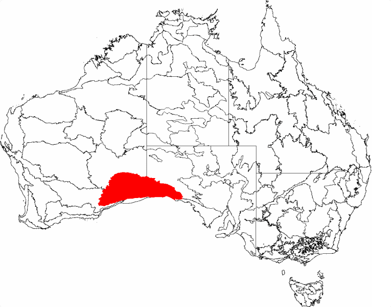
The Nullarbor Plain is wholly contained within the much larger Bunda Plateau of Southern Australia. The region is generally thought of as compromising both an inner treeless area and a fringe of low scrub, that together lie on a huge limestone mass along the curvature of the Great Australian Bight. It is the presence of the limestone and vegetation associated with the limestone soils that delineate the boundaries of the plain.
The southern boundary, except for the Ore Plains between Eucla and Twilight Cove, is formed by the Southern Ocean. From here, it extends up to 250 km inland to its northern boundary, the Ooldea Range, which extends intermittently west to merge with the sand dunes of the Great Victoria Desert. Here the limestone of the plain suddenly disappears beneath the sand.
Its eastern boundary extends approximately from the Ooldea / Colona track to near the Head of Bight. The western boundary, meanwhile, extends from the stand of eucalyptus and salmon gums at Naretha south to Balladonia and Israelite Bay.

The overall area of the Nullarbor is about 180,000 square km – almost the size of the state of Victoria! Of this, the treeless portion comprises about 52,000 square km. About one quarter of the plain is in South Australia and the remainder is in Western Australia. At its widest point from east to west, from the town of Ceduna on the Eyre Peninsula to Norseman in Western Australia, it extends for around 1,200 kilometres – a mostly straight 13-hour drive!
Geography
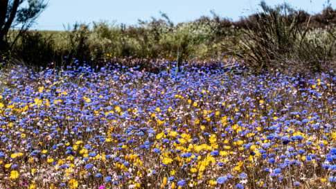
The Nullarbor Plain was named by the surveyor E. A. Delisser when exploring the country in the mid-1860s. Its name is derived from the Latin wording nullus arbor, meaning ‘no trees’. The Aboriginals before Delisser called the plain Gondiri, meaning ‘bare like a bone’. It is this absence of trees in the plain’s inner area that is a key geographical characteristic of the Nullarbor, along with the level nature of the surface, and its limestone soils. Nevertheless, it does contain vegetation – covered mainly with saltbush and blue bush. In non-drought seasons, even some wildflowers and grasses appear.
The Nullarbor is formed by a single giant piece of limestone, which is most evident on the treeless portion as rocky outcrops. It has an unusual degree of purity, with an absence of quartz or dolomite. The Nullarbor region, once part of an ancient seabed, is also one of the most significant karst regions in the world. A karst landscape is characterised by sinkholes, springs, caves, and rock holes, formed by water erosion of soluble limestone over a long period of time.

Many caves are found throughout the area, some containing fossils that are thousands of years old. Many of the underground cave systems make up some of the largest in the world, some including passages several kilometres long. In some areas, the Southern Ocean blows through many of the caves, resulting in blowholes as far as several hundred metres away from the coast.
The Murrawijinie Caves north of Nullarbor are publicly accessible, white Koonalda Cave and Bunabie Blowhole can be viewed form the top. Murrawijinie and Koonalda both host ancient Indigenous art dating back over 20,000 years.
Because of the porous nature of the limestone, any rainfall drains underground, resulting in no surface streams or freshwater lakes. And vertical relief within most of the Nullarbor is virtually non-existent.
Indigenous Peoples of the Nullarbor Plain
The margins of the Nullarbor Plain are the traditional homes of various Aboriginal groups, who have occupied the region for approximately 40,000 years. According to the research of pioneering anthropologist Norman B. Tindale into Aboriginal groups before European settlement, the southern portion of the Nullarbor was occupied by the Mirning group. Their country ranged from the Head of Bight to beyond Eucla and as far west as the Point Culver area. To the east were the Wirangu who roamed from the Head of Bight to the Gawler Ranges and north to Ooldea, while on the northern fringes of the plain the Kokatha, Ngalea, and Pindiini were dominant.
Population numbers, however, remained quite low in the Nullarbor, and the vast treeless portion of the plain was practically unoccupied. The scarce water resources and limited available food in dry times would have made it virtually uninhabitable.
Aboriginal people may have also preferred to remain and travel on the fringes out of fear of encountering the mythical water serpent known as Jeedara. According to the dreamtime stories of all the Aboriginal groups bordering the Nullarbor, Jeedara was chased underground by the Seven Sisters of the Pleiades (star cluster), where he pushed up the Bight cliffs and hid in the caves. He was believed to have remained in the caves of the region, with the water spraying from blowholes said to be his breath. The people stayed clear of the places he lived, believing he would seize anyone found in his territory. [Australia Through Time]

In the north of the Nullarbor, population numbers varied, with various groups constantly travelling to Ooldea for trading, corroborees, and initiation ceremonies. These groups came from as far away as the MacDonnell Ranges in Central Australia.
Ooldea acted as a centre due to a permanent water supply found at its soak. Rock-holes also provided the Aboriginal people with water. On the coast, the people could obtain water at the base of same sand-hills, such as Ilgamba, at the Head of Bight, Merdayerrah Sandpatch and Eucla. Various tracks were used to follow the availability of water.
With the coming of the white man, the Aboriginals were disenfranchised from their traditional lands. Their formerly self-sufficient way of life was restricted and they began to succumb to starvation and disease. Many were transported to the Koonibba Mission, and then reserves at Ooldea and Yalata.
The Yalata Aboriginal Lands was declared an Indigenous protected area in 1999. The land, spanning 456,000 hectares, consists of coastal dunes, sand plains and shrublands, home to various Aboriginal communities from the fringes of the Nullarbor and further afield. Traditional owners include the Kokatha, Antakarinja, Pindiini, and Ngalea western desert peoples. All groups continue their connection to the land through various traditions, cultural affiliations, and practices. With the return of their lands, some of the excesses of the past by white pioneers and settlers have to some extent been addressed. [Nullarbor Roadhouse]
European History
The first Europeans to have sighted the Nullarbor Plain were the crew of the Dutch vessel Gulden Zeepart (Golden Seahorese) under the command of Captain Francious Thijssen. In 1626-1627, they charted the coast from east of Cape Leeuwin (on the south-west corner of Western Australia) to 133.5’E near the islands of St Peter and St Francies south of Ceduna. The French navigator, Admiral Antoine Bruni d’Entrecasteaux, also sighted the south-west coast of Western Australia from sea in December 1792, reaching as far as Eucla, before heading directly to Van Diemen’s Land (Tasmania).
Matthew Flinders followed in 1802 in the Investigator, surveying the southern coast of Australia from Cape Leeuwen, past the immense cliffs of the Nullarbor, all the way to Sydney. Meanwhile, the French explorer Nicolas Baudin had been asked by his country to also explore Australia’s southern coast, setting out from Sydney. He and Flinders even had an unexpected meeting in Encounter Bay at the mouth of the Murray River on 8 April 1802. Baudin then continued his exploration over much of the area charted by Flinders as far as Fowlers Bay on the eastern edge of the Nullarbor.

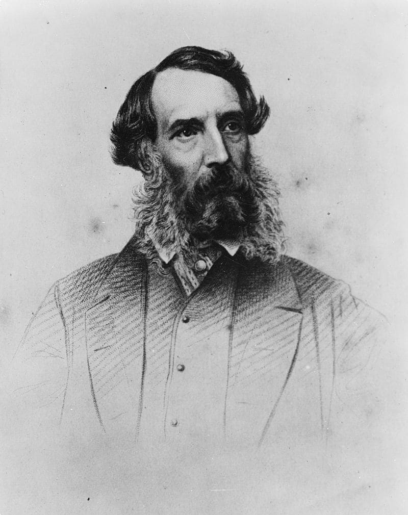
The first European to cross the plain was Edward John Eyre in 1841. He is remembered not only for this significant feat, but also because of the hardships he had to endure along the way. Eyre and his party departed Fowler’s Bay in November 1840 and. with the assistance of Aboriginals and their knowledge of coastal water sources, they made it as far as the Head of Bight. But with the next water source to be found at Eucla, a ten-day trip, the party returned to Fowlers Bay to obtain fresh provisions. At this point, the decision was made to attempt the crossing all the way to Western Australia.
Eyre departed on a second expedition on 25 February 1841 with his overseer John Baxter and three Aboriginals – Wylie, Joey and Yarry – accompanying him. They party arrived at Eucla on 11 March, where they found water in the sand hills, staying for a week before proceeding further west. By 29 March, however, their water supplies had run out. The party survived by collecting morning due, but one horse died from the lack of water and two others were abandoned. A lack of water and fresh supplies led to a mutiny on 29 April, with two of the Aboriginal men killing Baxter and taking the remaining supplies. Eyre and the third Aboriginal man, Wylie, nevertheless continued on with the expedition, surviving through the use of bushcraft and a fortuitous encounter with a French whaling ship at Rossiter Bay which provided them with some supplies. They eventually reached Albany on 7 July, completing their crossing of over 1,800 km.
Eyre’s memory is upheld with the naming of Eyre Peninsular in South Australia, which borders the Nullarbor, the name of the Eyre Highway between South Australian and Western Australia, and Lake Eyre – the largest lake in Australia.
Eyre’s journey took him from east to west along the lightly timbered coast, only glimpsing the treeless portion of the Nullarbor Plain at the Head of Bight. It wasn’t until 1860 that Peter Egerton Warburton became the first white man to observe the inner plain, making trips north and west from the Head of bight for about 50 km. In 1865, the surveyor E. A. Delisser and one his men, Hardwicke, became the first to cross the plain from south to north, giving it its name after its treeless landscape. The noted explorer, and later politicians, John Forrest then became the first to traverse the Nullarbor from west to east in 1870.
From the 1860s, some hardy individuals ventured to the Nullarbor to chance their luck in settling the region for sheep grazing. Over the next three decades, vast areas of the Nullarbor were leased to these sheep graziers. Many of the sheep stations were then later incorporated into the vast Fowler’s Bay run, stretching over 400 km westwards from Streaky Bay! Today, some agricultural interests still exist on the fringe of the plain, including the 2.5-million-acre Rawlinna Station – the largest sheep station in the world. The 1.7-million-acre Madura Station is also a significant sheep station. [Pocket Oz]
Not all pioneers in the Nullarbor were settlers though. Amongst others, some who left their mark on Nullarbor history include: Thomas Paul Richards, the first police trooper stationed at Fowlers Bay between January 1866 and 1884, who was involved in some of the major explorations of the eastern Nullarbor; Daisy Bates, welfare workers amongst Aboriginals and lifelong students of Aboriginal culture and society; the missionaries Annie Lock and Harry Green; and the personnel of the Bush Church Aid Society, who provided medical support to remote areas.
The Trans-Australian Railway
Crossing the Nullarbor is a single railway track – the 1,692 km Trans-Australian railway line from Kalgoorlie to Port Augusta. This includes the longest straight section of railway in the world – 478 km!
The railway came about as an inducement for Western Australia to join the new Commonwealth of Australia upon federation in 1901: it was promised that the project, linking Western Australia with the eastern states, would be nationally funded. However, it was not until 1917 that construction actually commenced at each end, with the track finally meeting at Ooldea about five years later in 1917. This was a remarkable achievement, with over 2.5 million sleepers and 141,500 tonnes of steel used in construction, and over 3,000 men employed in desert conditions remote from established towns. Steam shovels, scoops and side tip trucks operated with the aid of horses, while over 250 camels were used to transport supplies. [Pocket Oz]
The line was entirely rebuilt in 1969 as the various states standardised their gauges to allow for uninterrupted connections. This extended the Trans-Australian line westwards to Perth and eastwards to Sydney. With this, the Indian Pacific service was inaugurated, completing the first crossing on the new line to Perth on 27 February 1970. The Indian Pacific continues today, crossing the Nullarbor twice weekly in both directions. Running mostly in day times, it enables passengers to view the plain and reflect on the building of one of the world’s great railways over a century ago.

The Eyre Highway
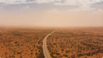
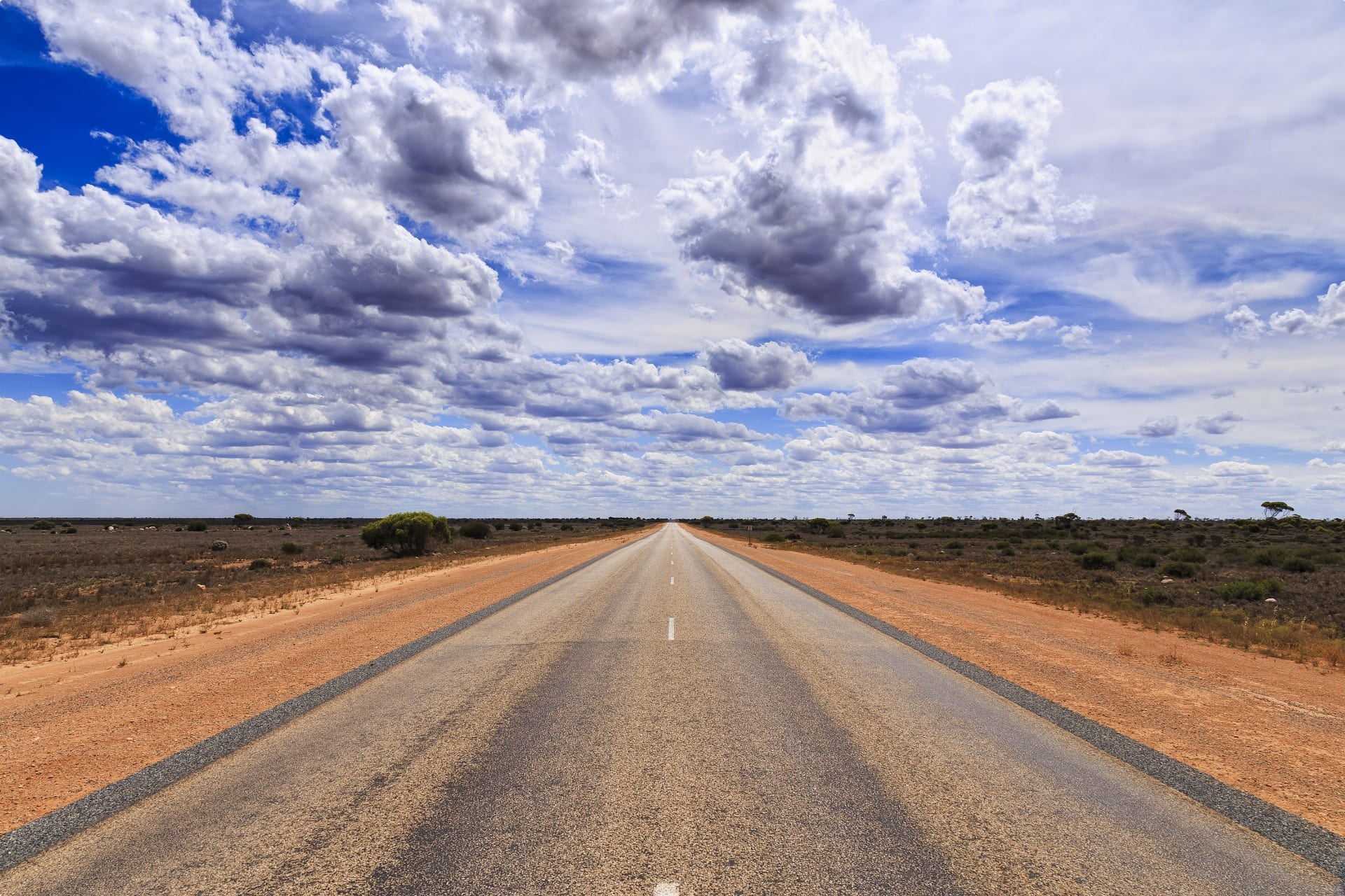
The Eyre Highway is the only road that crosses the Nullarbor Plain to join Western Australia with the eastern states. It runs from Norseman in Western Australia to Port Augusta in South Australia, stretching an astonishing 1,675 km. This includes the longest straight stretch of tarred road in the Australia – an incredible 146 km without a bend! The road is named after Edward John Eyre, with the present route within the South Australian portion of the Nullarbor Plain approximating the explorer’s epic 1841 journey.
Before the highway was built, the ‘road’ to South Australia basically consisted of little more than a stock route connecting pastoral stations, plus tracks used to transport poles during the construction of the overland telegraph line. During World War II, however, it was decided to build a proper road should it be needed to transport military equipment and personal to and from Western Australia. Work commenced in July 1941 and was completed hastily by mid-1942. This was a rough track at first, with only 2 small strips fully constructed and sealed: the passes descending form the Nullarbor Plain to the Roe Plains at Eucla and Madura. [Pocket Oz]
Due to the initial lack of sealed road, maintenance was difficult after the war. Corrugations and potholes were common and even light rainfall could turn the bulldust into a quagmire, rendering the road impassable for several days. The trip was always dangerous, with many accounts of damage to vehicles. As such, by the late 1950s, only a few vehicles crossed the highway each day. But as traffic increased during the 1960s, it was decided to construct a bituminised highway. Sealing to the South Australian boundary was completed in October 1969, with the final section of the South Australian side completed in September 1976.
In South Australia, the new road is further south than the old dirt highway, skirting the Bunda Cliffs and providing tourists with spectacular views of the huge expanse of the Great Australian Bight. In Western Australia, the highway covers large expanses of that part of the plain which is lightly timbered. Today on average 700 vehicles cross the highway each day. Motoring across the Nullarbor can be a pleasant experience, with modern motels and sightseeing stops at convenient locations along the way.
Key Towns and Settlements of the Nullarbor Plain
There are no towns or settlements of any considerable size on the Nullarbor Plain. However, historically Eucla, Cook, and Ooldea are the most important.
Eucla
Eucla is probably the most European historic site on the Nullarbor Plains. At the turn of the 20th century, it became the centre of all activity, primarily because of its location as a midway point between the settled areas of South Australia and Western Australia. Its coast also afforded the only harbour for hundreds of kilometres either east or west from which goods could be unloaded. The town was thus important during many explorations of the Nullarbor Plain. And when a telegraph station on the East-West Line between South Australia and Western Australia was established in the town in 1877, its importance was further enhanced. Eucla reached its peak in the 1920s, prior to the construction of a new telegraph line further north alongside the Trans-Australian Railway in 1929.
Today, the town has a population of about 50 located at the top of Eucla Pass where the Eyre Highway descends from the Nullarbor to the Roe Plains. It is 11 km from the South Australian border, with the nearest towns of any consequences being Ceduna in South Australia 490 kilometres to the east, and Norseman 700 km to the west. A service station, motel, caravan park, ambulance and various government agencies are located there.
Cook
The town of Cook, named after the sixth Australian Prime Minister, Sir Jospeh Cook, was established in 1917 with the building of the railway. Often jokingly referred to as the ‘Queen City of the Nullarbor’, it was a thriving railway town and a central stopping point for steam engines, being approximately half way between Port Augusta and Kalgoorlie. The town once had a population of about 300, a two-storey school, swimming pool, post office, locomotive workshop, air strip, and golf course.
The town diminished to only a few persons, however, when the railways were privatised in the 1990s. The hospital closed soon after in 1998. This was despite attempts to keep it open, including a large sign for disembarking passengers that read, ‘If you’re crook, come to cook’, with its reverse side urging assistance, ‘Our hospital need your help. Get sick.’
These days the ghost town of Cook remains a refuelling depot and only scheduled stopping point for the Indian Pacific passenger train on the Nullarbor. Visitors are free to disembark the train for about two hours and wander through the town. Most of the old buildings are still standing, including wood/iron police cells, and have become something of an attraction.
Ooldea and Ooldea Soak
Ooldea is a tiny settlement on the north-eastern edge of the Nullarbor plain in South Australia, located on the on Trans-Australian Railway. It is here that the final link of the railway was completed. The ‘long strait’ also begins here, in which the railway runs in a direct straight line west across the Nullarbor for 478 km. The railway siding of Ooldea arose because of the water at Ooldea Soak, situated a few kilometres to the north, that provided water for the steam engines of the early railway era. The name Ooldea itself is derived from an Aboriginal word yooldil-beena, meaning ‘swamp where I stood to pout out water’.
Due to its permanent source of water, Ooldea was also chosen as the site of a mission established by the United Aborigines Mission in 1933, running until 1952. The Ooldea wells were at this time yielding decreasing amounts of water and so the soak was abandoned. The railway siding was also abandoned at this point and all the main buildings have since been removed.

Nullarbor Plain Oddities
There are a number of unique attractions to be seen while travelling along the Nullarbor, including the world’s longest golf course, the remnants of World War II internment camps, and a portion of the 5,400 km Vermin Proof Fence (commonly known as the Dog Fence).
World’s Longest Golf Course
The Nullarbor Plain is home to the world’s longest golf course – the ‘Nullarbor Links’ – comprising 18 holes spread out over 1,365 km at various sites between Ceduna in South Australia and Kalgoorlie in Western Australia. Towns that already have an existing course have nominated a hole as part of the golf course; at other sites a hole and ‘green’ have been constructed. After playing one hole, the idea is to drive to the next, generally 100km further down the highway. This means a game of golf can take as long as seven days to complete!
The concept requires a player to purchase a score card, ball, and ball container. On completion of each hole a nominated person will stamp the player’s card. When arriving at either Kalgoorlie or Ceduna – depending on whether travelling east or west – the player will have his card validated and the used ball placed in the container as a memento of having played the course.
Internment Camps
Train passengers crossing the Nullarbor Plain may see signs indicating the sites of World War II Italian prisoner of war camps and, although the buildings have long since gone, stone pathways and edgings built by prisoners can still be seen in some locations.
The camps were established as a result of manpower shortages during the war and the need to continually maintain the Trans-Australian Railway with the ongoing replacement of old and damaged sleepers. Six camps holding two gangs of 25 prisoners each were constructed between Ooldea and Nurina, with a military site at Cook to house headquarters and staff. In December 1943, the use of prisoners was discontinued as a large Army contingent was necessary to guard them and experienced fettlers were needed to supervise the work.
The Dog Fence
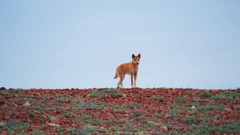
A portion of the largest manmade structure in Australia can be found on the eastern boundary of the Nullarbor Plain – the Vermin Proof Fence, or as it is more commonly known, the Dog Fence. It was erected to prevent dingoes and wild dogs from entering pastoral country and attacking sheep Commencing form the cliffs of the Great Australian Bight, south of Yalata, it now extends north to near the Eyre Highway, then east and north to the northern and eastern parts of South Australian to join up with the fences erected in New South Wales and Queensland – a total distance of 5,400km.
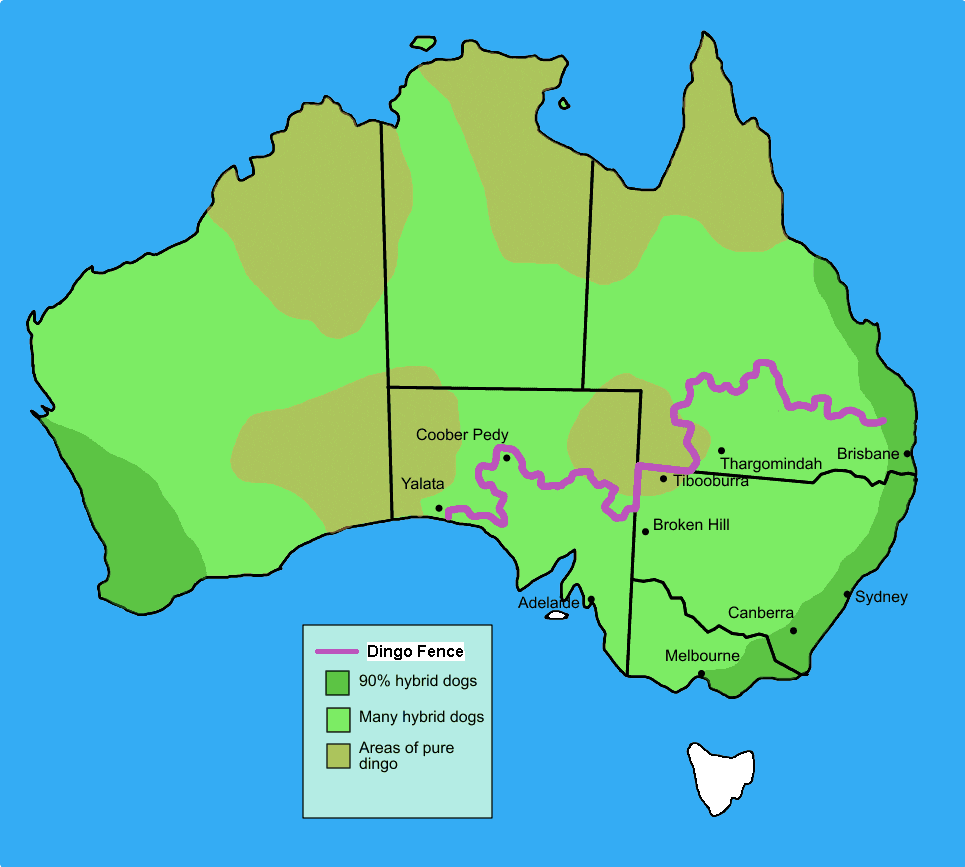
The dog fence is about 1.4 m high, with steel and wood posts holding meshed netting. On the Nullarbor boundary about 100 km of electric fence powered by solar panels has been erected to deter wombats from digging their large burrows near and under the existing structure. Constant contact by emus, kangaroos and wild camels can also cause severe damage and regular maintenance patrols are necessary to keep it in good condition.
Tour of the Nullarbor Plain
Odyssey conducts a tour of the Nullarbor Plain as part of our Long Tour of Australia for a small group of senior and mature travellers. This 65-day tour across Australia covers much of central, western and Southern Australia to Victoria. During it, we seek to introduce and enhance your appreciation of this unique country. From the Trading routes and Songlines of the Aboriginal communities and today’s contemporary art, to the colonial explorers such Grey, Sturt, Stuart, and Burke and Wills, and Pastoralists such as Kidman, the Duracks, and Forrest, to extensive wildlife and stunning landscapes – this program provides a great deal to the traveller. This includes a three-day road trip across the Nullarbor Plain from Western Australia to South Australia.
This includes a visit to the town f Norseman – the gateway to the Nullarbor Plain, and the first Western Australian town for travellers journeying from South Australia. (We also stop here during our Wildflowers Tour of Western Australia and our Western Australia Tour.) The town is home to the Norseman Gold Mine – the Australian’s longest continuously running gold mining operation – and much of Norseman’s architecture remains unchanged from the goldrush days of the turn of the 20th century. The town is also home to holes 14 and 15 of the Nullarbor Links golf course.
You can also join a number of our tours to nearby destinations, from which you can continue travelling on to the Nullarbor Plain. These include our:
- Eyre & Yorke Peninsulas, and the Gawler Ranges Tour (15 days)
- Small Group Tour of Australia’s Flinders Ranges (18 days)
- Small Group Motorcycle Tour of South Australia (18 days)
Odyssey Traveller has been serving global travellers since 1983 with educational tours of the history, culture, and architecture of our destinations designed for mature and senior travellers. We specialise in offering small group tours partnering with a local tour guide at each destination to provide a relaxed and comfortable pace and atmosphere that sets us apart from larger tour groups. Tours consist of small groups of between 6 and 12 people and are cost inclusive of all entrances, tipping and majority of meals. For more information, click here, and head to this page to make a booking.
Articles about Australia published by Odyssey Traveller:
- The Kimberley: A Definitive Guide
- Arnhem Land, Northern Territory
- Landscape of Southern Australia from Mallee and Mulga
- Natural Landscapes of Kakadu National Park, Northern Territory
- Understanding the Channel Country
External articles to assist you on your visit to Australia
Related Tours
days
MarLong tour of Australia for a small group
Visiting New South Wales, Northern Territory
Small group tour for senior couples and solo travellers touring Australia. Travelling through the outback and visiting many of the famous sights as well as off the beaten track locations. Learn about the history of the people who explored the deserts, from indigenous communities to Europeans, as well as Burke and Wills, visit White Cliffs, Marree and far north Kakadu and the Kimberley.
15 days
Aug, SepWildflowers tour of Western Australia
Visiting Western Australia
Escorted small group tour for senior and mature travellers as a couple or solo traveller. Western Australia's Wildflower regions including Esperance and the Fitzgerald river National park. Local guides and program leader share knowledge about this fascinating region whilst in bloom.
From A$15,125 AUD
View Tour
days
Feb, Mar, Apr, Jun, Aug +1Western Australia tour
Visiting Western Australia
Escorted small group tour for senior and mature travellers as a couple of solo traveller. Upto 12 people of WA's regional History tour. The program including Esperance, Kalgoorlie, Gwalia and Perth. Local guides and program leader share knowledge about this fascinating region.
days
Apr, May, Jul, Aug, Oct +2Small group tour of Australia's Flinders ranges
Visiting South Australia
Escorted small group tour of the Flinders range in South Australia from Adelaide. Learn about Coober Pedy, Wilpena pound and water system of Lake Eyre as we explore and learn also about the history of the people who explored the Flinders.

days
Feb, Mar, Apr, May, Jul +2Small group Motorcycle tour of South Australia
Visiting South Australia
Escorted small group tour for senior motorcycle riders of the Flinders range in South Australia from Adelaide. Learn about Coober Pedy, Wilpena pound and water system of Lake Eyre as we explore and learn also about the history of the people who explored the Flinders.
days
Sep, Dec, Jan, Feb, Mar +2Eyre & Yorke Peninsulas, and the Gawler Ranges
Visiting South Australia
Small group tour South Australia. Yorke, Eyre, and Gawler Ranges, discover the local history.